United States. 1947. Building the Navy's bases in World War II; history of the Bureau of Yards and Docks and the Civil Engineer Corps, 1940-1946. Washington: U.S. Govt. Print. Off.
The Navy Department Library
Building the Navy's Bases in World War II
Volume II (Part III, Chapter 26)
Chapter XXVI
Bases in the Southwest Pacific
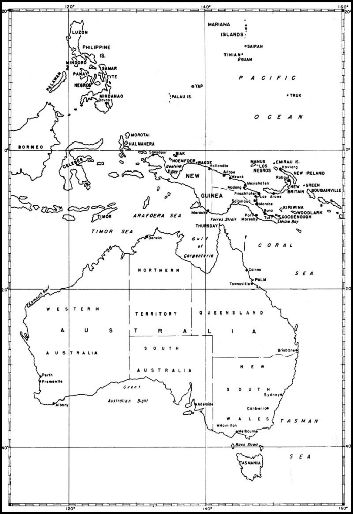
When the Japanese scored their initial successes in the Far East, the naval forces of the Allied powers retreated, fighting, through the Netherlands East Indies until they had fallen back to Australia. Refugee units and personnel from our Asiatic fleet began to arrive at northern and western Australian ports within a few weeks of the opening of the war.
The ensuing months showed a picture of considerable confusion. Cargoships, carrying supplies to destinations which had fallen to the enemy while they were en route, put in at Australian ports and were unloaded. The accumulation of such distress cargo created almost impossible problems of identification, storage, and protection, and much misdirection and loss of valuable material resulted. Gradually, however, storage space was found for Navy material in Brisbane, Sydney, and Melbourne on the east coast and at Fremantle on the west.
The major concern, however, was the development of facilities in Australia which would permit that island continent to serve as a secure base to support naval and military counter-offensives against the enemy. In April 1942, immediately after the command areas in the south Pacific were redefined, a board consisting of Australian and American representatives was convened to determine base-development requirements. It was understood from the beginning that Australia would provide the necessary construction labor and operating personnel and that the United States would be called on to supply only the materials and equipment that could not be obtained locally. Within a few weeks, plans had been formulated which appeared to satisfy the estimated requirements of the combined services and requests were forwarded to the United States for the materials and equipment which would not be available in Australia. Shipments were slow to arrive, however, and in the meanwhile the outcome of the battles of the Coral Sea and Midway had so changed the military situation that a thorough revision of the plans for base development was in order.
The general effect of the change was to shift major developments northward. The ports of Adelaide and Albany ceased to be important from a military standpoint, and Melbourne declined in importance as a center of activity after naval headquarters for Australia was moved to Brisbane in July 1942.
For the remainder of this first year of the war, work proceeded slowly on naval facilities, handicapped by Australia's severe manpower shortage. Base facilities for submarine maintenance and repair were put under way at Brisbane and Fremantle; PT-boat bases were developed at Cairns and at Darwin; repair and maintenance facilities to service escort vessels were established at Sydney and Cairns; and naval air bases were developed at Brisbane, at Perth, and on Palm Island, just northwest of Townsville. Moreover, a considerable amount of storage and supply space was obtained by lease of existing Australian facilities.
A few advance operating bases, particularly for submarines and PT boats, were also established during this period, at Merauke, on the southern coast of Dutch New Guinea, on Thursday Island in Torres Strait, and in Exmouth Gulf.
By the end of 1942, however, it was apparent that the shortage of manpower and materials in Australia was hampering the base-development program beyond the point of tolerance, and in January 1943 a request was made that naval construction battalions be assigned to expedite the construction work. In response to that request the 55th Battalion arrived in Brisbane on March 24, 1943.
In the meanwhile, it had been necessary to establish advance bases in New Guinea. In the earliest days of the war, Port Moresby on the southern coast of that island assumed considerable importance as a military debarkation point and as a destination of supplies for the forces resisting the
--277--
--278--
Japanese advance. Existing facilities were augmented by the Australians during 1942 and early 1943, particularly in connection with fuel storage. Milne Bay, at the eastern tip of New Guinea, had been occupied by Allied forces in the early summer of 1942 and a bomber strip had been built to permit air operations against enemy shipping and positions on the north coast.
In September 1942, the Japanese made a strong attempt against Port Moresby, their forces succeeding in pushing across the eastern New Guinea peninsula to within 30 miles of the port. Reinforcement of Allied ground forces and strong air support turned back the advance, however, and the enemy fell back upon his main base at Buna, on the north coast. A campaign by Allied forces to eject the Japanese from that base followed, its success signalized by the capture of Buna itself on December 14. Early in 1943 the northeast coast of New Guinea, from Buna, south, was finally cleared of the enemy.
In late 1943, after the Buna campaign had come to an end, our forces landed on Woodlark Island and Kiriwina Island, off the eastern end of New Guinea, with the intention of establishing air bases. Parts of the 60th and 20th Battalions participated in the landing on Woodlark; immediately thereafter the 60th set about the construction of the projected air strip. Army engineers undertook the airfield construction on Kiriwina, and in September, a detachment of the 20th Battalion was sent from Woodlark to Kiriwina to lend them assistance.
With Port Moresby, Milne Bay, Buna, Woodlark, and Kiriwina firmly in our possession, our next move was directed against the enemy's positions at Salamaua and Lae. Combining an overland drive from Buna and an amphibious assault, our forces succeeded in capturing both enemy bases by the middle of September. Maintaining the momentum of our advance, Finschhafen was taken on October 2, and by February 1944, all of the Huon peninsula was in our hands.
In November 1943, most of the 60th Battalion left Woodlark Island for Finschhafen to assist in the construction of an Army air strip and to build a naval base. During the months immediately succeeding, three more battalions arrived at Finschhafen to aid in establishing the then-forwardmost base in New Guinea.
The next move in our Southwest Pacific offensive was northward, directed toward the enemy's bases at Rabaul and Kavieng. On December 15, 1943, Army troops made landings on the southwest coast of New Britain, near Arawe, and on December 26, the 1st Marine Division went ashore at Cape Gloucester at the island's western tip. The 19th Construction Battalion was attached to the Marines and accompanied them in their landing.
In the meanwhile, our forces had established their positions in Bougainville, in the Solomons, to the east of Rabaul. Encirclement of that major Japanese base was carried forward another step by our invasion and occupation of the Admiralty Islands. On February 29, 1944, advance elements of the 1st Cavalry Division landed on the island of Los Negros on a reconnaissance mission. Finding the area lightly held, the division's mission immediately became one of invasion and occupation. Among the reinforcing elements sent ashore on March 2 were detachments from four of the construction battalions of the 4th Naval Construction Brigade, the 40th, 46th, 78th, and 17th. Development of Los Negros and Manus, the principal islands of the Admiralty group, during the succeeding months, yielded the largest and most important naval and air base in the Southwest Pacific theater. Facilities were established which, together with spacious Seeadler Harbor, made the base at Manus capable of supporting not only the 7th Fleet, attached to the Southwest Pacific command, but also a sizable portion of the Pacific Fleet as well.
Encirclement of Rabaul was completed by the occupation and development of Emirau, of the St. Mathias group, directly north of New Ireland. On March 20, 1944, Marines landed on the island to find it undefended. A few days later, construction battalions of the 18th Regiment, drawn from the Solomons, began to arrive and immediately started the construction of a naval base and two bomber fields for the Army. The once-important enemy base on New Britain was left to share the fate of other by-passed Japanese positions.
The momentum of our offensive was not permitted to run down. Aided by air support from naval carriers, Army forces on April 22 made successful landings on the New Guinea coast at Aitape and Hollandia, 400 miles and more to the west of Finschhafen. On May 9 the 113th Battalion arrived at Hollandia and set to work constructing naval-base facilities on Humboldt Bay to support
--279--
the 7th Fleet in its future operations, and fleet headquarters facilities in an upland area about 25 miles inland.
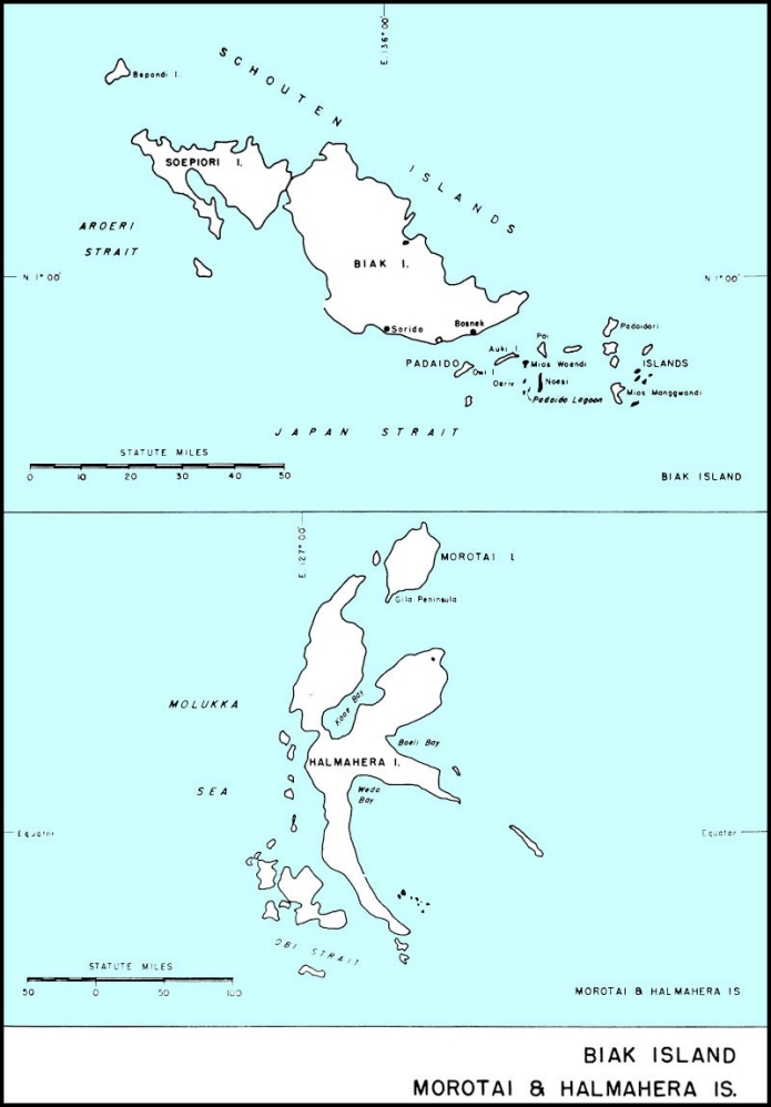
The establishment of our position at Hollandia had cut off more than 50,000 Japanese troops to the eastward, and our command of the sea approaches foreclosed their support or reinforcement. Our control of the remaining portions of the New Guinea coast was not far off. In May, our forces assaulted and occupied the island of Biak, the neighboring island of Noemfoor in July, and Sansapor, at the western tip of New Guinea, on July 30. Our control of the New Guinea coast was now complete. By that time, Japanese air strength had almost disappeared in the entire area and our offensive steadily gained momentum. On September 15 our forces invaded and occupied the island of Morotai, north of Halmahera; the reconquest of the Philippines clearly lay ahead.
Australia
Brisbane - Operating bases in the Australian area for patrol and escort craft were needed to anchor the far end of our long supply line to the Southwest Pacific. Accordingly, it was directed early in the war that there be provided in Brisbane, a base to support task forces, submarines, and escort craft.
Brisbane, the capital of Queensland, with a population of 370,460, is located on the Brisbane River, about 14 miles from the east coast. Moreton Bay, at the mouth of the river, affords suitable anchorage for vessels of draft not exceeding 33 feet.
United States naval activities in Brisbane began on April 14, 1942, when the tender USS Griffin and her company of submarines tied up at New Farm Wharf, where existing installations consisted principally of wharves and wool-storage sheds. In order to provide the necessary equipment for a naval supply depot, part of these facilities were rented and paid for under reverse Lend-Lease.
Shortly thereafter a submarine supply and repair base was established; necessary facilities were rented or leased from the Australians and renovated by Australian construction men to meet the Navy's needs. Although harbor facilities were limited, the base was eventually expanded until it became the largest United States naval base in continental Australia. Existing buildings and Australian materials and labor were used when available; however, some Seventh Fleet units brought with them prefabricated buildings which were set up by their own men or by the Seabees.
Seabees played no part in the establishment of the base until March 24, 1943, at which time the 55th Battalion arrived and established a base for themselves at Eagle Farm, 5 miles northeast of Brisbane, later used as a staging camp for the Seabees in the Southwest Pacific and known as "Camp Seabee." After two weeks in Australia, half of the battalion was sent to New Guinea, while the other half continued work on the camp and also began to build a mine depot. By June 10, other detachments had been sent north to Palm Island and Cairns, leaving only 250 men in Brisbane.
The 84th Battalion landed at Brisbane on June 19, 1943, and moved immediately into Camp Seabee. Here, orders were received sending approximately half the battalion to Milne Bay, New Guinea. The portion of the battalion left in Brisbane assisted the 55th Battalion in constructing the mine depot, additional barracks at Camp Seabee, a Merchant Marine anti-aircraft training station, and Mobile Hospital No. 9. During May and June of 1943 the 60th Battalion staged in Camp Seabee and aided forces there in the construction of projects then under way.
On January 20, 1944 the 544th CBMU arrived to take over all maintenance in the area.
In addition to the projects already mentioned, the Seabees built an advance base construction depot, containing 90,000 square feet of warehouse space and 53 acres of open storage; established a naval magazine at the mine depot by erecting 52 storage huts, 20 by 50 feet. At Hamilton, they renovated existing structures to give a ship-repair unit 5,000 square feet of shop space, and built a wharf, 40 by 130 feet. In addition, many small jobs were done by the Seabees as additions to, or in conjunction with, work performed by the Allied Works Council, including the building of access roads serving the newly constructed warehouses.
The 55th performed logging operations during a period of acute lumber shortage, and also established and operated a river-gravel plant which supplied all the concrete aggregate required at Brisbane by the United States Navy. They also operated a disintegrated-granite pit which provided surfacing material for roads and open-storage areas.
--280--
The Australians had not previously used this disintegrated granite as a surfacing material, but it proved thoroughly satisfactory.
Mobile Hospital 9 arrived at Brisbane with sufficient prefabricated buildings to set up 500 beds; it was later expanded to accommodate 1,000 beds, and subsequently 3,000. All buildings were of prefabricated metal, with the exception of a storehouse, theater-recreation building, laundry, and a sewage pumphouse, and the power plant. All construction was performed by Seabees, with the assistance of station personnel.
No air strips had to be built, for the local airport at Archerfield was made available, and air strips built for the United States Army at Eagle Farm were also used by Navy planes. In addition to 100,000 square feet of existing plane-parking areas, 192,000 square feet and 180,000 square feet were added to Archerfield and Eagle Farm, respectively. Repair shops and a parachute tower were erected, and two hangars, 248 by 105 feet each, which had been built for the Army, were turned over to the Navy. Leave areas, accommodating 250 men each, were built for naval personnel at Toowoomba, west of Brisbane, and at Coolangatta, on the sea, 65 miles south of Brisbane.
Local labor and materials were used almost exclusively. Australian labor also built a seaplane base on the south bank of the Brisbane River about 3 miles below the city. The existing finger pier was utilized, with barges attached at the outer end to facilitate loading and unloading operations. All station personnel and plane crews were quartered at this site.
The first major installation to be discontinued was the mine assembly depot, which was dismantled and crated in January 1944. The moving of Seventh Fleet headquarters to Hollandia, prior to the Philippines campaign, greatly decreased activities as Brisbane, and many of the facilities were returned to the Australians.
Townsville. - At Townsville, on the northeast
--281--
coast of Australia, a section base was set up to service convoy and combatant ships operating in the forward areas of the Solomons and New Guinea.
Land was acquired rent-free, from the Townsville Town Council, for the site of a fleet post office, and a frame building, occupied in the middle of April, was built entirely by Australian labor for this activity.
A naval magazine, 45 miles from Townsville, was completed August 23, 1943. It consisted of four prefabricated magazine huts and two wooden-frame buildings for barracks and mess hall. Local labor and some local materials were used. A 120-bed hospital, consisting of a group of quonset huts, was begun October 22, 1943 on the shores of Rose Bay, near Townsville, by Company C of the 55th Battalion and was operative by December 20, 1943.
Meanwhile, on October 25, 1943, another detachment of the 55th Battalion had arrived at Townsville to build a second hospital, on a site 10 miles north of the city. This hospital, also consisting of quonset huts, had a capacity of 100 beds.
The base remained in operation until July 1944, when a detachment of the 84th Battalion began dismantling it and crating material for shipment to a forward area.
Sydney. - The capital of New South Wales, a modern, well-developed city, with a population of 1,250,000, provided a major repair base, an operations and maintenance base for escort craft, and a major port of debarkation.
United States naval facilities at Sydney, consisting of a supply depot, an ammunition depot, and Base Hospital 10, were constructed by civilian contractors,
--282--
under the auspices of the Australian Allied Works Council, on reverse Lend-Lease. The construction program was not initiated until the summer of 1943.
Storehouses for the supply depot were constructed of standard Australian wood-frame buildings and by rental of existing space. For the ammunition depot, twenty concrete magazines, 25 by 50 feet, and two 30-by-100-foot units were erected.
Base Hospital 10 occupied a small civilian hospital, which was augmented by standard barracks, ward buildings, an operating center, galley and mess hall. The normal capacity of the hospital was 200 beds, with a maximum emergency accommodation of 500 beds.
Commercial port facilities were used. The Australian government had under construction during 1943 and 1944 a graving dock, 1094 feet long and 140 feet wide, with a depth of 401/2 feet. Facilities ashore were simultaneously developed equivalent to those of a destroyer tender. During the summer of 1944, a detachment of 90 men from the 84th Battalion was stationed at Sydney to repair the USS Venus.
By July 1944, plans had been formulated for the elimination and reduction of our naval facilities at Sydney, with the exception of the ammunition depot, at the earliest practicable date.
Palm Island. - Palm Island, within the Great Barrier Reef, north of Townsville and 20 miles off the coast of Australia, was selected as a naval air station with facilities for the operating and overhauling of patrol bombers.
Palm Island, the largest of several closely grouped small islands, is triangularly shaped and contains 23 square miles. With the exception of a few small areas, the terrain is rugged from the water's edge. The air station overlooked a large stretch of sheltered water, ideal for seaplane operations.
On July 6, 1943, a detachment of 2 officers and 122 men of the 55th Battalion was sent from Brisbane to Palm Island to construct the station. As all the material could not be shipped at one time, a similar detachment, with 1,500 tons of material, was sent from Brisbane to Townsville by rail. Half of this detachment remained in Townsville to unload, store, and reload this material. No local labor and little native material were used, but coral aggregate for concrete was obtained and the entire
--283--
1,500 tons moved to Palm Island by such small craft as became available.
The Seabees on Palm Island set up a camp with all necessary facilities for 1,000 men. Concrete-surfaced seaplane ramps and a seaplane parking area large enough for 12 planes were constructed. Three nose hangars were built, and moorings for 18 planes were provided in the bay. A tank farm with a capacity of 60,000 barrels of aviation gasoline was constructed, using 2000 feet of shore pipeline and 1,200 feet of submarine pipeline. All buildings were wood frame.
No local labor and little native material were used, but coral aggregate for concrete was obtained from off-shore reefs at low tide.
By September 23, 1943, when personnel for the operation and maintenance of the base began to arrive in large numbers, the major facilities of the base were ready for operation. A month later the base was completed with the exception of the tank farm, construction of which was in progress, and a small portion of two nose hangars. On October 25, the Seabees began moving out, leaving a group of 35 men to complete the nose hangars and other miscellaneous minor jobs, after which the detachment rejoined the battalion at Townsville on November 8.
In addition to the construction of the facilities already listed and the unloading of construction equipment and material, some 3,500 tons of base operational and maintenance equipment and supplies had been unloaded by the Seabees between July 6 and October 22. They had also set up and maintained their own camp.
Housing and operational facilities were fully utilized from October 25, 1943, to May 1, 1944, with an average of four planes per day repaired. On June 1, 1944, a detachment from the 91st Battalion arrived to dismantle the camp, and by September 1, 1944, work was completed, with 5,000 tons of material and equipment loaded on ships for forward areas.
Darwin. - In order to fulfill an agreement with the Australian government, whereby the United States Navy was to supply mines to the Royal Australian Air Forces operating out of Darwin, a mine depot was established there. Facilities were later expanded to service United States submarines and PT boats operating off the northwest coast of Australia.
Darwin, on the northern coast of Australia, occupied a peninsula between Clarence Strait and Frances Bay. With a peacetime population of 3,000. Darwin had no industries, serving only as a port of call for coastwise shipping and as a base for pearling luggers. A civil airfield and a RAAF airfield on the other side of the strait provided air facilities.
The first echelon of Company B, 84th Battalion, arrived at Darwin on August 28, 1943, and immediately commenced work on the construction of a 500-foot PT-boat slip, and shortly thereafter erected a quonset warehouse. Existing facilities proved to be inadequate; hotels and private residences were renovated and used as quarters, and existing stores and warehouses were utilized, overflow space being provided with tents and new construction. Commissioning of this section base took place on November 21, 1943.
In January 1944, work was commenced on 12 magazine huts, with a detonator locker in the magazine area on Frances Bay, just south of the RAAF field. Roads were built. This construction, augmented by a warehouse and an assembly shed, was completed by April 6.,/P.
During January 1945, the Seabees also built a base camp, consisting of 22 huts, supply tents, and accompanying accommodations. A radio unit with necessary equipment and three quonset huts were set up at Adelaide River, 77 miles from Darwin.
Cairns. - Our base was planned to provide logistic support and hospital facilities to serve advance bases and operational forces afloat.
Cairns, on Trinity Bay on the east coast of Australia, is in a sub-tropical region, temperatures often exceeding 100°F. Much of the flat coastal area along the bay is mangrove swamp, requiring considerable fill to make it usable for construction purposes. By dredging, the harbor was kept at a depth of 22 feet.
On October 6, 1943, a detachment of 3 officers and 223 men from the 55th Battalion arrived at Cairns to set up an escort base on the site of [a] small PT repair base, which had been erected by various service units, with no planned construction layout. Practically all installations, however, were ultimately incorporated in the base. Although built to accommodate one PT boat, the wharf accommodated several more by nesting.
Escort Base One was set up for destroyer repair, mine maintenance, patrol-craft repair headquarters, and supply. The work of grading, filling,
--284--
and erecting buildings was taken over by the Seabees upon their arrival. Construction by the 55th Battalion included a galley and mess hall for 1,000 men, hospital facilities with complete installations for 50 patients, administration and operational facilities, all necessary buildings for radar and repair, ships' stores, fleet post office, storage and base roads.
Ninety days were required for the initial development of Cairns, completion date being January 1, 1944. Major obstacles were poor drainage and unstable material for structures and roads. These were overcome by using disintegrated granite as fill, installing culverts, grading, and ditching.
Development beyond the original plans included construction of a 40-ton floating drydock, a 600-foot timber wharf, and four 5,000-gallon water tanks. Time required for these developments was thirty days, with the final job completed January 31, 1944. The detachment then returned to Brisbane.
Late in December, it had been decided to provide ammunition-storage facilities, but as participation in this project would prolong too greatly the Seabees' service in a tropical area, another detachment arrived from Brisbane, December 30, 1943. At the dump site, 7 miles inland from the main base, the Seabees set up 18 prefabricated ammunition-storage huts, a frame barrack, and all other necessary camp facilities, which were completed March 19, 1944.
Apart from these projects, the 19th Battalion,
--285--
in July 1943, assisted the U.S. 6th Army Engineers in the construction of a large Army operating base, which included a drainage project, power plant, railroad, camp sites, and other facilities.
The naval base was used extensively for repair of all types of small craft and destroyers. During the construction period, as well as upon completion, the base was taxed to capacity.
CBMU 546 started roll-up late in 1944, and by January 7, 1945, all usable material had been sent to forward areas.
Merauke, Dutch New Guinea
Merauke, approximately 2 miles from the mouth of the Merauke River, on the southern coast of Dutch New Guinea, was selected as the site for a base to support PT squadron units, as well as operations of Allied Army, Navy, and Air components.
The area around Merauke consists largely of low land, covered with mangrove swamps interspersed with ridges of more stable sandy clay. The climate is tropical, with an average annual rainfall in excess of 100 inches.
A detachment of 4 officers and 233 enlisted men from the 55th Battalion arrived at Merauke on May 8, 1943, to construct the PT-boat base. As the town jetty had been destroyed by Japanese bombs, material and equipment had to be beached by unloading into leaky scows, which were towed to a makeshift wharf.
Trouble was encountered in selecting a camp site in the swampy terrain. Drinking water was obtained from seepage wells, and then purified. Timber for the construction of a 300-foot pier and a smaller one for PT boats did not arrive until July 15; work was then started immediately, and both were completed by September 3.
The air strip, 150 by 6,000 feet, was commenced on June 28, 1943; eight days later, it accommodated its first plane. This strip was able to handle one squadron of fighter planes and several medium bombers. Twenty miles of roads connected the strip with the town and with gasoline and fuel dumps.
As Merauke at this time was within easy range of enemy air bases, it was subject to numerous strafing and bombing raids. On May 11, three days after arrival, the Seabees experienced their first bombing raid; they sustained no casualties but lost some gear and equipment. Numerous alerts and attempted raids followed, but there were no more bombings until September 9, by which time all assignments had been completed.
Facilities of this base, both harbor and airfield, were used extensively, daily reconnaissance missions and bombing flights being flown from the strip.
Milne Bay
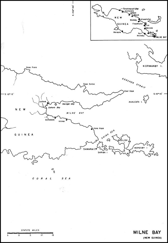
The naval base at Milne Bay was developed to relieve overcrowded ports on the east coast of Australia and to provide facilities nearer the enemy. The major installations consisted of a transshipment and staging area, major overhaul facilities for PT boats, and a destroyer base.
Milne Bay, on the southeastern extremity of New Guinea, is 20 miles in length, with an average width of 7 miles, affording an extensive protected harbor. A dense, swampy, jungle plain extends inland from the narrow coral and mud beaches to the Owen Stanley Mountains. The climate is tropical, with high humidity and heavy rainfall. Population is extremely sparse.
The first Seabees, one company of the 55th Battalion, arrived in Milne Bay on May 23, 1943. Their mission was to construct PT Advance Base Six at Kana Kopa, on the south side of the bay. Personnel had unloaded supplies and set up a few tents. As the Allied forces moved up the coast of New Guinea, it was found that the major engine-overhaul base at Cairns, Australia, was too far behind the lines to be practicable; accordingly, it was decided to enlarge the base at Kana Kopa.
Despite excessive tropical rains and adverse soil conditions, the Seabees had the base in operation five weeks after work was started, in time for its boats to strike the Japanese at Salamaua and Nassau Bay on June 29 and 30. In four months this small detachment also installed facilities for housing and feeding 800 men, shops and storehouses of quonset huts, three 15,000-gallon water tanks, a tank farm of four 1,000-barrel fuel tanks, a timber pile wharf, and two pontoon drydocks for PT boats.
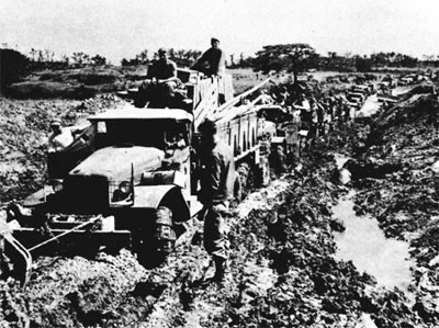
This base was completed in the scheduled time, despite adverse weather conditions and disease. Severe rains often caused knee-deep mud, and in some places men worked waist-deep in the churned earth. In pouring concrete, it was necessary to keep the slabs under cover, so temporary shelters were erected. An ingenious system for building quonset
--286--
--287--
huts from the top down was later devised to eliminate the construction of temporary structures for protecting the concrete. Mud sills were set, and on them, blocks were placed at intervals to support a quonset hut, which was then erected. The concrete floors and foundations were then poured under the completed hut.
Milne Bay is in one of the most malaria-ridden areas in the world, and in spite of a rigorous preventive campaign, from 23 to 39 percent of the personnel was incapacitated from this cause alone. This, combined with tropical skin diseases also prevalent, had a pronounced and detrimental effect on the speed with which the project was built.
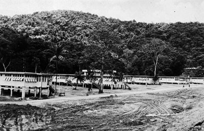
On July 8, 1943, two companies of the 84th Battalion arrived and immediately began to unload. A temporary camp was set up on the beach, near the native village of Gamadodo. By the middle of August, a permanent camp was nearly complete and work had been started on the supply and ammunition depots, though a major portion of the heavy equipment had not yet arrived.
Construction specified in the original planning was essentially complete by the end of December. After clearing the site, 81/2 miles of roads were built, and housing and messing facilities in the staging area for 4,000 men, a dispensary and sick bay for 50 patients, a 40-by-900-foot wharf, 20 quonset and frame warehouses, 54,400 cubic feet of cold-storage space, and 10 ammunition magazines were constructed.
In these developments, more than 400,000 cubic yards of sticky, water-soaked gumbo were moved. A sawmill was set up and supplied all except a small portion of the lumber used. A large portion of the available manpower was engaged in stevedoring until the arrival of a detachment of the 15th Special Battalion in December.
On July 31, 1943, a small detachment of the 84th was sent to the island of Samarai, southeast of
--288--
Milne Bay, to construct a small seaplane base. Work was somewhat delayed due to serious material shortages and changes in original plans, but in 42 days the project was substantially complete.
The main features were a 50-foot ramp, leading to a nose hangar and a 40,000-square-foot parking area. Barracks, messing and galley space for 220 men and 50 officers, together with water, power, sanitary, and refrigeration facilities complemented them. Aviation-gasoline storage was provided by the erection of four 1000-barrel steel tanks.
In addition, this same group of men was assigned the task of building a small seaplane operating base in Jenkins Bay, on the north coast of near-by Sariba Island, consisting of a camp for 130 men, a small boat pier, communications building, offices, and general storehouses.
The 91st Battalion, arriving October 21, 1943, relieved a small group of the 84th who were building the base headquarters at Ladava, on the western end of the bay. About one-fourth of the battalion remained at Ladava to improve the camp and construct piers, jetties, roads, electric and communication systems, warehouses, a hospital unit, and facilities for housing 75 officers and 1,000 men.
Another detachment was detailed to construct a destroyer repair unit at Gohora Bay, half a mile south of Ladava. This project included numerous shops and warehouses, piers, jetties, roads, and housing facilities for 30 officers and 1,000 men. The principal problem confronting this detachment was one of terrain; the site to be used was under water at high tide, necessitating a large amount of fill, which had to be hauled more than 5 miles by truck, over poor roads.
The remainder of the battalion went to Hilimoi, about 5 miles east of Gadadodo, to relieve the detachment of the 84th constructing a 500-bed hospital there. This project was expanded to include a recuperation center for 3,000 men. At the same time, a small detail was sent to Swinger Bay, in the northwest corner of Milne Bay, to start an amphibious training center.
A portion of the staff of the 12th Regiment, part of the 3rd Brigade, reached the area on November 29, 1943, and set up headquarters at Ladava. All
--289--
units in the Milne Bay area were assigned to this command and worked under its direction.
The 105th Battalion, which reached Milne Bay in January 1944, was given the job of completing the amphibious training center at Swinger Bay. This project comprised housing for 1,500 men in quonset huts, a large frame galley and mess hall, several quonset storehouses, class rooms, and shops, and the development of about 2,000 feet of waterfront. In all, more than 250,000 yards of dirt were moved in grading this project.
Soon after the 105th landed at Swinger Bay, a detachment was sent to Hilimoi to assist the 91st in their work on the hospital. Another group of about 150 men was sent to Gamadodo to set up a sawmill, augmenting the one already in operation by the 84th, and to build an additional Liberty-ship pier.
As work on the amphibious training center neared completion, men thereby released were moved to Gamadodo until eventually only enough were left at Swinger Bay to carry out maintenance and minor construction.
Arriving with the 105th was the 528th CBMU, which took over completion of naval headquarters at Ladava as well as maintenance of naval facilities in that area. Shortly thereafter, Pontoon Assembly Detachment 3 debarked at Gamadodo and commenced operations.
February 1944 saw the arrival of the 115th Battalion, which carried on the construction of the advance base construction depot, begun by the 84th. In March, the 118th Battalion landed and assisted the 115th until the depot was complete, their primary function then becoming its operation.
By the middle of 1944, most naval installations were complete. Original plans for Gamadodo were constantly expanded, and before our forces had advanced far enough to render this base unimportant, the following developments had been constructed and were in use: a magazine, a staging area with all facilities to care for 10,000 men, a supply depot, a pontoon assembly depot which was assembling pontoon cells as well as barges, and a large advance base construction depot which included a spare-parts warehouse, housed in what was probably the largest building in New Guinea - 120,000 square feet in area.
While work continued on some minor unfinished construction, dismantling was started on facilities which had fulfilled their purpose and were no longer needed by advancing forces. By July 1945, the advance base construction depot had been torn down and crated, and was waiting shipment to a forward area. By October, the hospital at Hilimoi had been readied for shipment north. At Gamadodo as soon as a building was vacated, crews went to work salvaging material which would be needed in the Philippines and Okinawa.
Port Moresby
The naval base at Port Moresby was established to provide major communication facilities and advance headquarters for the Seventh Fleet.
Port Moresby, on the southeastern coast of New Guinea, has a protected waterway, 5 miles long by 3 miles wide, with a sand and clay bottom affording excellent holding ground for anchorage. Temperatures are relatively mild, with rainfall uniform in distribution and not excessive.
A detachment of 70 men from the 55th Battalion arrived at Port Moresby on June 20, 1943. An Army base for forward operations and supply was already in existence there.
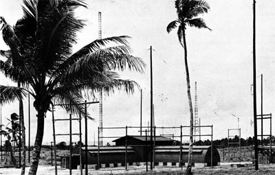
The construction project consisted of a radio station, to be used also as a communications center, and Port Director facilities. Constructed at the radio station were 10 quonset huts for living quarters, water supply and storage equipment, 2 transmitter and generator buildings, roadways, and parking areas. The station was placed in operation on July 15, 1943, and 8 additional quonset huts were erected by January 12, 1944.
The Port Director facilities in the original plan were to consist of 17 quonset huts for living quarters and offices, storage facilities, a water-supply system, a generator building, and roads. Work was begun July 28, 1943, and the project was ready for use within a month. As subsequent enlargement became necessary, 19 quonset huts were added and the port Director facilities became known as naval headquarters.
All construction was accomplished by the original 70 men augmented by 50 men sent from a detachment of the 55th working at Milne Bay. This contingent provided the additional labor required from late September until December 1943, at which time they returned to Brisbane with 20 men of the original detachment. No native materials or labor were used.
A detachment of CBMU 546 arrived on April 3,
--290--
1944, to relieve the 55th, which had carried on with routine maintenance after completing the construction program. During October the roll-up of this base was under way, and was completed by November 1, 1944.
Woodlark Island
Woodlark Island, lying northeast of Milne Bay, was occupied by United States forces on June 30, 1943, for the purpose of developing a supporting base to provide air cover for Allied operations along the northeastern coast of New Guinea.
The island has a rolling terrain, covered with dense jungle. Coral barrier reefs surround it except at Guasopa Bay, the principal harbor, which is accessible through two passages. Limited channel depth restricted the use of the harbor, but LST's could be brought to the beach for operations. Small supply ships anchored just offshore.
The task force which occupied Woodlark Island in a surprise landing on June 30, 1943, included Army and Marine units, the 60th Construction Battalion, and a naval base unit to which about 500 men of the 20th Construction Battalion were attached. Enemy resistance was light. The men of the 20th were assigned the construction of housing, roads, and services. The 60th had as its mission the construction of an airfield and accessory facilities.
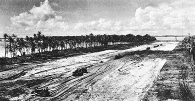
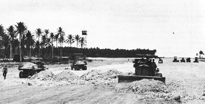
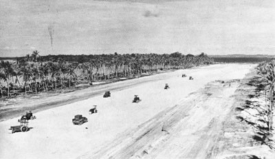
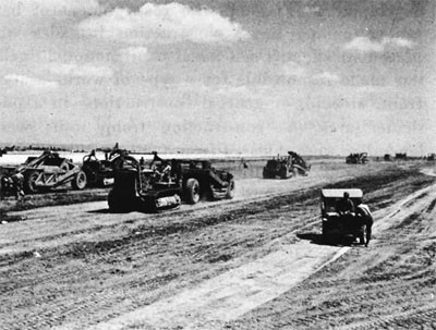
On July 2, the first echelon of the 60th Battalion began clearing and grading for the airstrip; 12 days later a coral-surfaced strip, 3,000 by 150 feet, was ready for operations. Work continued on the airfield, and by mid-September the runway was completed to a length of 6,500 feet, with a maximum width of 225 feet. A parallel taxiway, 6,000 feet long, with a minimum width of 60 feet, a dispersal loop, and 110 hardstands were completed by October 12.
Meanwhile, the 20th Battalion concentrated on road and housing construction and the establishment of a water system. The first project after landing had been the cutting of trails into the coconut plantations and the surrounding jungle to allow immediate dispersal of all equipment and supplies. These trails were later developed into suitable roads, and by October, a 30-mile network of good hard roads had been completed. Housing was generally in floored and screened tents, although eight prefabricated wooden buildings and nine quonset huts were provided for the Army Air Force, and a small hospital.
Three 3-by-7-pontoon barges were assembled and turned over to the naval base unit for operation. One 2-by-12-pontoon string was assembled and anchored offshore for use as a PT-boat pier. The Seabees also did considerable repair work on landing craft, picket boats, and PT boats.
Ample water supply was procured locally from several rivers. A sawmill, which was set up, provided 15,000 board feet of lumber per day. A coral pit for road and airstrip surfacing material was also operated.
Spasmodic enemy bombings continued throughout the construction period at Woodlark, causing only minor damage and no casualties to the Seabees.
By November 1, 1943, all Seabees had been detached from Woodlark, with the exception of 309 men of the 60th Battalion who remained for maintenance duties until March 1944.
Kiriwina
Kiriwina Island, the largest of the Trobriand group, lying off the extreme eastern tip of New Guinea was occupied by United States forces on June 30, 1943, in a virtually unopposed landing, its capture being simultaneous with further landings by U.S. forces on New Georgia and on the New Guinea coast. It was intended to use Kiriwina as an air base to support future moves against the Japanese in New Guinea.
Near the center of this densely wooded island, which is 25 miles long and 6 miles wide at its broadest point, the United States Army Engineers constructed a coral-surfaced airstrip, 6,000 by 150 feet, for fighter and bomber operations. In September 1943, at the request of the 6th Army, 12 officers and 306 men of the 20th Battalion were sent to Kiriwina to assist in the airfield development.
The principal task of the Seabees was the construction of two taxiways, one 7,000 feet long, with 25 fighter hardstands; the other, 5,300 feet long, with 16 bomber hardstands. The first taxiway was completed on October 12, two days ahead of schedule, in time to support a major air raid against Rabaul. About a week later, the second taxiway was completed and the Seabees turned attention
--291--
to the erection of operations buildings and camp facilities for aviation personnel.
The projects assigned to the battalion were completed by October 28, 1943, when the Seabees returned to Woodlark.
Finschhafen
The advance base at Finschhafen was established to provide supporting facilities for the accommodation of light naval vessels, such as PT boats and amphibious craft, to maintain a staging area for naval units participating in further forward movements, and to serve as a staging and supply point for the Seventh Fleet.
Finschhafen is on the eastern coast of British New Guinea; its harbor affords excellent shelter for moderate-size vessels and anchorages ranging from 5 to 45 fathoms. Climate is sub-tropical, with heavy rainfall.
The base was constructed on a narrow coastal plain backed by mountains. The major part of the area was jungle, with a top soil of deep black mud, underlain by poor-quality coral.
The first naval representatives to arrive at Finschhafen were members of the 60th Battalion, in early November 1943. This battalion, less one company which had remained at Woodlark, aided the Army in completing an airstrip and later developed a naval base.
Landing from LST's in Langemak Bay, near Finschhafen on November 5, the 19 officers and 658 men found the beach a morass as a result of heavy rains the previous night. Trucks and other rolling stock were unable to move more than 100 feet from the ships. The LST's were unloaded, however, and the next morning the work of clearing the beach began. A temporary dump and the camp site selected were about 300 yards from the beach, but in spite of every effort by the Seabees and a company of Army engineers, the road to this site was impassable for four weeks.
As a result, it was impossible for the Seabees to render any assistance to the 808th Army Aviation Engineer Battalion on the airstrip until November 16. The Seabees were assigned the job of rough-grading and mat-laying on the northern half of the field and of producing coral for fine-grading the entire area. In spite of the lack of equipment for road building, this strip was operating by the December 5 deadline.
The 78th Battalion landed at a point south of Finschhafen on December 9, and the 40th Battalion arrived at Finschhafen December 16, on the first Liberty ship to enter this zone. The 46th Battalion landed on the south side of Langemak Bay on January 6 and established a camp site adjoining the area occupied by the 78th Battalion.
Work on base construction was begun December 24. On January 5, 1944, the 808th Army Aviation Engineers departed, leaving the remaining airfield construction and maintenance to the 60th Battalion. The 60th built hardstands for fighters and medium bombers at Dreger Airfield, an aircraft repair area adjacent to the airstrip, four 2,000-barrel aviation-gasoline tanks, complete with piping and pumping units, and a 200-foot pile-and-timber jetty. Assistance was rendered on these projects by the 46th and 78th Battalions.
In the early months of 1944, an operating base for the support of two PT-boat squadrons was built by the 60th Battalion, the facilities including a 30-by-60-foot pier, a torpedo pier, one finger pier, two unloading piers, and 84-foot repair pier, a complete camp, warehouses, torpedo shop, and other work shops. During the late summer of 1944, the 91st Battalion, which had reported in July, improved these facilities with frame buildings and quonset huts for ships, warehouses, quarters, and recreation buildings.
Waterfront facilities were developed early in 1944. The 46th Battalion built four timber piers, each 330 feet long and 30 feet wide, with necessary approaches for Liberty ships.
Progress was slow, for it was impossible to obtain suitable piping, and the material into which the piles were driven was very soft and considerable penetration was needed to attain the required bearing. Two pontoon wharves, with bridge approaches, were erected, and covered storage in prefabricated buildings was provided at the cargo ship piers. Until the arrival of the 19th Special Battalion in late January, detachments of the several units handled stevedoring.
Base facilities were constructed by the 60th and 78th Battalions. These installations included a 500-man camp of framed and screened tents, quonset huts for administration use, and a 300-bed hospital. Base Hospital 14 consisted of ten 20-by-48-foot quonset huts for dental, surgery, storage, and ward facilities, with nine framed tents for additional wards.
Installations at the supply depot included four
--292--
--293--
6,800-cubic-foot refrigerators, twenty prefabricated warehouses, a 40-by-80-foot timber-and-coral-fill wharf, and ten 20-by-50-foot standard prefabricated steel magazines. The 78th also built a fuel-oil tank farm of five 10,000-barrel tanks, with all necessary piping.
Staging areas were established at Finschhafen for both Army and Navy personnel. The 40th Battalion built an Army staging area for 17,000 men, with camp and storage facilities, 14 LST loading ramps and 15 miles of two-lane roads with several timber bridges. During the summer of 1944, the 91st Battalion began construction of the naval staging area for 2500 men, with necessary camp and storage installations and roads. This project was about 75 percent complete on November 1, 1944, when orders were received to curtail further work at the base.
From March to June 1944, the 102nd Battalion, while restaging, assisted in minor construction activities. CBMU's 545 and 543 reported in February and April 1944, respectively, in time to aid in the major construction at the base.
Native labor was used, where available, for clearing brush and for logging and milling operations. The 60th Battalion set up a sawmill in November 1943, and the Army furnished the logs. This sawmill was later taken over by the 46th Battalion. Coral for the roads and the airstrip was secured from a nearby coral pit, operated by the Seabees.
Major obstacles to construction were heavy rains and occasional enemy bombings, which caused the Seabees some casualties.
All major projects at the base were curtailed in November 1944, and by January 1945, roll-up by CBMU 543 was well under way. The base was disestablished
--294--
April 1, 1945, and all facilities were turned over to the Army.
Cape Gloucester
On December 26, 1943, when the 1st Marine Division went ashore at Cape Gloucester, on the northwest tip of New Britain, it was accompanied by the 19th Construction Battalion, whose mission was the building of roads for supplies and access during the assault, and the preparation of beaches and piers for landing craft.
Reconstruction of two enemy airstrips, which were the principal objectives of the attack and from which United States planes could continue raids against Japanese-held Rabaul and Kavieng, was carried out by the 1913th and 841st Army Aviation Engineer Battalions. The strips were captured by the Marines on December 30, and next day the American flag was raised over all Cape Gloucester.
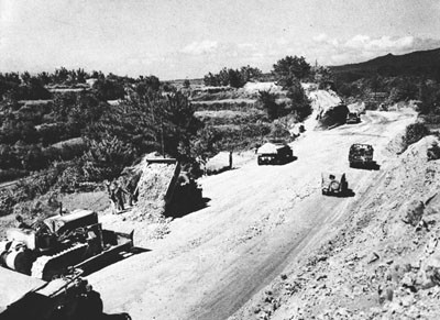
Road construction, with necessary bridges, continued throughout the Seabees' stay. Pulverized volcanic slag produced a surface so hard that even after continual truck traffic, the tread of a large bulldozer did not cut into the surface.
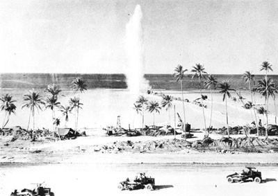
A new method of "drilling" holes for blasting was developed on this work. A 75-mm armor-piercing shell, fired into a rock ledge by a General Sherman tank, left a hole about 10 inches in diameter and 10 feet deep which could be quickly prepared for a dynamite charge.
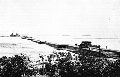
Waterfront construction consisted of a rock-fill pile-and-crib finger pier, 130 feet long and 50 feet wide, a 160-foot rock-fill approach jetty for a cargo-ship berth, landing-craft unloading pier, and a 350-foot seawall of piles and log-facing, backed with large boulders.
The 19th Battalion, the only Seabee group at Cape Gloucester, was attached to the First Marine Division and left with the division in late April for the Russells. During the first weeks, continuous enemy air raids resulted in 5 men of the battalion killed and 24 wounded.
Manus
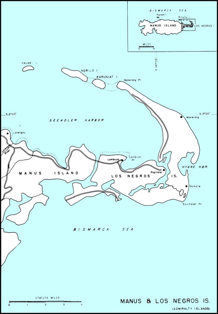
A major naval and air base, capable of service, supply, and repair to forces afloat, air forces, and other Allied units in the forward area, was established early in 1944, at Manus, in the Admiralty Islands, about 300 miles north of Lae, New Guinea, and, apart from the St. Matthias group, the northernmost group of island in the Southwest Pacific area. Manus lay close to the enemy line of communication between Truk and Rabaul, and also near the route between Kavieng and Wewak.
Manus and Los Negros comprise the major islands of the Admiralty group, which includes some 160 small islands and atolls and three first class harbors. Manus, about 50 miles long and 15 miles wide, is the largest island of the group. The terrain, which rises to a maximum elevation of 3,000 feet near the center of the island, is of volcanic origin, principally basalt, which weathers to a thick, reddish, clayey gumbo.
Seeadler Harbor, one of the largest and best in the Southwest Pacific, lies within the ellipse formed by Manus, the curving shore of adjoining Los Negros, and the reef-bound islands to the north. Its protected waters are capable of accommodating a large fleet of capital ships. Los Negros, roughly crescent in shape, is separated from the much-larger Manus by a narrow passage. The island is low and, for the most part, swampy, with coral just below the topsoil.
The first echelon of the 4th Construction Brigade, consisting of part of the 40th Battalion and small detachments of the 46th, 78th, and 17th Battalions, landed at Hyane Harbor, Los Negros, on March 2, 1944, with the first reinforcements to the original group of 1,000 Army troops, who had landed two days earlier. Only a small beachhead then existed. Enemy resistance, which had been severe, was overcome by March 4.
The Seabees' first job was to rehabilitate Momote airstrip, which had been sized on February 29, by a reconnaissance party of the First Cavalry Division. Although the airstrip was in our hands, the enemy occupied the surrounding areas, and 2 officers and 100 men from the 40th Battalion were placed in the front lines to reinforce the Army unit holding the area. These Seabees remained in this advanced position for two nights, withstanding three enemy attacks. For this action, the 40th was awarded the Presidential Unit Citation.
The captured airfield consisted of a 4,000-foot strip and a number of dispersal areas, none of which was in service, due to poor construction methods and design and to bombing by our forces. The Seabees began work on March 3, the morning after landing, and continued for several days, despite constant sniping and the loss of bulldozers to other activities. The condition of the strip was such that 14,000 cubic yards had to be filled and graded
--295--
before matting could be laid, as local coral material proved unsuitable as surfacing.
On March 10, RAAF fighters arrived and began operations, although construction continued until June 1, 1944, when the facilities were turned over to the Army for maintenance. Completed installations consisted of an airstrip, 7,800 by 150 feet, with taxiways and hardstands for 90 fighters and 80 heavy bombers, a 17,000-barrel aviation-gasoline tank farm with fuel jetty for small tankers, bomb storage revetments, roads, operations buildings, and personnel facilities.
Construction of an additional airfield (Mokerang) was the major project of the 104th Battalion, which arrived on April 1, 1944. An Army engineer aviation battalion assisted throughout the operation. The original plan called for a bomber runway, 8,000 by 200 feet; a taxiway, 8,500 by 125 feet, with hardstands and service areas for 50 bombers. This project was completed as scheduled, on April 22, with the use of additional equipment from other battalions. The first landings of 307th Bomber Group planes had taken place on April 21.
The original taxiway was later enlarged and two additional taxiways built. Other installations included a 30,000-barrel tank farm, quonset-hut shops, and personnel facilities. A second bomber strip of equal size, added to the plan, was built by Army engineers aided by Seabee equipment and operators.
By July 1944, the Seabees had constructed numerous other facilities in the Hyane Harbor area, including a 500-bed evacuation hospital for the Army. Waterfront construction consisted of two cargo-ship wharves, a repair pier with fixed crane, and a fuel pier, 800 feet long, to serve major ships.
Facilities at the pontoon assembly depot, operated by PAD 1, which arrived June 19, 1944, involved a pontoon pier, four prefabricated steel buildings for warehouses, shops, and offices, structural steel factories, and a personnel camp of 40 huts with all utilities for 50 officers and 500 men. The depot could assemble 900 pontoon cells per month.
An aviation supply depot was established as the central procurement, storage, and issuing agency for all such material and equipment in the Southwest Pacific area. For this activity, the 46th Battalion erected 24 steel warehouses, each 40 by 100 feet, and 83 quonset huts for administration and personnel. Facilities for an aviation repair and overhaul unit were set up, consisting of 25 steel buildings, 40 by 100 feet, for shops, a personnel camp for 1,000 men, roads, and all utilities. A naval airstrip, 5,000 by 150 feet, with hardstands, a 7,000-barrel aviation-gasoline storage farm, a parking area, warehouses, and a personnel camp were also built. The section base at Hyane Harbor was provided with facilities for small-boat repair, including a wharf, personnel camp, and shops.
In April 1944, two additional locations on Los Negros were selected for development, one at Papitalai Point and one at Lombrum Point.
The projects at Papitalai Point were assigned to the 58th Battalion, which arrived on April 17, 1944. The next day, survey crews were sent ashore to select a camp site. Constant heavy rainfall and the unfavorable terrain, however, made progress difficult. Quarters were finally erected on coconut-log footings at least 2 feet above the ground.
The first major construction assignment was the building of a 30-foot primary road from Lombrum Point to Papitalai Point.
For a drydock storage area and personnel camp, the 58th built seven 40-by-100-foot warehouses, 29 quonset huts, a mess hall, a galley, a water system, and a coconut-log, coral-fill jetty, 40 by 80 feet, the site of which required considerable fill.
Heavy rains, which turned the area into a mass of mud, considerably delayed construction of a PT-boat overhaul base and personnel camp; however, it was found that coral from a nearby deposit furnished a measure of stability. Due to the lack of available access roads, a jetty had to be built entirely by hand labor. Installations upon completion consisted of seven 40-by-100-foot warehouses, three quonset huts, one 30-by-50-foot wood-frame building, and a frame galley and mess hall.
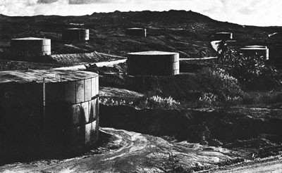
The major project at Papitalai, a tank farm with sufficient storage of fuel and diesel oil to supply a large base and major units of the fleet, was begun on June 23. Lack of suitable coral for surfacing again proved a handicap. Material for tank foundations had to be ferried across the harbor, and roads deteriorated to such an extent that corduroying was the only solution. However, the schedule to complete 25 tanks by August 15 was met despite the difficulties encountered, and work continued until 63 tanks were erected, each having a 10,000-barrel capacity. A two-way pumping system and a drum-filling plant completed the farm, which was split into sections, making it possible to operate from any single unit or series of units.
The 11th Battalion was the first unit to land at
--296--
--297--
--298--
Lombrum Point, on April 17, 1944. A permanent camp was set up and work begun on three main projects - a seaplane repair base, a ship repair base, and a landing-craft repair base.
For the landing-craft repair base, the Seabees erected six warehouses and shops, two quonset huts for administration buildings, and frame quarters and messing facilities, with all camp utilities. A 250-ton pontoon drydock was provided for docking LCT's, LSM's, and smaller landing craft.
Facilities at the ship-repair base combined docking, repair, and supply services equivalent to those furnished by auxiliary ships. Docking equipment consisted of a 100,000-ton sectional dock capable of handling battleships, a 70,000-ton sectional dock capable of handling most major ships, and an 18,000-ton steel floating dock.
The seaplane base at Lombrum Point was established to furnish operational, service, and repair facilities. Installations included a 50-by-250-foot concrete seaplane ramp, one steel nose hangar with a concrete deck, an 8,000-barrel aviation-gasoline tank farm, a pontoon pier for small boats, four 40-by-100-foot prefabricated shops, quonset-hut shops, and camp facilities.
Development of base facilities on Manus Island was initiated by the 5th Construction Regiment, composed of the 35th, 44th, and 57th Battalions, which landed between April 14 and 20, 1944. There was no enemy resistance, although Army patrols killed three snipers on the beachhead and captured several prisoners in the vicinity during the next ten days. For six weeks, the Seabees maintained perimeter guards at their camps.
The principal installations were made for the supply depot, which was to serve shore-based activities in the Admiralties as well as all forces afloat in the area. The Seabees erected 128 storage buildings, 50 refrigerators, each containing 6,800 cubic feet, built open-storage areas, 5 miles of access roads, an LST landing beach, and two major piers, one 800 feet and the other 500 feet long. Ultimately, the storage floor space was extended to give the equivalent of 180 storage buildings. This was accomplished by lean-to additions. These facilities were located along the Lorengau airstrip,
--299--
which had been found unsuitable for operational development. The depot was commissioned on July 2.
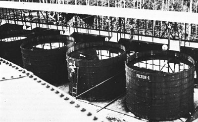
A major development undertaken by the various units of the Seabees at the Manus naval base was the construction, operation, and maintenance of a water-supply system, capable of producing 4,000,000 gallons per day.
Two primary systems were developed. The Lorengau system, with its source of supply the Lorengau River, produced a daily average of 2,700,000 gallons. The Lombrum system, utilizing five small streams and impounding reservoirs, produced an average of 600,000 gallons per day.
In addition, 23 unit water systems in outlying areas, using portable purification units, could draw 850,000 gallons per day from shallow wells.
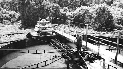
Treatment of both primary supplies incorporated aeration, sedimentation, coagulation, filtration, and chlorination, producing a quality of water that was considered very good for all purposes.
Distribution was accomplished from a gravity-flow system; however, auxiliary pumps were spotted in the lines to boost the pressure in the event of an emergency.
The main reservoir of the Lorengau system had a capacity of 2,142,000 gallons, augmented with five 10,000-barrel steel tanks, one 1,000-barrel steel tank, and various wood-stave tanks at the population centers.
The Lombrum system was tied in with a main 420,000-gallon reservoir and wood-stave tanks.
All distribution mains were steel pipe, ranging from 6 to 12 inches in diameter. Laterals and auxiliaries were from half inch to 4 inches in diameter.
The administration area for the entire Admiralty base was located at the mouth of the Lorengau River. Facilities included 48 quonset huts for officers,
--300--
a 2,000-man mess hall, 10 quonset huts, signal towers for base communications, all utilities, and a timber pier. On May 4, the 4th Brigade headquarters were moved from Los Negros to Manus.
Original plans contemplated two separate hospitals, but these were consolidated into one 1,000-bed unit, Base Hospital 15. Facilities included 42 quonset huts, a 1,000-man mess hall, 8 wards, 5 operating rooms, storage facilities, administration, dental, and laboratory installations, and all utilities. A receiving station was also established, containing facilities for 5,000 men in 292 quonset huts, with frame galleys and mess halls.
Two additional air bases were constructed on the nearby small islands of Ponam and Pityilu.
At Ponam a fighter base, to provide minor repair and overhaul facilities for carrier-based planes, together with housing facilities for pilots and crews, was established by the 78th Battalion in the summer of 1944. Installations consisted of a coral-surfaced airstrip, 5,000 by 150 feet, a 5,000-foot taxiway with a parking area, 6,000 feet square; 34 quonset huts for repair shops and operations; a 1,500-man camp; and an 8,000-barrel tank farm with sea-loading line for aviation gasoline. Fifty per cent of the work area was swamp land, requiring fill, all of it coral, blasted and dredged from the ocean bed.
The 71st Battalion set up a base for carrier planes on Pityilu, to care for one patrol squadron, to service and repair all types of carrier-based planes, and to provide storage for 350 of these planes, with camp accommodations for 350 officers and 1,400 men. The coral-surfaced runway measured 4,500 by 300 feet, with taxiway and three parking areas. Prefabricated steel huts were erected for administration, operations, and shop use. Other facilities included a 7,000-barrel aviation gasoline
--301--
tank farm with sea-loading line, one prefabricated nose hangar, and munition dumps. This work was accomplished in May and June 1944, with assistance from Company C of the 58th Battalion. Later, the field was extended 1,000 feet; parking areas were increased; the camp was enlarged to accommodate 2,500 men; and the dispensary was developed into a 100-bed hospital with all facilities.
The eastern end of Pityilu Island was cleared, graded, and made into a fleet recreation center to accommodate 10,000 men at one time.
Stevedoring for all naval activities was handled by the 20th, 21st, and 22nd Special Battalions.
Although little native labor was employed, native woods and coral were used in abundance.
Arriving September 17 and 18, 1944, the 63rd Battalion was assigned to a wide variety of work. An ammunition depot, consisting of concrete-floored storage buildings, with sorting warehouses, and quonset huts for personnel, was built, together with additional warehouses for the supply depot. Maintenance of all facilities, including roads, boats, and electrical equipment, as well as coral excavation, was also assigned to the battalion. In addition, both a concrete batching plant and a sawmill were set up and operated. These activities, with improvements to docking facilities and extensive power line installations, were carried out before the 63rd departed for Manila on March 25, 1945.
The 140th Battalion landed at Manus on June 17, 1944, two companies being detailed to Ponam and Pityilu, respectively. On Manus, the 140th assisted the 63rd in the establishment of the ammunition depot, later taking over the entire maintenance and development.
On V-J Day, the 140th Battalion, the 20th and 22nd Special Battalions, CBMU's 561, 587, and 621, and PAD 1 were still in the Admiralties. All units were engaged in stevedoring and in general maintenance and repair.
Emirau
Continuing the Pacific strategy of by-passing Japanese strong points and occupying intervening islands to aid in cutting the enemy's lines of communication and supply, and to provide landing
--302--
fields for our shore-based bombers in the coming attacks on Truk, Yap, and Palau, the island of Emirau was occupied on March 20, 1944. In addition to landing fields, the island was to be developed as a naval base, a PT operating base, and a minor repair base.
Emirau, one of the many small islands of the Bismarck Archipelago, lies 250 miles north of the once strongly fortified Japanese base of Rabaul, New Britain. The Truk Islands are 600 miles due north, and Yap and the Palau group are 800 miles to the northwest.
The island is approximately 2 miles wide, and 8 miles long in an east-west direction, with an arm in the central section jutting northward for about 21/2 miles. The shoreline border of flat land, several hundred feet in width, rises several feet above sea level, and is broken by a parallel cliff formation, which rises abruptly, 75 to 185 feet above the sea at most points, to a comparatively level plateau of about 4,000 acres. The island is covered with light vegetation, second-growth timber, and some heavy forest. Hamburg Bay, a fair harbor, lies on the northwest coast. The climate is tropical, with high humidity and heavy rainfall. About 300 natives inhabit the island.
Emirau was occupied without enemy opposition, March 20, 1944, by two battalions of the 4th Marine Division. Main contingents of the 18th Construction Regiment, comprising the regimental staff, Battalions 27, 61, 63, and the 17th Special Battalion, arrived with the second and third echelons of the division on March 25 and March 30. These contingents were augmented April 14 by the 7th Construction Battalion.
All construction was assigned to the 18th Regiment for distribution among its battalions; the work was inter-related as far as possible, no battalion being assigned projects solely of one type or in one area.
The 27th Battalion took over the construction of the naval base headquarters, PT Base 16, the small-boat pool, Hamburg Bay harbor developments, an LCT floating drydock and slip, and a portion of the roads.
The construction of the main road arteries, aviation housing facilities, ammunition-storage buildings, the runway at North Cape Field, some of the
--303--
building at the PT base, and sawmill operation comprised the work of the 61st Battalion.
The 63rd assisted in the operation of the sawmill and work on the aviation shops, camps, roads, the airfield, harbor facilities, storage warehouses, magazines, and bomb and aviation-gasoline dumps.
To the 77th Battalion fell the task of constructing taxiways and hardstands on Inshore and North Cape airfields, aviation shops, and camps, bomb dumps, and the construction, maintenance, and operation of the aviation-gasoline tank farm.
The Inshore Field runway and approach zones, aviation shops and camps, radio range and radio direction finder stations, and the road and causeway at the eastern end of the island were built by the 88th Battalion.
The two airfields, Inshore and North Cape, were both heavy bomber strips, 7,000 by 150 feet, and coral surfaced, as were the warm-up areas at each end of the fields. Inshore Field had 35 double hardstands capable of parking 210 fighter or light-bomber planes. There were 42 hardstands on North Cape Field, with space for parking 84 heavy bombers. Both fields had all necessary facilities for operations, including a control tower, field operations building, field lighting, and a dispensary. All buildings used for supplies and servicing were of prefabricated steel or wooden frame. Screened and decked tents housed 1,050 officers and 4,200 enlisted aviation personnel.
A tank farm for aviation gasoline was installed with three 10,000-barrel and nineteen 1,000-barrel tanks, two tanker moorings with anti-torpedo nets, two sea-loading lines, and a gravity distribution system to six truck-filling points. In connection with this farm, an adequate reserve of more than 40,000 barrels was maintained in drums. The ammunition and bomb dump provided covered storage, steel magazines, and revetments.
Three hospitals were built on the island. The naval base hospital, with a capacity of 100 beds, and the 24th Army Field Hospital, with beds for 160, were both located in the southwestern tip of the island. Acorn 7 Hospital, located on the extreme northern tip of Cape Ballin, had facilities for 150 patients.
The anchorage in Hamburg Bay accommodated five capital ships; Purple Beach, on the Bay, with three finger piers and one 77-by-120-foot slip was sufficient to handle seven LCT's. On this beach were also eight pier cranes, refrigerators with a capacity of 42,400 cubic feet, six 40-by-1,000-foot warehouses, and approximately 400,000 square feet of open-storage space, which permitted the handling of 800 tons of cargo a day. An LCT floating drydock was also maintained in the Bay. All other beaches on the island were unsuitable for efficient cargo handling; however, five beaches on the western coast were improved to accommodate thirteen LCT's.
Communication facilities consisted of two wooden transmitter buildings with concrete floors, two 16-by-32-foot revetted wood-frame power plants, and two quonset-type receiver stations.
The naval base was established at the southwest tip of the island. Facilities constructed for its operation consisted principally of wooden frame, canvas-covered structures, replaced later by quonset-type buildings, when urgent airfield facilities had been provided.
Quarters and messing for 560 officers and men, engine overhaul and repair shops, a magazine, a total of 350 feet of coral-fill piers, a signal tower, and all the necessary utilities for a PT base, were erected on the island of Eanusau, just off the southwest tip of Emirau. The small-boat pool was also installed there, consisting of a camp for 250 men and 15 officers, 4 quonset-type dry-storage buildings, shops, a sick bay, an armory, a generator plant, ships' service, a personnel pier, and a signal tower. Connecting the various activities and camps were a total of 40 miles of 40-foot coral-surfaced, all-weather highway.
In July 1944, CBMU 502 arrived to relieve the construction battalions of maintenance work. By August, construction was complete, with the exception of minor additions.
The 61st Battalion left in July, and by the middle of December, all construction forces, with the exception of the maintenance unit, had left. The 502nd, by that time, was engaged in dismantling quarters and buildings as soon as they were vacated, and crating equipment no longer needed. By the end of May 1945, the roll-up was complete, except for installations which were to remain on the island, and on June 6 the 502nd departed for Manus.
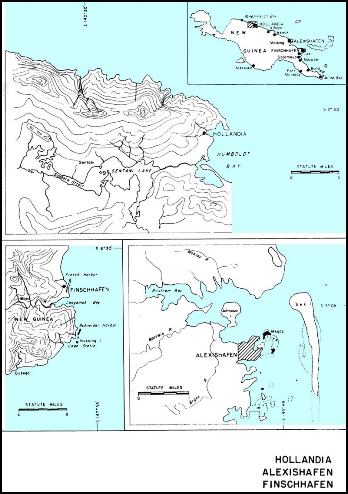
Hollandia, New Guinea
The naval base at Hollandia was established to provide logistic support to services afloat and later to become a supply base for the invasion of the
--304--
Philippines. It was to include a base for convoy escorts, a supply depot, a repair base for destroyers and lighter craft, and an ammunition depot. In addition, it was to be advance headquarters of the Seventh Fleet.
Hollandia is located on Humboldt Bay on the north coast of Dutch New Guinea. This area has a tropical climate, with heavy rainfall.
Generally throughout the Hollandia region the terrain is rocky, erosion having caused a jumble of hills and bluffs, some of which exceed 1,000 feet in height. Fresh water is extremely scarce except in the Hollandia valley. A reef, composed of soft coral and silt, lies close along the shore. Humboldt Bay, adequate and well protected, provides the only extensive anchorage between Wewak, about 200 miles to the east, and Geelvink Bay, some 350 miles to the west.
Naval facilities at Hollandia were extensive, including a staging area, fleet postoffice, Seventh Fleet advance headquarters, and a fueling depot. All facilities were located near Humboldt Bay, with the exception of advance headquarters, which was about 12 miles west of the bay, and the fueling depot on Tanahmerah Bay.
Preliminary surveys were made by the officers in charge of the 24th Regiment and the 113th Battalion on D-Day, April 21, 1944. The 113th Battalion arrived on May 9, and was immediately assigned the construction of all base roads, docking facilities, and utility systems, as well as heavy grading and drainage work for dump areas.
Road construction to provide access to the scattered sites of the various base facilities, as usual, took first priority. Accordingly, men and equipment were landed at three different points in order that construction could be pushed. The first day, 4,000 feet were rough graded; within two weeks the roads were open for traffic. In all, 6 miles of road were laid down through particularly difficult country.
The construction of a pier for Liberty ships carried the next highest priority. A temporary camp, to ready and assemble construction material, was immediately set up. Work started on May 25, and 82 feet of the pier was available for use by June 9. From that time until its completion on July 3, 1944, the pier was constantly in use.
At the same time, a water-supply system was under construction. Treated water from small nearby springs, supplementing that truck-hauled from distant streams, was used to supply the camp pending the arrival of pipe. A temporary system to service small landing craft was constructed in four and a half days, and was put into service on May 27. A supply of 6-inch pipe was received on June 2, and within 24 hours, 960 feet of it had been installed; by June 8, the system had been extended to supply Liberty ships. The permanent system consisted of 58,400 feet of 4-inch, 6-inch, and 8-inch pipe, one 10,000-barrel and twenty 5,000-gallon storage tanks, with a chlorination system that provided 2,500,000 gallons of treated water a day to vessels and to all activities of the base.
Construction of another pier began on September 13, but lack of materials delayed completion until November 23, although 130 feet were ready October 22, and ships were tied up continually from that time on.
Land for sorting and storage areas was obtained by filling and surfacing with concrete a shallow cove between the first pier and the LST watering point, the edge of the fill being further developed as a landing-craft watering and loading point. Similar areas were built at both docking areas, as well as adjacent to the fleet postoffice and harbor administration area.
In addition, the 113th Battalion worked on numerous other projects, large and small, among them the 40-by-494-foot pier for the destroyer repair base. Work there was started on July 31. The pier was completed within a month, during which time a fleet postoffice and harbor administration facilities were also constructed. The communications department of the battalion installed a complete telephone system for the base, including 10 switchboards, 203 miles of telephone line, 76,000 feet of submarine cable, and 351 stations and trunk lines.
The 102nd Battalion arrived at Humboldt Bay, on June 12, 1944, and was assigned the construction of a supply depot, a destroyer repair shop, and a degaussing range, as well as housing facilities at several locations.
The supply-depot warehouses included 16 quonset huts, 40 by 300 feet, with concrete floors. Ten banks of refrigerators, with a capacity totaling 136,000 cubic feet, were built, as well as a complete camp accommodating 200 men. For the destroyer repair shop, it was necessary to fill in approximately 150,000 cubic yards of shoreline and set up all
--305--
facilities, including storage, office, and foundry, quonset huts, and necessary roads.
In addition, the battalion built housing facilities for the various activities of the base, including housing and messing facilities for 100 men at the staging area on Pancake Hill. Other camp areas included housing for 500 men at base headquarters, and housing and messing for the men assigned to the 24th Regiment.
Crews from 102nd were assigned to the operation of the battalion's pontoon barges and all barges and LCM's which belonged to the 24th regiment. This equipment was essential to the unloading of ships, especially in the early stages before piers were completed. The 102nd also operated the regimental supply dump, supplying men, cranes, and trucks, and installed 2 miles of overhead and submarine cable incidental to the construction of the degaussing range.
The 119th Seabees reached Humboldt Bay on June 13, 1944, the day after the 102nd landed. On June 19, their ship, with all equipment, was sent to Tanahmerah Bay, 25 miles farther west, where it was unloaded and most of the cargo transported to Lake Sentani, 8 miles in the interior. The battalion was assigned three major projects: a tank farm at Tanahmerah Bay, advance naval headquarters at Lake Sentani, and pontoon assembly at Humboldt Bay.
Although working conditions at Tanahmerah Bay were ideal as far as rain was concerned, the boggy condition of the terrain slowed road construction. Initial plans called for a total of one 10,000-barrel diesel-oil and twenty, later reduced to eleven, 10,000-barrel fuel-oil tanks. The original date of completion was set for September 15, 1944, but due to shortage of materials and the boggy ground, only the diesel-oil tank and seven fuel-oil
--306--
tanks were ready by that date. By October 7, three additional fuel-oil tanks were in operation. This construction included all necessary piping, manifolds, and pump installations as well as a 12-inch welded fuel line on the Army-built pipeline pier.
Advance naval headquarters at Lake Sentani included quonset huts for administration and for housing and messing 800 men. Completion date was set for August 15, but 34 quonset huts were usable by July 23, and shortly thereafter the Seventh Fleet personnel began moving in. A stevedoring unit of 100 men was furnished by the 119th Battalion during this period.
Important jobs assigned the 122nd Seabees, who arrived June 28, 1944, were the construction of port director's facilities at Wakde and at Aitape, the base water supply, and, later, G-2 hospital in Hollandia valley. Construction at Wakde and at Aitape was started on July 10 and July 11, respectively. It included administration facilities at Wakde and housing and messing facilities at Aitape. The Wakde project was completed on June 30; the job at Aitape, on July 2.
A radio transmitter was built at Hollandia and a radio receiving station at Leimok Hill. Work was started on the transmitter on July 10 and was completed in 35 days; work at the receiving station required an additional five days. These projects included all buildings for both administration and personnel, and all other equipment necessary for operation of the stations.
A 500-bed hospital, consisting of 78 structures, was begun August 8 and completed September 30. Before this hospital, located in the upper end of Hollandia valley, was begun, it was necessary to make a fill of 85,000 cubic yards and to divert a stream which meandered through the site. A 5-foot dam across the stream and wood storage tanks provided a gravity-flow water system.
Numerous other projects were completed by the
--307--
122nd while at Hollandia, including housing facilities for 350 men at the destroyer repair base and naval base facilities for 1,000 men. A naval base water-supply system, consisting of 3,500 feet of 8-inch water line, was installed in 18 days. A large percentage of all the lumber used on the base was logged and milled by the battalion.
The battalion was constantly handicapped by the urgent need for all facilities. Ships unloaded on piers only half completed, and personnel moved in as soon as even a portion of the administration and personnel areas were usable.
By V-J Day, only a small part of the base had been rolled up by CBMU 558, stationed there since the preceding October. Hollandia was strategically important as a base for strikes against the enemy and was a major factor in the invasion of the Philippines, furnishing a large portion of the supplies.
The naval base at Hollandia was disestablished in December 1945. All installations were sold to the Netherlands East Indies Government.
Biak, Owi, Mios Woendi
Biak Island, in the Schouten group, was developed to provide an operating and repair base for seaplanes and PT boats; repair facilities for landing craft, from LST's to the smallest types; and hospitalization for patients evacuated from advance areas. It gave the Allies a base only 900 miles from Davao, P.I., and control of northwestern Dutch New Guinea. However, most of the facilities originally scheduled for Biak were eventually installed on Owi and Mios Woendi in the Padaido Islands, as enemy resistance on Biak was unexpectedly heavy and slowed the time schedule.
The Padaido Islands, which consist of many wooded islands, cover an area 35 by 211/2 miles, close to Biak at the entrance to Geelvink Bay in northwest New Guinea. Owi, which is nearest, is less than 5 miles south of Biak. Padaido Lagoon, at Mios Woendi, provides an anchorage area of 5 square miles, with 2,100 feet of navigable beach front. The climate is tropical, with an annual rainfall reaching 100 inches.
On June 6, 1944, PT Advance Base 2 arrived at Mios Woendi, accompanied by a detachment of the 113th Battalion, to set up operating and living facilities for two squadrons. The first detachment of the 55th Battalion, with equipment, arrived at Mios Woendi on June 12 and 14, and work was immediately begun on a camp site. On July 5, the detachment from the 113th returned to Hollandia.
Upon the arrival of PT Base 21 on June 26, construction was begun on an operational repair base. Housing, messing, and collateral facilities were provided for 2,000 enlisted personnel and 250 officers. Twelve finger piers were installed to accommodate as many as 50 PT boats, together with a torpedo-change pier, small-boat landing, and a large pontoon pier with crane facilities for changing engines. Five pontoon drydocks were placed in operation for repair work, and two prefabricated warehouses were set up.
Company D of the 55th Battalion accomplished the major portion of the construction program, the finger piers being installed by Company A.
All the shops were in operation six weeks after unloading; on August 7, 1944, the base was usable.
On June 18, half of the 19th Special Battalion arrived with a 100-bed mobile dispensary and immediately started preparation of a camp site and hospital facilities, both of which were more or less temporary. On July 12, materials and equipment for a 200-bed dispensary arrived. The smaller, 100-bed mobile dispensary was absorbed into the larger unit, and became Naval Base Hospital 16, thus providing accommodations for 300 patients.
The 55 Battalion erected 32 quonset huts for use as wards, offices, laboratory, diet kitchen, galley, laundry, and storerooms, as well as 56 tents for living quarters, in connection with the hospital, which was completed August 16.
Mobile Amphibious Repair Base 2, a functional component designed to provide repairs necessary to support the operation of 18 LST's, 18 LCI's, 36 LCT's, 60 LCM's, and 240 LCVP's, arrived at Mios Woendi between July 4 and July 25. For this base, construction performed by the 55th, with additional labor from the repair-base personnel, consisted of a camp of 150 tents, shop facilities of 7 quonset huts, and 5 small miscellaneous wooden structures, all of which were completed by September 15.
The major construction problem at this base was the sorting, assembling, cataloging, and overhauling of machinery and spare parts, which, due to outdoor storage and several transshipments, carried no outside identification. Damaged equipment was repaired and conditioned in the field while the shops were being constructed.
On July 8, 1944, the 60th Battalion (856 officers and enlisted men) arrived at Owi. The Army was already in the process of building two airstrips
--308--
--309--
there, but Army and Navy plans called for the Navy to assist in the construction.
At the time the battalion arrived, one airstrip was completed to 5,000 feet, with approximately 30 hardstands. Plans called for two airstrips, 7,000 by 150 feet each, parallel taxiways, and 219 heavy bomber hardstands.
All airstrip construction was in coral, and easily performed as the site was level and covered only with scrub growth. Many of the dispersal areas and hardstands, however, were in hard, rough coral and heavy timber, which necessitated much drilling, blasting, and rooting. The construction of all airstrip facilities on Owi was completed on September 25, and the maintenance work was then taken over by the battalion.
Other construction accomplished by the 60th on Owi included camps for Acorn 8, two bomber squadrons, and two air-supply units, the 17th Army Station Hospital, roads, bomb and gasoline storage areas, an aviation-gasoline tank farm, landing facilities for four LST's, and a small-boat pier.
Navy Seaplane Base 2 personnel arrived at Mios Woendi July 16 and were established as an operations and maintenance unit for Fleet Air Wing 17. Facilities installed for their use, by the 55th Battalion, included messing and housing for 850 officers and men, a well-water system of 15,000-gallon capacity, a seaplane ramp and parking area, a nose hangar, an operations tower with three quonset huts for combat operations structures, a radio station, and shops for various maintenance work, together with roadways and walkways. Use of local materials were, as in all construction in the area, confined to sand and shells for roads and concrete aggregate, and a few logs for foundations and heavy supports.
Construction at Mios Woendi included 8 quonset huts for offices and administration, 136 tents and 18 quonset huts for quarters and messing, 18 quonset huts for storehouses, a 400-by-40-foot wharf, a vehicle repair shop, and various recreational facilities. Work was completed by August 31.
Other work performed by the 55th consisted of
--310--
a tank farm of twenty 1,000-barrel tanks on nearby Noesi island, the port Director's office on Biak, and a mine warfare facilities project and ammunition storage unit on Oeriv Island, southeast of Mios Woendi. Existing facilities on Mios Woendi were also developed and enlarged to accommodate the increase of shipping handled by the base.
Night air attacks and numerous alerts during the early days, heavy rains, and lack of proper aggregate for concrete were difficulties met and overcome without halting operations.
With the departure of the 19th Special Battalion on October 14, the 55th, in addition to their other duties, took over stevedoring at the base. In November 1944 the Fifth Air Force headquarters moved from Owi to Leyte, P.I., and the 60th Battalion, after dismantling and shipping their buildings and equipment, embarked for rehabilitation leave in the United States on December 20, 1944.
CBMU 605 arrived at Mios Woendi during the month of November, relieving the 55th, who departed during February 1945. On V-J Day, all facilities were operating as planned.
The naval base in the Padiaido group was disestablished January 19, 1946.
Alexishafen-Madang, British New Guinea
The primary purpose of the base at Madang was to provide logistic support, through boat pool and repair facilities, for small craft in the area. The section base constructed at Alexishafen, near Madang, on the northeast coast of British New Guinea, included a section base, boat pool, ship and boat repair facilities, and a fresh-water system.
Alexishafen is located on Bostrem Bay, which provides an ideal anchorage for large ships. The channels are clear, with a depth of 30 fathoms, and the area is protected by Sek Island and a reef. Only a 20-foot tide exists, with a weak current. Rainfall is excessively heavy.
Establishment of this base was requested by the Seventh Amphibious Force in May 1944, and on June 13 a detachment of 200 men of the 91st Battalion arrived. Materials were to be provided by moving part of the facilities from Cape Cretin (Finschhafen) and the remainder from the advance base construction depot at Milne Bay. A camp with all necessary facilities was set up for the 400 men assigned to the base, together with a water supply system that would provide 500,000 gallons per day of untreated water to ships at the watering point. The ship and boat repair facilities were floating units, augmented by two pontoon drydocks. The section base, operated by Commander Service Force, Seventh Fleet, was commissioned on August 17, 1944.
Plans for the discontinuance of this base were begun early in November 1944, as the location was then too far behind the area of operations to serve a useful purpose. On November 30, final roll-up was ordered, and a detachment of 80 men from the 91st was sent to Alexishafen on December 25, 1944, for this purpose. The water-supply system was transferred to the Royal Australian Navy when the base was evacuated by the United States Navy and decommissioned on January 28, 1945.
Morotai
The naval installation on Morotai was established to provide an operating base for PT boats and land- and seaplanes, as well as repair facilities for small landing craft, with a supplementary communication system and hospital.
The island of Morotai, which lies about 10 miles east of the northern tip of Halmahera, in the Netherlands East Indies, is 28 miles wide by 48 miles long, with the Gila Peninsula, 6 miles long and a mile wide, at its southern end. This peninsula, with 3 additional square miles, was occupied and developed by American forces. The peninsula terrain is flat, coral sand, covered by fine topsoil, planted with coconut groves. The remainder of Morotai is mountainous and heavily covered with forests, which provided suitable timber. At the northeast corner of the peninsula, about 1,500 feet of shore is ideal for LST landings.
The climate is tropical, and the annual rainfall, which is moderately heavy, is evenly distributed throughout the year.
The 84th Battalion landed from LST's on September 27, 1944, twelve days after D-Day. The original plan called for the construction of an advance base unit and a naval air-facilities camp.
Construction at the advance base involved erection of tents for 1,000-man camp for the 84th Seabees and 24 quonset huts for the base. The Seabees also erected two steel towers for the radio station, two frame buildings, four 6,800-cubic-foot refrigerators, a boat-repair pier, a personnel pier, and a pontoon drydock.
At the air-facilities camp, tents provided living quarters for 1,800 officers and men, and quonset
--311--
huts were used for the radio station and ships' service. Frame structures with canvas roofs were set up for such facilities as sick bay, galley, storage, shops, and offices. Roads, walkways, and power and water systems to supplement these activities were then installed.
Water was piped from wells drilled by the Army on the north end of the peninsula. Later, when further developed by the Seabees, these wells provided a plentiful supply of fresh water and replaced the stills which had been necessary during the first two months.
The 84th also erected and operated a sawmill which produced 800,000 board feet from native woods.
A 50-bed dispensary, with additional facilities, was constructed of 18 quonset huts and three frame buildings which were used for administration, galley, and storage. The power-distribution system for the whole base included three 75-kw generators, two 50-kw generators, and one 15-kw generator.
The base was complete and usable by November 20, 1944, with the exception of the hospital unit. Naval planes used the Army airstrips.
On nearby Soemsoem Island, a base to service three PT-boat squadrons was established. The camp consisted of tents, except for four quonset huts which were used for storehouses. Here, also, a dispensary was established with a capacity for 1000 men.
The outstanding project for this area was the assembly of a pontoon Liberty-ship pier. The 431-foot wharf section was made up of four 6-by-18-pontoon barges and six 3-by-18-pontoon bridge sections, with necessary hinges, piles, cable, and incidentals, completely fabricated at Milne Bay by PAD 3. All sections and equipment were towed by two Navy tugs from Milne Bay to Morotai, a distance of 1,700 miles. The first ship used this facility on October 8, 1944, just 11 days after the battalion arrived. The pier was used thereafter by the 84th Battalion, which took over all stevedoring of Army and Navy cargo. Enemy action during the construction period was confined to night air attacks.
On February 15, 1945, the 565th CBMU arrived to relieve the 84th, which left Morotai on February 28 for Palawan Island in the Philippines.
The Morotai base was disestablished January 21, 1946. Part of the equipment, materials, and installations were turned over to the Royal Australian Navy, under Lend-Lease agreements. The rest was sold to the Netherlands East Indies Government.
--312--
Chapter XXVII
Bases in the Central Pacific
In November 1943, our forces were undertaking the final phase of the Solomons campaign, the reduction of Bougainville, and had progressed up the New Guinea coast as far as Finschhafen. Rabaul, the key Japanese position in that part of the Pacific, was under constant bombardment. On November 20 a third thrust against the enemy-held area was opened by our invasion of the Gilbert Islands.
Tarawa, Makin, and Apamama, atoll islands, became the objects of our assaults in this opening move of a major offensive which was to carry us across the Pacific Ocean during the the year that lay ahead. The assault on Tarawa was bitterly contested, and casualties to the Second Marine Division ran high. Within four days the islands had been captured, however, and the key position of the Gilberts was in our hands. Immediately thereafter, three construction battalions arrived at the tiny atoll to build airfields for both fighter and bomber planes.
Army units made the landing on Makin, and although the island's defenders put up a belatedly stiff resistance, the position had been taken by November 22.
The landing on Apamama on November 24 met no serious opposition; on November 28 the 95th Battalion arrived to build an airfield.
Control of the Gilberts was only the first objective in the great Central Pacific offensive which had been put in motion. Next came the Marshalls group; at the end of January 1944, our forces moved against Kwajalein and Majuro atolls. After a terrific bombardment by carriers and battleships, on February 1 the Fourth Marine Division, accompanied by the 121st Construction Battalion, landed on Roi and Namur, the northernmost islands of the Kwajalein atoll, while Army forces landed on its southern islands. By February 8 the entire atoll was in our possession. Four more construction battalions followed closely on the heels of the 121st; again, air-base construction became the first task after the assault period was over.
Landings made on Majuro at the same time found that atoll unoccupied by the enemy. A battalion of Seabees, the 100th, went ashore the next day to build a bomber field on one of the islands.
On February 17 our forces, moving still farther westward, landed on Eniwetok, and by February 20 its capture was announced. Engebi, the northernmost island of the Eniwetok atoll, was captured on February 18. Another bomber strip was put under construction within a week by the 110th Battalion, which arrived at Eniwetok on February 21.
Control of these strategic positions in the Marshalls was of vital importance. The by-passed Japanese garrisons at Mille, Wotje, Maleolap, and Jaluit were put in a position of helpless isolation. Moreover, the Japanese line of communication south from Wake Island had been effectively severed.
Great inroads had been made on the Japanese-mandated islands by our successes in the Gilberts and Marshalls. Ahead lay the important Mariana chain of islands. In the summer of 1944 the invasion of Saipan, Tinian, and Guam was put under way, involving some of the most important operations of the Pacific war. An account of the conquest and development of the Marianas is presented in Chapter 28.
Following closely upon the capture of the Marianas, Pacific Ocean areas forces moved to the west and south to attack Japanese positions in the western Carolines. Establishment of our forces in that area would complete the isolation of the enemy-held central and eastern Carolines, including the base at Truk
Peleliu, in the Palau group of islands, was the point chosen for the first beach assault. On September 15, 1944, units of the First Marine Division went ashore. Within two days the airfield, which
--313--
had been the prime object of the operation, had been captured, but thereafter enemy resistance stiffened and it was not until the middle of October that the defending forces were completely overcome.
On September 17, Army forces landed on Angaur, 6 miles south of Peleliu. Opposition encountered was much less severe than that at Peleliu, and by September 20 the entire island had been over-run. Prompt steps were taken to develop a heavy-bomber field, to be used in the projected moves against the Philippines.
Control of the western Carolines was completed by the capture of Ulithi atoll on September 23. The Japanese had abandoned the position, and our landings met no opposition. Possession of the atoll gave us an extensive anchorage.
By this time the net was closing on the Philippines; Southwest Pacific forces were in complete control of New Guinea and had extended their strength as far west as Morotai by an operation coincident with the assault on the Palaus; the Marianas were in our hands and were already being developed as major Central Pacific bases; Rabaul, Truk, and Yap were isolated and neutralized. Recapture of the Philippine archipelago was the task that lay ahead.
Tarawa, in the Gilbert Islands
The Gilbert Islands, which include Tarawa, Apamama, and Makin, are a group of coral atolls lying athwart the equator. Formerly held by the British, they were seized by the Japanese at the outbreak of the war, a move of great strategic significance as they were in close proximity to islands in our possession and immediately south and east of important Japanese bases in the Carolinas and Marshalls. Bases in these islands, therefore, became essential steps in our movement toward Japan.
The assault on Tarawa on November 20, 1943, was bitterly contested. Heavily fortified, and garrisoned by several thousand Japanese troops on Betio, the principal island of the atoll, it had been attacked repeatedly from the air for weeks preceding the assault, and on the previous day had been heavily bombarded by surface craft. Although these attacks silenced the Japanese heavy guns, wrecked everything above ground, and killed approximately half the enemy troops, many dugouts, pillboxes, and bomb-proof shelters were still intact or usable.
The enemy was able to concentrate his forces beside the only beach where a landing was possible, and in spite of air and surface fire support, our casualties were heavy. The assault lasted nearly four days, at the end of which time the island was considered secure, although subjected to air raids and isolated sniper action.
During the remainder of 1943, Army and Navy planes based at Tarawa carried out repeated attacks on enemy holdings in the Marshall Islands and on Nauru, inflicting considerable damage on ships and shore installations.
Tarawa, a triangular-shaped atoll, is composed of a series of island in a reef, covering 22 miles in length. The enclosed lagoon, about 17 miles long and tapering from 9 miles to less than a mile in width, is open to the west, though partially barred by a section of the submerged reef.
Betio, lying at the southwest corner of the Tarawa atoll, measures roughly 21/4 miles in length by less than half a mile in width. The reefs of Tarawa average 500 yards in width, the outer reef being about 2 feet higher than the lagoon reef. The beach is from 30 to 50 yards wide, rising only 5 or 6 feet.
Unforeseen wind and tide conditions uncovered the inner reef to such an extent that it became impassable to assault craft after the landing of the first wave. Ensuing waves were then forced to lie to under heavy fire or disembark their troops at a distance from the beach, in water so deep that wading ashore was extremely difficult. Heavy casualties and the loss of invaluable time resulted.
The first echelons of the construction battalions scheduled for Tarawa, the 74th and 98th, arrived in the lagoon November 24, 1943, D-plus-4, and advance reconnaissance parties went ashore as soon as the islands were declared secure. The 74th immediately began unloading LST's on Betio. The 98th, which was to perform the construction on Buoto Island, was held up on unloading until the final location of the airstrip was decided.
On November 27, a pontoon barge, which had been assembled on the ship, brought the first of the 98th's equipment to the beach. This equipment was used in the construction of a causeway to facilitate the unloading of the small boats and barges, and the work of clearing the fighter and bomber runways was started the next day. By the 29th, the entire battalion personnel was ashore except
--314--
--315--
for a crew of 70, left aboard ship for stevedoring purposes.
A temporary camp was established near the beach, and by December 8, the galley was able to serve the first hot meal. The permanent camp was begun on the other side of the island, but work was retarded through lack of manpower, all available hands being used to expedite completion of the airstrip. On December 4, the second echelon arrived to relieve the manpower shortage, and work on the camp went ahead.
The early completion of an operational strip was the primary objective. By December 18th, or 20 days after work was started, a 4000-foot fighter strip on the eastern end of the bomber strip was usable, and two days later the first planes arrived.
Despite interruptions by enemy air raids, work progressed on the two strips. The taxiways and runways were surfaced with a 10-inch compacted layer of coral, mined from the lagoon below the level of high tide. In order to attain a more durable wearing surface, a coarse grade of coral, approximately one and a half inches in diameter, was worked into the top six inches of the original layer, providing an excellent runway surface. The completed bomber strip was 7,050 feet long with a surfaced width of 200 feet, and had 27 hardstands. The fighter strip was 4,000 feet by 150 feet and had 18 hardstands. More than 6,000 feet of taxiways were built, leading to an additional 25 hardstands.
Besides the landing fields and their own camp, the 98th built all the necessary housing and living facilities for 1,300 men of the unit which operated the field, a 100-bed quonset-type hospital, ammunition and bomb storage, a control tower, an aviation-gasoline tank farm of 500,000 gallon capacity and ready tank storage of 20,000 gallons. They also moved 30,000 cubic yards of coral fill in the construction of a 2,200-foot causeway at the western end of the landing field.
When the 74th Battalion went ashore at Betio, by far the most heavily defended island in the atoll, organized resistance had ceased, although many snipers were at large, and groups of Japanese were barricaded in underground shelters and in block-houses.
The greatest obstacle to be overcome was the condition of the island. As a base, it had been wrecked. Chaos, ruins, a litter of corpses and decaying food dumps extended over the entire 285 acres. Flies and mosquitoes, with ideal breeding conditions, existed in countless swarms; all water sources were brackish and polluted, with only salt water available for washing purposes. The menace to health was immediate and alarming, and it was little short of miraculous that no epidemic broke out, although dengue and dysentery appeared. The battalion lost no time in correcting these conditions.
Although no casualties were suffered by Seabee personnel, there was air raid damage to installations, stores, and equipment. Vehicles were burned or destroyed; others were perforated by bomb fragments, which also did considerable damage to tents; and heavy tire damage was caused, not only by the actual explosion of bombs, but by sharp fragments which littered roadways and the strip.
Literally every square foot of the island had to be cleaned, cleared and graded in order to begin with the installations and improvements. The necessity of unloading supplies on the tidal flat required a disproportionate number of men and created serious maintenance problems due to the exposure of equipment to the corrosive effect of sea-water and to damage from coral entering working parts. Carryalls and tractors were similarly damaged when removing coral from the reef. All
--316--
grading and excavating work was rendered hazardous by buried mines and unexploded shells, as well unpleasant by the decomposed bodies frequently uncovered. In the latter connection, Seabees were used extensively as burying details for both enemy and American dead.
Almost as soon as heavy equipment was ashore, the 74th went to work on the enemy airstrip. The existing installations consisted of an air base with all necessary appurtenances. The strip was 4,400 by 150 feet, surfaced with coral concrete of an average thickness of two inches, underlaid with a poorly compacted coral fill. It was relatively undamaged by the bombardment and assault, and temporary repairs made it possible for a squadron of fighters to land fifteen hours after the first Seabees went shore, and to operate continuously thereafter.
Six days later, six medium bombers landed and commenced patrol operations. The wheel loads of these planes proved so much greater than those of Japanese aircraft that the concrete strip surface began to fail rapidly and was condemned. It was removed and replaced, half the width at a time, continuous flight operations being maintained on the remaining half, and on December 17, 1943, twelve B-24's were staged through the field. Existing hardstands and taxiways were used and were later enlarged and augmented.
When the strip was completed, it was 6,600 by 400 feet, and totally coral-surfaced. The original schedule planned the strip to be operational for B-24's by D-plus-45; the 74th bettered this date by 18 days.
Aside from the air strip, the only Japanese installation of any value was a badly battered, coral-fill quay. It was repaired, but was so unstable that it could be used only for foot traffic and jeeps. As soon as manpower was available, work was started on a 1900-by-32-foot wharf. As there was no timber available for piling, it was necessary to use the rails from an abandoned narrow-gauge Japanese railroad. These piles were braced with Japanese reinforcing rod. Pierced plank was attached with wire to the rails and rods, and sheathed on the inside with light corrugated iron. The resulting structure was then filled with compacted coral.
Additional work of the 74th included housing and messing facilities for aviators and ground crews, and a tank farm of twelve 1,000-barrel tanks with two ready-gas stations, 7,200 feet of buried pipe-line, and 4,500 feet of submarine line for the handling of aviation gasoline. One of the larger Japanese bomb shelters was cleaned and renovated for use by the Medical Corps as an operating room and as shelter for patients during air raids.
The water supply was obtained from evaporators, and 19 wells producing brackish water were drilled to supply them. Evaporators with a total daily capacity of 20,000 gallons were installed and two 15,000-gallon and four 5,000-gallon wood-stave storage tanks erected, together with 7,000 feet of underground pipe-line.
In addition to high-priority jobs, other important construction and maintenance work was subsequently carried out. Surveyors, who had preceded the construction gangs under hazardous conditions, located important sites on Betio and the adjacent islands and made maps of them. Communications, power and light, and refrigeration facilities were built, together with all construction necessary for base operation.
After adequate living quarters were set up, they were improved by additions necessary for morale, such as a post office, theatre, and ship's service. Stevedoring work was aided by native labor, which had been returned to the island and which proved most satisfactory.
Considerable work was done in converting enemy equipment to our own use, as well as salvaging our own worn-out and damaged equipment. A small but effective detail was assigned to diving and salvage. This group recovered equipment and removed obstacles from the ocean floor and on several occasions examined and reported on hull damage to ships. Another group carried out extensive demolition work ashore.
The Seabees worked in close and friendly cooperation with the occupying force of Marines, each making use of the others' equipment and facilities until the departure of the 74th on March 1, 1944.
Apamama, in the Gilberts
Apamama Atoll, in the Gilbert Islands, was occupied and developed as an air base simultaneously with other islands of the group, Tarawa and Makin, and for the same reasons. The atoll, approximately 15 miles long and 6 miles wide, contains a large, well-protected lagoon with an extensive anchorage area. The islands of the atoll have an elevation of about 12 feet, the soil being soft on the sea side
--317--
but firmer on the lagoon side, consisting of coarse loosely packed sand.
The initial landing on Apamama was made November 24, 1943. The 95th Battalion followed on November 28, after minor enemy resistance had been overcome, the task being to build an air base.
A 4,000-by-150-foot fighter strip, O'Hare Field, was ready December 10, and the first plane landed on December 13. Extension to 6,000 feet for bomber operations was accomplished by December 21. The 95th Battalion continued the development of the field until March 1944, when CBMU 557 reported to relieve the battalion. At this time, installations at O'Hare Field consisted of a 7,700-by-200-foot coral-surfaced bomber strip, with an additional 1,950-foot sand strip; 21,000 feet of taxiways, with 100 coral-surfaced hardstands, 125 by 150 feet; and quonset huts for ready rooms and repair shops. The final aviation facilities were greater than planned, as the location proved of strategic importance for bombing missions to adjacent Japanese bases in the Gilberts and Marshalls.
The Seabees also constructed 19 miles of coral-surfaced roads, a 12,000-barrel tank farm with a 5,000-foot submarine pipe line, and a causeway to serve an as access pier for unloading and making minor repair to LST's and smaller craft. Storage space was provided by six prefabricated huts; quonset huts were erected for hospital facilities, offices, and work shops. Personnel were housed in tents.
The total number of natives employed at the peak of construction operations was 426. They proved entirely satisfactory as unskilled workers if sufficient supervision was provided. They were used extensively in the handling of cargo on the beach, and for procuring and placing coconut logs for pier construction. There was an abundance of suitable coral for airstrip and road surfacing, although the source was available only at low tide.
During the construction period, there were four minor air raids, resulting in the loss of one B-24 and slight damage to taxiways and hardstands. Neither the terrain nor the weather presented any obstacles to construction.
By May 1944, Apamama had definitely become a rear base, its mission of supporting the campaigns in the Marshalls completed. CBMU 557 continued maintenance operations until the fall of 1944, when the base was decommissioned.
Majuro, in the Marshall Islands
The naval base at Majuro Atoll was established to support two Marine dive-bomber squadrons, half of a patrol squadron, and temporary staging for one Army fighter group. In addition, it was to provide Naval Air Transport Service requirements, fleet anchorage without shore-based facilities, medical facilities, and a loran transmitting station. Repair ships, submarine and destroyer tenders, together with tankers and supply ships, were to provide for the needs of the fleet.
Majuro Atoll, in the Marshall group, consists of 56 islands, of which Majuro Island, at its western tip, is largest. The airstrip occupied the major portion of Dalop Island, on the eastern tip, and Uliga and Darrit Islands contained the base facilities, camps, and Port Director's area.
The surfaces of these islands are covered with coral sand which in some places had acquired a topsoil through the decay of vegetation. Rainfall is heavy, and the climate tropical.
Within the lagoon, depths run from 25 to 35 fathoms, with variable sand and coral bottom, relatively few coral heads existing other than in the western portion. The channel approach contains ample depth for the largest ships, and sand beaches afford excellent small boat and LST beaching areas.
Army assault forces landed on January 31, 1944, and found the atoll unoccupied. The 100th Construction Battalion followed on February 1, together with the first echelon of a Marine defense battalion.
Darrit Island had once been occupied by the Japanese, who left a 400-foot timber pier, a narrow-gauge track from the pier leading to four frame warehouses, a seaplane ramp, and two steel buildings. At one end of a cleared area a large concrete slab had been poured for a hangar and structural steel was stacked nearby, from which a warehouse was constructed. A frame building, located between the pier and the seaplane ramp, became the harbor captain's office. Several food-storage buildings in the vicinity were also utilized. A large frame native worker's barracks became the maintenance shop building. Other barracks were made in to quarters for transients and a hospital; a seaplane hangar was converted into a warehouse; and smaller Japanese construction was used for various purposes.
On Dalop Island a coral-surfaced airstrip, 5,800 by 445 feet, was constructed. This was used on D-Day-plus-12 for an emergency landing, and by
--318--
--319--
April 15, the airfield, taxiways, aprons, housing, shops, and piers, as originally planned, were completed. Additional construction included 10 miles of coral roadways and 11,000 feet of 30-foot coral causeways connecting various islands.
Acorn 8 dispensary, located among former Japanese quarters, was increased by the erection of Quonset huts and tents, its final capacity being 150 beds. Fuel-storage facilities were confined to gasoline-storage tanks; aviation gasoline storage was twelve 1,000-barrel bolted tanks set up on Bigariat Island, connected by 4-inch pipes to the underground ready-gas tanks at the airstrip. Delivery to the tank farm was by tanker, through a sea-loading line.
Water was supplied by distillation, the 21 stills used for this work producing about 50,000 gallons per day. Storage tanks for fresh water included 25 wooden tanks of 160,000-gallon capacity, four 12,000-gallon canvas tanks, and two 8,000-gallon cisterns. The water was distributed to various points by pipe line and tank trucks. A deep-water floating pier, 625 by 28 feet, was constructed, and unloading operations were further facilitated by nine 4-by-12-pontoon and four 3-by-7-pontoon barges.
Storage facilities erected, in addition to Japanese structures, were tents, tarpaulin-covered shelters, and 47 quonsets. Ammunition was stored in several underground magazines, in three Quonset huts, and in open-storage revetments.
Shop facilities were located in 17 Quonset huts and 6,000 square feet of tarpaulin-covered shelters. The administration buildings included ten Quonset huts and 81 tents, as well as the Japanese buildings remodeled for the purpose. On Calanin Island, at the entrance to the approach channel, a signal station and a harbor entrance control post were established.
Bomb-proof shelters were constructed at strategic locations, requiring a total of 350,000 cubic yards of coral fill. Fleet recreation facilities were also provided, all work being done by the 100th Battalion, supplemented in some cases by station personnel. The Seabee unit was housed in two tent camps, two companies living in the area adjoining the airstrip and the balance being based on Uliga, the main housing and administration area.
This construction was the work originally planned. The assignment of additional units to the base and the increased scope of activity necessitated considerable expansion.
Fourth Marine Air Wing headquarters and Marine Air Group 13 established at Majuro Atoll in the middle of March 1944. These units required the construction of two 750-man camps, shop and storage facilities. At the airstrip, it was necessary to build seven Quonset huts, a nose hangar, and several lean-to structures, and to increase hardstands and apron facilities. A utility air squadron was also assigned to Majuro and required the standard number and types of headquarters buildings, shops, nose hangars, and parking facilities.
When it was decided to locate the carrier replacement plane pool at Majuro, a strip, 175 by 4,000 feet, was cleared and paved on Uliga Island and a two-lane causeway connecting Uliga and Dalop was constructed, furnishing a 30-foot roadway. To accommodate air transport operations, a 150-by-800-foot apron was cleared and paved adjacent to the runway, with four Quonset huts to house office and storage facilities. Introduction of the plane pool activities demanded the doubling of carrier-aircraft service-unit personnel, and consequent enlargement of their living and shop facilities. The fleet recreation grounds and facilities were increased, and a submarine base recuperation camp was constructed which involved all installations necessary for a 750-man camp.
All facilities were used to capacity as numerous bomber and fighter squadrons operated from the airfield. The carrier-aircraft service unit serviced the fleet carriers, and the plane pool serviced and furnished replacement planes. The harbor was used as a fleet anchorage and fleet recreation center. The sorting of supplies, mail storage, communications, and personnel replacement taxed the remaining station facilities to the utmost.
Stevedoring duties were taken over from the 100th Battalion in February 1944, when Construction Battalion Detachment 1034 arrived in Majuro. This detachment of six officers and 250 men handled all cargo operations until August 1944, when they moved to Japtan Island in the Eniwetok Atoll.
The 60th Battalion performed all construction and maintenance work until relieved by CBMU 591 on June 18, 1944. The 60th left Majuro on July 5, 1944, for Pearl Harbor, CBMU 591 remained to take care of construction and maintenance. On V-J Day, all facilities were still operating at capacity, and no roll-up steps had been taken.
Kwajalein Atoll, in the Marshall Islands
To support air offensives against, and maintain surveillance over, the by-passed Japanese bases in
--320--
the Marshalls and the Carolines, an advance air base, with minor fleet facilities, was established on Kwajalein Atoll, in the Marshall Islands. Complete facilities were to be provided for the operation of landplanes and seaplanes.
Kwajalein Atoll is 66 miles long and has a maximum width of 18 miles. More than 80 islands and islets lie along the partially submerges reef, which surrounds a lagoon of about 655 square miles.
Land areas large enough to be developed are found at only three points on the atoll, Kwajalein Island and neighboring islands at the southeastern end, Roi Islands and nearby islands at the northern end, and Ebadon Island at the western end. The southern islands are covered with a dense growth of coconut trees and smaller vegetation; the islands to the north are wooded.
The Kwajalein area includes Kwajalein Island and the islands on the reef for 12 miles to the north and 10 miles to the northwest. Ebeye Island lies 21/2 miles north of Kwajalein, and is separated from
--321--
the latter by an unbroken reef. It is 1770 yards long and 230 yards wide throughout most of its length. Kwajalein Island, crescent-shaped and open to the lagoon on the northwest, is about 3 miles long and varies in width from 1,000 to 2,500 feet.
In the Roi area, considerable land exists only on Roi and Namur islands. Roi is 1250 yards long 1170 yards wide. Namur, to the east of Roi and connected with it by a narrow strip of land, is 890 yards long and 800 yards wide.
Kwajalein Atoll was highly developed as a military base by the Japanese. A major air base existed on Roi Island, and on Namur, connected by a causeway to Roi, were barracks, warehouses, a radio station, and a 450-foot L-shaped pier extending into the lagoon. Kwajalein Island contained many buildings, some of which were used as warehouses for a supply center. A 2,000 foot pier extended from the lagoon side of the island. An airstrip, 400 by 5,000 feet, had also been completed. Ebeye Island was the site of a seaplane base with hangars, two ramps, and an L-shaped pier.
On January 30 and 31, Kwajalein Atoll was subjected to heavy surface bombardment and air attack prior to landings by the Fourth Marine Division on Roi and Namur Islands and by the Seventh Army Division on Kwajalein, on February 1. The 121st Construction Battalion accompanied the first waves of Marines landing on Roi and Namur, as shore parties for combat teams. By February 2, Roi and Namur had been secured despite strong Japanese counterattack on Namur. Kwajalein Island was under Army control by February 5, and the entire atoll was secured by February 8.
Roi and Namur. - The uprooting of all vegetation and the almost-complete destruction of enemy facilities by the assault force caused a tremendous accumulation of debris. Before any progress could be made in setting up camp and storage areas, beach development, or airfield construction, it was necessary for the 121st to remove the debris as quickly as possible.
On February 5, the battalion was ordered to consolidate and begin work on the Roi Island airfield, the 109th Battalion arriving the next day to assist on the project. The 121st, which was attached to the Marine division, had only 20 per cent of its equipment; consequently, the major portion of the heavy construction fell upon the 109th.
Of the three Japanese oil-surfaced airstrips, the runway, measuring 300 by 4,300 feet, was the first to be reconstructed. The existing strip was ripped up and resurfaced. The first fighter squadron arrived on February 13 and operated from the base as construction continued.
By February 12, most of the Marine division had departed and the remainder, with the 121st Battalion, were preparing to leave. On February 13, Japanese bombers launched a heavy attack against Roi, setting fire to a bomb dump. In the resulting destruction, the 109th Battalion suffered 102 casualties and lost 75 per cent of its material and 35 per cent of its equipment. The 121st's losses were 55 casualties, equipment remaining intact. Before the departure of the 121st on February 15, all its remaining equipment was transferred to the 109th to help replace losses from the attack.
The 109th continued the airfield construction. The east-west Japanese runway, lately used as a storage area, was reconstructed by May 1944, with a 2,200-foot taxiway, and a concrete parking area was also provided. The third Japanese runway was then resurfaced for an additional repair and parking area. Including fighters, light bombers, and patrol planes, 100 planes were now based on Roi. The field was commissioned on May 15, and from it daily missions operated against Japanese installations on Wotje, Jaluit, and Truk.
On March 5, 1944, a detachment of 15 officers and 487 men of the 95th Battalion arrived on Namur, their major assignment being the construction of an aviation supply depot, which was commissioned on June 10. Roi was strategically located for use as a center to supply aviation materials to bombing missions against islands of the Marshalls and Marianas. Considerable amounts of supplies from this base also were used in support of the Marianas landings.
The 95th also erected a 4,000 barrel tank farm, with necessary piping; provided hospital facilities at three dispensaries, having a combined capacity of 300 beds; and erected housing accommodations of floored tents, Quonset huts, and barracks for all military activities.
As there were no deep-water waterfront facilities in the area, a 4-by-30-pontoon pier was assembled and a Japanese L-shaped pier, 450 by 33 feet, was used extensively to unload supplies from small craft. Repair installations consisted of overhaul shops for small-boat motors and a 4-by-15-pontoon
--322--
--323--
drydock for 100-ton capacity for aircraft rescue boats, picket boats, and LCM's. Connecting causeways and a perimeter road for each island were also constructed.
Coral found on the islands was not of proper quality for use in surfacing, due to the large percentage of coarse sand, which resisted binding, consequently coral for surfacing purposes was taken from the lagoon. Native woods were used for minor construction, and native labor was employed on clean-up and sanitation details.
CBMU 590 arrived in June 1944 to relieve the construction battalions and continue maintenance.
Kwajalein Island. - The 74th and 107th Battalions reported on Kwajalein Island in March 1944, the 74th setting up headquarters on near-by Berlin, or Gugegwe Island. This island had apparently been used by the Japanese as a supply base and for the repair of small craft. A marine railway with a capacity of 250 tons had been damaged by shelling, but was restored to usefulness for small-boat repair. A concrete pier, almost completed by the Japanese before our occupation, proved small but adequate, when finished for use of the boat pool. Berlin Island then became the site of shops for small-boat repair and overhaul, and of the Seabees camp.
A rock-crushing plant had been set up by the Japanese on Berlin Island and, although damaged, was salvageable for use in connection with the development of crushed coral for airstrip and road surfacing. The Seabees then rebuilt the existing Japanese runway on Kwajalein Island to provide a 6300-foot coral-surfaced strip with two 80-foot taxiways and 102 hardstands for heavy bombers. One hangar with minor aircraft-repair installations, was erected, and more than 12 miles of coral roads were built in the area.
Waterfront facilities were developed to provide minor fleet repairs. The Japanese pier was restored, and a 50-by-240-foot boat-slip was added to the outer end, forming an L. The depth alongside was 20 feet, and the pier could safely dock five LST's or a large number of small craft at one time. The Seabees also constructed a log crib, coral-fill quay, 300 feet long, with two 3-by-12-pontoon arms, and established repair facilities for landing craft. A 250-ton pontoon floating drydock was assembled, and a 2,000-ton floating drydock, capable of handling destroyer escorts, was provided for the base. Half the 15th Special Battalion was divided between Kwajalein and Roi-Namur for stevedoring.
Personnel were housed in floored and framed tents and in wooden frame barracks. Other base installations included the 200-bed 22nd Station Hospital, 80,000 square feet of covered storage, and a 12,000-barrel aviation-gasoline tank farm.
Between June and September 1944, the two battalions sent detachments to erect a large fuel-oil tank farm on Bigej Island, north of Kwajalein Island. This consisted of four 50,000-barrel tanks and fourteen 10,000-barrel tank, with all appurtenances.
CBMU 607 arrived in the area in August 1944, to relieve the construction battalions and take over maintenance and minor construction.
Ebeye Island. - On March 7, 1944, four officers and 242 men of the 107th Battalion were sent to Ebeye Island to develop the seaplane base. As the two Japanese seaplane ramps had sustained only minor damage before their capture, construction work necessary for the development of the base, with the exception of paving the parking area and erecting shops and housing, was small.
In April 1944, the atoll commander was instructed to move his headquarters from Kwajalein Island to Ebeye. A detachment of the 74th Battalion was sent there to handle the construction necessary to the development of the headquarters, pending completion of the seaplane base by the 107th.
A Japanese pier, 1600 by 30 feet, with a 50-by-240-foot L extension, was repaired by the Seabees and a 250-foot Japanese H-shaped pier was also used. In addition, the Seabees assembled a pontoon wharf and pontoon barges for transporting damaged carrier aircraft to repair units ashore.
Further installations on Ebeye consisted of housing in floored tents and quonset hut, a 150-bed dispensary, four magazines, 24,000 square feet of covered storage, and a 4,000-barrel aviation-gasoline tank farm.
Although the war moved far forward, no roll-up was contemplated at Kwajalein, as it was necessary to maintain aerial surveillance of the bypassed Japanese bases in the Marshalls and Carolines.
Eniwetok Atoll, in the Marshall Islands
With the capture of Eniwetok Atoll on February 20, 1944, control of the Marshall Islands, which
--324--
had been in Japanese hands since 1914, passed to the United States. The atoll was to be developed principally as a Navy and Marine air base and a fleet anchorage, with no shore facilities other than a recreational area.
Eniwetok Atoll, consisting of 30 small islands of sand and coral, lies about 326 miles northwest of Kwajalein. The circumference of the atoll is 64 miles and the maximum elevation is 15 feet. There are three entrances to the lagoon.
Eniwetok Island is two miles long and one-quarter of a mile wide. Engebi Island is triangular, each side measuring one mile, and has a good landing beach on the lagoon side. Parry Island is two miles long and very narrow, with a sandy beach on the lagoon side.
The 22nd Marines and elements of the 106th Infantry captured Eniwetok Atoll in a swift amphibious operation that lasted less than five days, landing February 18, 1944, on five small islands in the atoll, just southeast of Engebi Island. Engebi, forming the northern tip of the atoll, was the site of an airstrip, the most important installation on the atoll. \ Bombardment of Engebi continued throughout the day and night, and the following morning the assault began. Our forces moved rapidly inland, and the island was in our hands by late afternoon. While mopping-up continued in the northern section of the atoll, other Army and Marine units, on the morning of the 20th, landed on Eniwetok Island, the southeastern anchor of the atoll and the largest island of the group. By late the next morning, enemy forces had been eliminated. On the morning of the 22nd, our forces landed on Parry Island, site of a seaplane base, northeast of Eniwetok, and by evening that island also had been captured. No Seabee units participated in the initial assault.
Echelons of the 110th Battalion arrived at Eniwetok between February 21 and 27, 1944, and immediately began clearing for a bomber strip. On March 11, the first plane landed and on April 5, the first mission by permanently based bomber squadrons was flown from Stickell Field. The completed field, 6,800 feet long and 400 feet wide, had two taxiways, facilities for major engine-overhaul, and housing for aviation personnel in quonset huts.
As activities increased, land area became insufficient to support these activities properly. To overcome this difficulty, quonset huts were erected atop one-story buildings, a measure which proved very practical.
On Parry Island, the 110th Battalion developed a seaplane base, using the existing Japanese ramp, and provided a coral-surfaced parking area, and shops for minor aircraft and engine overhaul. This base was capable of supporting one squadron of patrol bombers, but activities were limited by the existence of only one ramp and by tides which were unfavorable to beaching activities.
Wrigley Airfield, on Engebi Island, was built to support four squadrons of Marine fighters until sufficient space at Eniwetok became available for their operation. The 126th Battalion arrived at Engebi on March 11, 1944, and took over development of this airfield from the 47th Army Engineers. Aviation facilities, when completed, included a fighter strip, 3950 by 225 feet, taxiways with 150 hardstands, and engine-overhaul shops.
A tank farm of twelve 1,000-barrel tanks, with piping, a floating pipe-line, 1,200 feet long, and a tanker mooring, was completed for aviation gasoline on Eniwetok Island by May 1944. Completion had been delayed by the explosion of an LCT in March, which reduced the status of completion of the farm from 80 to 30 percent. An aviation-gasoline tank farm, with a capacity of 146,000 gallons and all appurtenances, was also erected on Engebi.
Two coral-fill piers, one 80 and the other 150 feet long, were built on Eniwetok Island, and two beaches were developed for LCT's. Small-boat-repair shops were also built, and a floating dock for small ships was assigned to the base. At Parry Island, a marine railway was installed on an existing Japanese pier, and boat-repair shops were also erected. The Seabees repaired a 30-by-150-foot Japanese pier at Engebi, with timber piling, to accomodate small craft, including LCM's.
Medical facilities were provided by three dispensaries with a total capacity of 200 beds, one each at Eniwetok, Engebi, and Parry islands. Quonset huts and tents were erected for base storage and housing.
By June 1944, the major work projects on Engebi had been completed and CBMU 594 reported to take charge of maintenance activities. The 126th Battalion, pending its departure in October, was assigned to small projects on several islands in the atoll, including construction of a fleet recreation center on Hawthorne Island. CBMU 608 arrived in
--325--
August 1944 to relieve the 110th Battalion, which left in September. The air base on Engebi was decommissioned on September 18, 1944, and by May 1945, all activities except a token garrison had been transferred to Eniwetok.
In June 1945, the 67th Battalion reported at Eniwetok, to build a fleet recreation area for 35,000 men and to extend carrier-aircraft service-unit facilities at Parry Island. V-J-Day found the 67th and CBMU 608 still stationed at Eniwetok.
Palau Group, in the Caroline Islands
Guarding the eastern approaches to the southern Philippines, the Palau Islands were developed by the Japanese, in conjunction with Truk, into a powerful naval base. After the virtual neutralization of Truk by repeated Allied air attacks, the Palau Island replaced it as the principal Japanese advance naval base and assembly point for fuel, ammunition, and supplies moving between Japan and the southwest Pacific. The islands had also been developed as an air base, and were needed by us as advance airbases to support light, medium and heavy aircraft, in the forthcoming Philippines operations.
The Palau Islands, which lie about 540 miles due east of Davao, are among the westernmost islands of the Carolines. The group is actually a complex atoll, made up of a cluster of volcanic islands, fragmented coral atolls, and islands of limestone composition, the whole surrounded by reefs. Peleliu and Angaur, at the southernmost tip of the group, were the only islands developed by our forces.
Angaur, 21/2 miles in length and less than 2 miles wide, rises 15 to 20 feet above sea level. The island is densely wooded, and the soil is generally coral limestone, so hard that it hindered construction. There is only one sheltered water area, a small boat basin on the western side of the island.
--326--
--327--
Peleliu is 51/2 miles long and 21/2 wide. The major portion of the land is low and level, but the central and northern portions contain numerous high rock ridges. Swamp areas, extending north and south, divide the island except for a minor strip on which its single east-west road is built. The coastline is mostly rocky but has about 2 miles of scattered sandy beaches.
Although the Palau group offers a spacious and well-protected anchorage for major fleet elements, no major Japanese facilities existed for construction or repair of any except small craft. There were three airfields in the Palau group, the largest of which was located on Peleliu. A new operational strip was on the small island of Ngesebus, just north of Peleliu and connected to it by a bridge in the last stages of construction. A third field was still under construction at Airai, near the southern end of Babelthuap Island.
The Peleliu airfield, a cleared area at the southern portion of the island, contained two runways in an X pattern, one 3,900 feet and the other 3,850 feet long. There were two sizable service aprons, connected with each other, and with turning circles, by hard-surfaced taxiways. Good roads lined the northern coastal areas with the airfield.
Three days of surface bombardment and air bombing preceded the landing on Peleliu. During this time, mine sweepers cleared the waters of Peleliu and adjacent Angaur Island, and underwater demolition teams removed beach obstacles. The landing, on September 15, 1944, was made by units of the First Marine Division. Despite difficult reef conditions, the initial landings were successful, and the troops quickly overran the beach defenses, which were thickly mined but less heavily manned than expected. By the night of the 16th, the Peleliu airfield, which was the prime objective of the entire operation, had been captured. After the rapid conquest of the southern portion of the island, however, progress on Peleliu slowed, as the rough ridge which formed the north-south backbone of the island was a natural fortress of mutually supporting cave positions. Although these were surrounded by September 26, it was not until the middle of October that the assault phase was complete.
The 81st Infantry Division went ashore on Angaur Island, 6 miles south of Peleliu, on September 17. Beach conditions here were more favorable than at Peleliu, and opposition also was less severe. By September 20, the entire island had been overrun, with the exception of a small inland area.
Marines from Peleliu landing on Ngesebus Island, just north of Peleliu, on September 28, by a shore-to-shore movement, and light enemy opposition was overcome by September 29. Later, several small islands in the vicinity were occupied as outposts. From Peleliu and Angaur, the other islands were dominated; enemy forces were neutralized.
Three Seabee groups participated in the initial landing on Peleliu, the 33rd and 73rd Battalions and Construction Battalion Detachment 1054. On D-Day, the two construction battalions assigned men of the shore parties to assist in unloading supplies and ammunition and to aid in burying the dead. Unloading operations were made extremely difficult by the lack of harbors and the nature of the reef.
CBD 1054 operated the 24 pontoon barges with propulsion units. These pontoon barges were used extensively in the Peleliu invasion to transfer cargo between various types of landing craft, and to serve as floating dumps for high-priority cargo. On D-Day-plus-three, CBD 1054 installed pontoon causeways to the outer reef, and the next day the first LST was beached and unloaded over them. Causeway sections were also used to ferry loads of mobile equipment from LST's.
On D-Day-plus-four, the 33rd Battalion commenced removing land mines, duds, and shell fragments from the airfield, and when the first construction equipment came ashore the next day, it was immediately put to work filling shell holes and making general repairs. The strip was placed in operation 72 hours after the first equipment began work, when three squadrons of fighters arrived to support the remainder of the operation.
No Seabee units participated in the initial assault on Angaur. Army engineers immediately began the construction of a bomber field there.
On September 23, the 33rd Battalion began construction on Peleliu of a bomber strip, 6,000 feet long, with additional equipment borrowed from the First Marine Engineer Battalion and the 73rd Construction Battalion. Land mines were encountered, and during the first six days the field was subjected to mortar fire, but 24-hour air operation began on the seventh day.
Airfield development continued during the early months of 1945. When completed, the bomber strip measured 6,000 by 300 feet, and the fighter runway,
--328--
--329--
4,000 by 250 feet. Taxiways and parking areas were constructed to support the assigned seven squadrons and 100 transient and cargo planes.
The Seabees also erected four quonset-type warehouses for aviation shops, 20 quonset huts for offices and repair facilities, and complete camp installations for aviation personnel.
By January 1945, the 73rd Battalion had completed a tank farm, consisting of one 10,000-barrel tank for motor gasoline, twenty 1,000-barrel tanks for aviation gasoline, and three 1,000-barrel tanks for the diesel oil.
Hospitals constructed by the Seabees were the 17th Army Evacuation Hospital and Navy Base Hospital 20. The former had a 440-bed capacity and was completed by the 73rd Battalion in November 1944. The 33rd Battalion then started construction of the naval hospital, and by the end of December, six H-type quonset-hut units, of 100 beds each, had been completed with all facilities. Due to delay in the arrival of materials, the 320-bed annex to Base Hospital 20 was not completed until March 1945. Numerous dispensaries, with a total capacity of 161 beds, were also provided for various naval activities.
By the end of January 1945, minor waterfront facilities were complete. The 33rd had rebuilt a Japanese concrete-block pier, which provided berths for three light craft. The approach channel was dredged to a 10-foot low-water depth and an LCT landing beach prepared.
The 301st Battalion, a harbor reclamation unit, was brought in to dredge access channels to a small boat basin, and to provide sufficient maneuvering
--330--
space for small craft at all stages of the tide. A marine railway and shops for small-boat repair were built by the 73rd.
Stevedoring was handled by the first section of the 17th Special Battalion, with the assistance of crews from the 73rd Battalion.
Three major supply centers had been established by early 1945. Construction of the supply depot, begun by Army Engineers, was taken over by the 33rd Battalion in December 1944. Eight quonset-type warehouses, with concrete floors, were built for this activity. For the aviation supply depot, the Seabees constructed five quonset buildings. At the airfield, four 20-by-50-feet steel magazines were erected. The spare parts depot consisted of four quonset buildings, with concrete floors and unloading platforms, and several quonset huts for offices. More than 16 miles of primary roads were built to serve these activities on Peleliu.
Angaur was developed as an Army base, the airfield being constructed by two Army engineer battalions. Installations for the field were an airstrip, 7,000 by 150 feet, adequate taxiways, and hardstands for 120 planes. CBMU 532, which reported at Angaur in October 1944, assisted the Army by the erection of quonset-hut camps for aviation personnel.
The construction program for Angaur was not an extensive one. Detachments of Seabee units stationed on Peleliu were sent to Angaur to handle the erection of a tank farm, to assist the Army in the construction of the 39th Station Hospital, and to develop waterfront facilities.
During late 1944, the 73rd Battalion sent men to Angaur to build the tank farm, comprising twelve 1,000-barrel tanks for aviation gasoline, two 10,000-barrel diesel-oil tanks, and five 1,000-barrel tanks for motor gasoline. The existing phosphate pier was used to carry the pipe line for the tank farm. The project was completed by February 1945. A small boat basin was developed by a detachment of the 301st Battalion, just south of the
--331--
phosphate loading pier on the western side of the island, and the harbor was dredged to provide a minimum depth of 6 feet at low tide. A natural coral breakwater, forming the western side of the boat haven, was improved on the basin side by the construction of a concrete deck. Pontoon strings were used to form the southern end of the basin. This section was, in effect, a 70-foot pier which could furnish barge berths on the basin side.
The 73rd Battalion built boat shops and a 30-ton marine railway, 130 feet long.
At Blue Beach, one officer and fifteen men of CBD 1054 were assigned to the construction of a pontoon causeway. The installation consisted of two single-pontoon strings, 150 long, placed about 150 feet apart at right angles to the beach line. A 2-by-30-pontoon string was then placed at right angles to the offshore end of the first two strings. The enclosed space was filled with coral rock, sand, and gravel, after all sections had been filled with sand and sunk. The pier was ready for use by LCT's on November 1, 1944.
In June 1945, the Army air base was abandoned. CBMU 532 took charge of dismantling and crating salvageable structures; they were secured on July 11, 1945.
Ulithi, in the Western Carolines
The naval base at Ulithi was established to provide a fleet anchorage and an air base to support half of a night fighter squadron, a light inshore patrol squadron, a pool for a maximum of 150 carrier replacement aircraft, a utility squadron, and staging facilities for transport aircraft. The basic plan also called for maintaining shore facilities to support the garrison and the fleet.
This atoll, 93 miles northeast of Yap, 370 miles southwest of Guam, and 370 miles northeast of Peleliu, consists of four elements: the main atoll, in the west; the island of Falalop off the northeast point; a small detached reef with several islets, lying east of the main atoll; and Zohhoiiyonu Bank, an incomplete atoll, to the extreme east.
All the islets of the group are of typical atoll structure, with low level land, wooded in spots and swamp areas, generally covered with thick vegetation. The rainfall is heavy and the climate tropical. Mogmog Island, in the north, is the principal islet; others which were most used by our forces are Falalop, Asor, Potangeras, and Sorlen.
Ulithi Atoll was occupied on September 20, 1944, with no ground opposition by Japanese forces. There were numerous air raids in the early days of the operation, but no damage to Seabees or equipment resulted.
The 18th Special Battalion arrived on October 1, 1944. This unit, consisting of 17 officers and 514 men, was quartered on a barracks barge. The battalion was to stevedore for the fleet rather than to handle straight shore-to-shore stevedoring operations. This type of work was then highly essential at Ulithi, where all supplies, fuel, ammunition, and spare parts were stored afloat. The 18th Special worked at this task until May 25, 1945, when it was detached and ordered to Leyte Gulf. During that period, the battalion handled an average of 20,000 tons of cargo monthly.
On October 10, 1944, a detachment of the 6th Special Battalion arrived at Ulithi to operate as a ship-to-shore stevedoring unit. During its service there, the 6th handled a monthly average of 12,000 tons of cargo. This battalion was detached in June 1945 and returned to Pearl Harbor, where it was inactivated.
The 51st Battalion disembarked on October 8, 1944, with 797 enlisted men and 28 officers, and was assigned the task of widening, lengthening, and improving the Japanese airfield on Falalop
--332--
--333--
Island. A 3,500-by-150-foot runway was completed in 27 days. The east end of the strip extended approximately 20 feet past the natural shoreline of the island, log cribs being used as foundation for this addition to the island. The first plane landed on the strip 15 days after work was begun. Six taxiways were constructed; one, 4,000 by 100 feet; and one, 3,250 by 700 feet; and four, 500 by 100 feet. Also installed were hardstands, lighting, a traffic-control tower, operations buildings, aviation-gasoline ready tanks, and a tank farm; all work was completed by December 1, 1944.
The first section of the 88th Battalion, consisting of Companies C and D and half of the headquarters company, landed at Ulithi on October 10, 1944. Its assignment included construction of the shore facilities necessary to use the atoll as a fleet recreation center; improvement of living conditions on all island; and the providing of airstrips for light plane operations. Work was also begun immediately on a camp site.
A seaplane ramp was constructed at one end of the main airfield on Falalop Island. This ramp, which extended from extreme low-water mark to the hardstand, was 50 by 95 feet, surfaced with pierced plank, and protected along the outer edges by a concrete slab. Work was begun on November 4, 1944, and completed on December 5, five days ahead of schedule.
A number of pontoon piers of a new and special design were built at Ulithi. These piers, each consisting of the 4-by-12-pontoon sections, filled with sand and gravel, were sunk and anchored in place by guy ropes to deadmen on shore and by iron rods, driven into the coral, with connecting tie pieces running across the tops of the pontoons. Despite extremely heavy weather on several occasions the pontoon piers stood up remarkably well, giving extensive service, with few repairs necessary. Piers of this type were also installed by the 51st Battalion to be used as aviation-gasoline mooring piers near the main airfield.
One of the major construction jobs on Ulithi was that of a fleet recreation area on Mogmog Island. The selected area was cleared, and a swamp area filled with coral, to eliminate mosquitoes and insects. Construction of the recreational facilities began on October 15. Numerous facilities for sports, a band stand, and beverage storage were provided. When completed in January 1945, the center could accommodate 8,000 men and 1,000 officers daily. A 1,200-seat theatre, including a 25-by-40-foot stage with a quonset hut roof, completed in 20 days was ready for use on December 20, 1944. At the same time, a 500-seat chapel was built. A similar theatre, seating 1600, was constructed on Sorlen Island in 19 days.
The construction of facilities for a standard landing-craft unit on Sorlen Island was another major project. This development involved grading the entire island and covering it with quonset huts for storage, shops, mess halls, offices, and living quarters, and building roads, supply dumps, and necessary facilities to supply water and electricity to all parts of the island. Eleven distillation units, drawing water from the sea, and nine 5,000-gallon storage tanks were set up to provide drinking water.
The Sorlen Island hospital, constructed between November 24, 1944, and January 17, 1945, included quonset huts and supplementary facilities to house and operate a 100-bed unit.
Other construction included the erection of 42 quonset huts for use as a receiving station, and a 1600-man mess hall, complete with galley, warehouses and refrigeration units. Three strips for light plane operations between islands of the atoll were built between December 12, 1944, and January 27, 1945. Additional facilities included the atoll commander's headquarters, a dispensary, an administration building, a shop and Marine aviation camp.
All construction was performed by the 88th Battalion between October 10, 1944, and February 7, 1945, at which time the battalion left for Samar.
On November 8, 1944, CBMU 603 arrived, and in addition to general maintenance of the airstrip and taxiways, constructed a sewage-disposal system for the Marines and for the Seabees galleys. Construction of a 3,000-man galley, a refrigeration storage building, a butcher shop, an issue room, a bakery, an officers' mess, and shops for a landing craft unit was another important task. Other construction included enlarging and improving a finger pier and the removal of 10,000 cubic yards of coral to improve beaching facilities for landing craft. With the departure of the other battalions, CBMU 603 took over all duties of construction, maintenance, and stevedoring.
On V-J Day, this base was still operating at capacity, with CBMU 603 still attached.
--334--
Capture of the controlling positions in the Marshalls and Gilberts early in 1944 gave us command over a strategically vital area of the Pacific Ocean and permitted us to undertake the next major offensive operation, the conquest of the Marianas. These islands formed the southern end of an almost continuous chain, extending southward from Tokyo for 1,350 miles. The Nampo Shoto, the Bonins, the Volcano Islands, and the Marianas, together, provided the enemy with a series of mutually supporting airfields and bases affording him a protected line of communications from the Japanese homeland to Truk, his major Central Pacific base, and to the eastern Carolines, the Philippines, and conquered territory to the south and west. Wresting the Marianas from him would cut that important line of communication and give us bases from which we could extend our control still farther westward and on which we could base aircraft to bomb the home islands of the Empire.
Plans for the Marianas operations called for the development of large-scale facilities on the three largest island of the group - Saipan, Tinian, and Guam. On the two northern islands, long-range bomber fields for the Army's use were to be the dominant features; Guam was to be developed both as a long-range bomber base and as the principal naval base in the Central Pacific west of Pearl Harbor.
The invasion of the Marianas was begun by an assault by the Second and Fourth Marine Divisions on Saipan on the morning of June 15, 1944. Landings were made on the southwest coast of the island, to the north and south of the town of Charan Kanoa. The Fourth Division had the capture of Aslito airfield as its objective; the Second Division's mission was the capture of Mt. Tapotchau, in the center of the island. The 121st Construction Battalion went ashore with the Fourth Division assault forces; the 18th Battalion, with the Second Division.
The landing was vigorously opposed by the Japanese defenders, and it became necessary to commit to the engagement the 27th Army Division which was to have been held as reserve. Despite the severe fighting, Aslito airfield was in our hands by June 19, and the Seabees set about repairing the battle-damaged runway. By June 29, our fighter planes were operating from the Aslito strip, giving the front-line troops land-based air support. By July 9, Saipan was secured.
Originally, it had been intended that the capture of Tinian would follow the Saipan operation after a few days, and that the capture of Guam (by another task force) would take place shortly thereafter. The stiff defense of Saipan, however, upset this schedule. The expeditionary force reserve had to be used; furthermore, the enemy fleet made an unsuccessful attempt to contest our advance into hitherto Japanese waters. Assaults on both Tinian and Guam were delayed, therefore, for about a month, time enough to permit bringing additional reinforcements from Hawaii.
Invasion forces landed on Guam on July 21. Possession of Apra Harbor, together with the development area surrounding it and the airfield on Orote Peninsula, was the initial objective. Landing forces struck north and south of the harbor, the Third Marine Division near Asan and the First Provisional Marine Brigade near Agat. As at Saipan, Seabees participated in the assaults - the 25th Battalion, the 13th Special Battalion, and CBMU 515 on the southern beaches. For three weeks, combat and construction proceeded together, until August 10, when Japanese resistance came to an end.
As a development of considerable magnitude had been planned for Guam, calling for the employment of a large number of construction battalions, the 5th Construction Brigade had been formed for the purpose of coordinating and directing all construction on the island. On August 15, the brigade
--337--
--338--
assumed control of construction, and the development of base facilities for both the Army and the Navy was begun.
Guam became a great Army air base as well as the principal naval base in the western Pacific. In large measure, Army facilities were built by Army engineer troops, and Navy facilities by Seabees, but there was much interchange of construction personnel and resources, made possible by the unified construction command.
Three days after the invasion of Guam, the Fourth Marine Division moved across the narrow strait separating Saipan from Tinian. Again, the Marines were accompanied by the 18th and 121st Construction Battalions. Enemy resistance was relatively weak by this time, and the conquest of the island was quickly completed. Again, all construction was under a unified command, that of the Sixth Construction Brigade, but in this instance, naval construction battalions were made responsible for all construction, even though facilities for the Army Air Forces dominated the base-development plans. During the ensuing months, Tinian became a gigantic air base, primarily for Superfortresses engaged in the long-range bombing campaign against Japan.
By the end of 1944, the long-range strategic bombing of Japan was in full fury. The bases were 1,500 miles away from the target, however, and the B-29's had to make the entire run without fighter-plane escort or the benefit of emergency landing fields. To strengthen the attack, therefore, it became necessary to capture and develop the uninviting island of Iwo Jima, just about half way between Saipan and Tokyo.
On February 19, 1945, the assault took place. Three Marine Divisions participated - the Third, Fourth, and Fifth - accompanied by three construction battalions - the 31st, 62nd, and 133rd. Resistance by the defending forces was stubborn and losses ran high, but on March 16, the island was declared secure.
Fighter fields for bomber escorts and bomber fields to serve as intermediate landing points for
--339--
Superfortresses were the principal facilities to be constructed. Fifty B-29's, returning from Japan, had made emergency landings at Iwo by the time the island was secured. The Ninth Construction Brigade was formed to control the work of the battalions made responsible for the development of Iwo.
Saipan
As soon as the essential points in the Marshall Islands had been secured, preparations were made for operations in the Marianas. Saipan, the first objective, was the key to the Japanese defenses. It had been in Japanese hands since World War I and its fortifications were formidable. Moreover, the island was surrounded by a reef which made landing extremely difficult. The principal anchorage area, at Tanapag Harbor, was limited in size, and the depth varied from 9 to 25 feet.
The island, second largest of the Marianas, is about 12 miles long and 5 miles wide. Mt. Tapotchau, in the center of the island, is the dominating physical feature. Along the western shore, between Garapan and Agingan Point, there is a low and generally poorly drained coastal plain.
About 70 per cent of the island was under sugar cultivation. The population numbered about 25,000, more than 20,000 being Japanese. Garapan was the largest city and administrative center for the Saipan governmental district.
At dawn on June 15, 1944, the transports, cargo ships, and landing craft of the amphibious forces came into position off the west coast of Saipan. The Second and Fourth Marine Divisions moved in, under heavy fire from enemy mortars and small-calibre guns, to establish two beachheads at the town of Charan Kanoa. Landing with the Marines were men from the 121st and the 18th Construction Battalions, together with small echelons of the 92nd and 67th Battalions.
Aslito airfield was captured on the fourth day of fighting, but not until the strip had been damaged by shells and was covered with shrapnel. It was decided that the northern side of the runway was easiest to repair, and the next day, three companies of the 121st Battalion began work. Holes were filled with coral from stockpiles found near the edge of the field. Two Japanese road-rollers were found and put into operation.
By the end of the second day, the entire strip, 150 by 4500 feet, had been repaired, and the first plane, a Navy TBF, landed. The Seabees were then assigned to unloading and storing aviation gasoline in Japanese-built gasoline-storage blockhouses. By D-plus-six, the runway had been widened to 200 feet. An Army aviation engineer battalion then took over the remaining construction, one company of Seabees remaining at the field to assist in laying marston mat. On D-plus-seven, Army planes began patrol operations from the field.
Seabees not assigned to airfield construction were occupied in unloading activities and repair of a Japanese pier.
On June 21, the 121st Battalion was ordered to repair the railroad from Charan Kanoa to Aslito Field, which had been badly damaged by shell fire. Four days later the first train ran from Charan Kanoa to the field. Other railroads were soon repaired and running smoothly, and the Seabees then turned to road repair.
By July 1, American troops had captured the central part of the island around Mt. Tapotchau, gained control of the heights commanding Garapan and Tanapag Harbor on the west coast, and advanced to within 5 miles of the northern tip of the island. Organized Japanese resistance ended on July 9.
On September 13, 1944, the commander of the naval base presented to the island commander a plan for the development of a naval base, to include housing, boat-repair facilities, a seaplane base, tank farm, a naval supply depot, a naval hospital, an ammunition depot, fleet recreation areas, and general harbor developments. During October, the 39th, 17th, 101st, and 117th Battalions and the 31st Special Battalion arrived at Saipan to construct the naval base. In December, the 51st Battalion reported to augment the construction forces. CBMU's 595 and 614 were also assigned to Saipan in the fall of 1944.
On October 11, the 39th Battalion, assisted by CBMU 595, began work on the seaplane base at Tanapag. They found the site littered with wrecked Japanese planes, wrecked masonry buildings, the twisted steel framework of Japanese hangars, a damaged concrete seaplane ramp, and a demolished concrete apron. The badly damaged buildings were destroyed and the area cleared of wreckage. Work was pushed to make major repairs to the Japanese ramp and parking area, to secure adequate drainage, and to increase the operating area.
Housing was provided for 1,750 men in quonset
--340--
huts, and a 100-bed dispensary was erected. Quonset huts and steel arch-rib buildings were built for shops, and two portable seaplane hangars were provided. By the end of January, all work under the original plan for the base had been completed. During April and May, facilities were expanded to include an aviation supply annex, an aviation repair unit, and additional housing for 2,500 men. Expansion of the base also required drainage of a swamp.
Construction of a tank farm to supply fuel, diesel oil, and aviation gasoline for the Fleet as well as aviation gasoline for the seaplane base was started by the 39th Battalion on October 16, 1944. The tank farm was to consist of eighteen 1,000-barrel tanks for aviation gasoline, seven 10,000-barrel tanks for diesel fuel, and fifteen 10,000-barrel tanks for fuel oil, together with connecting pipelines, pump housing, and 1,200 feet of submarine line for each type of fuel. The work was greatly delayed by the lack of material. By the end of November, however, the tanks and lines for aviation gasoline had been completed. By V-J Day, seven of the fifteen 10,000-barrel oil tanks were in operation and the balance ready for tests; three of the original diesel tanks were in operation and the other four under construction. All lines from tanker moorings to the tank farms were completed in March.
In October 1944, the 17th Battalion began construction of a naval supply depot, which was to support the Fleet and shore-based personnel in the area. Two 100-by-300-foot transit sheds were rushed to completion to provide for 2,500 tons of supplies due early in November. The supply depot, completed in February 1945, consisted of 64 steel arch-rib warehouses, 11 refrigerator sheds, and 8 quonset huts for administration.
Another task of the Seabees was the erection of their own permanent camps and naval base housing for 3,200 men. The latter construction, the project of the 117th Battalion, included two 1,500-man galleys and mess halls. Ten double-deck barracks and an office were constructed adjacent to the housing development for use as a receiving barracks.
Before development of the naval base, waterfront facilities at Tanapag Harbor consisted of three berths for Liberty ships at an existing masonry pier and two at a 12-by-72-pontoon pier. The concrete ramp at the seaplane base was used for the discharge of LST's, LCT's, and LCM's. Harbor
--341--
development was the major task of the 117th Battalion, with the assistance of a detachment of the 301st Battalion, which had as its special mission the dredging of an entrance channel and the clearing of isolated coral heads to develop Tanapag inner harbor.
The naval base plan called for the establishment of a mobile repair facility sufficient to maintain and repair hulls and engines of craft assigned to small-boat repair units and a small-boat pool.
The mobile amphibious base repair unit consisted of five steel arch-rib buildings, one 3-by-7-pontoon barge, one 4-by-7-pontoon barge with a 12-ton crane, one 6-by-18-pontoon drydock with a 4-by-7-pontoon tender barge, three 2-by-24 pontoon piers, and two 30-ton ramps. Fuel storage for this unit was provided in four 10,000-barrel diesel-oil tanks and two 1,000-barrel aviation-gasoline tanks, erected by the 39th Battalion as part of the major tank farm.
The small-boat repair unit included one, steel, arch-rib building, two 2-by-12-pontoon barges, and one 4-by-6-pontoon wharf, and a 4-by-15-pontoon drydock, two quonset huts, and mobile machine shops.
A small-boat pool and LVT repair facilities were constructed on the site of an existing Japanese boat-basin. The Garapan pier, which had been partially repaired during the assault phase of operations, was further improved by putting in additional piling and coral-fill to provide 1,900 lineal feet of marginal pier. During the spring of 1945, the 101st Battalion erected two 75-ton cranes on 6-by-18-pontoon barges and constructed an ammunition pier at Garapan, together with a 900-by-22-foot earth and coral causeway.
An industrial area, established in the spring of 1945 consisted of eight quonset huts and nine, steel, arch-rib buildings, with access roads and utilities. Three, steel, arch-rib buildings and two quonset huts provided shops for the repair of base equipment.
An ammunition area, a project assigned to the 101st Battalion, involved the construction of 112 steel magazines, 20 by 50 feet, each; four torpedo magazines; shops and a motor-maintenance shed; coral-surfaced bunkers and parking areas; and more than 6 miles of access roads.
Naval medical facilities at Saipan were provided by small dispensaries at individual naval activities
--342--
and one 400-bed hospital constructed early in 1945 by the 17th Battalion. The hospital unit contained 40 quonset huts for wards, laboratories, mess halls, galleys, quarters, and administration buildings. Two steel arch-rib buildings with concrete decks and a refrigerator were constructed for general medical storage. The hospital was used for casualties from the Iwo Jima and Okinawa campaigns.
The major medical installations on Saipan were for the Army, and the Seabees assisted in the construction of several Army hospitals. In March 1945, the 101st Battalion was ordered to construct Convalescent Hospital No. 5, a 3,000-bed unit of tents with wooden decks. Work was started on March 25, and 1,000 beds with necessary facilities were ready eight days later. The hospital was completed on April 28.
On March 14, 1945, the 39th Battalion was assigned the completion of the 2,000-bed General Hospital 148, which had been under construction by the Army for seven months. The work remaining to be accomplished was the erection of 45 quonset huts, 20 prefabricated huts, all utilities, and improvements to galleys and mess halls. About half of the battalion worked on this project, with aid from 180 men of an Army engineer battalion, and completed the work by the end of April.
For Army General Hospital 39 and Army Station Hospital 176, each of 600-bed capacity, the 17th Battalion erected quonset and wood-frame buildings.
Construction of the huge Kobler and Isely air fields for B-29's on Saipan was essentially an Army engineering job, but Seabees assisted in the erection of housing and the installation of utilities. Two small fields were established by the Seabees, one at Marpi Point and one at Kagman Point.
The 51st Battalion began the construction of Marpi Field in January 1945 and had nearly completed the facilities by the end of April, when the balance of assigned construction was turned over to the Air Corps. The field had a 4,500-foot runway, 15,000 feet of taxiways and parking areas, 45 buildings, and several portable hangars. CBMU 616 assisted in the further construction of the field. The 101st Battalion operated the coral pit and hauled coral to the field. By the end of July, the field had been increased to include a second strip, 3,500 feet long, and a 1,400-foot addition to the original runway.
In April, the 51st Battalion was assigned to the partial construction and revision of Kagman Field. The existing coral-surfaced strip, 5,000 by 150 feet, was repaved, and additional facilities were built, including two portable hangars, a 1,000-man mess hall, and 58 quonset huts for quarters, shops, and utilities.
Another major project was the construction of an ammunition-storage area (500 acres) by the 101st Battalion. Many of the bunkers were located in hard coral, which had to be blasted, a process which slowed production and resulted in excessive break-down of equipment. The original plan called for 248 bunkers and 22 steel magazines. Plans were changed on January 15, 1945, to 109 bunkers and 197 steel magazines. Work progressed as rapidly as the arrival of equipment permitted.
On V-J Day, the 39th, 51st, 117th, and 121st Battalions, the 31st Special Battalion, and five maintenance units were at Saipan, the 121st Battalion having returned from Tinian in June.
Guam
Guam, the second step in the occupation of the Marianas, was destined to become the nerve center of the final thrust against Japan. Within air-striking distance of the Japanese homeland and athwart the lines of Japanese air and sea communications in the western Pacific, Guam was developed as an air base to support offensive operations, became the Pacific Fleet headquarters, and was used as a huge storehouse of supply.
The island of Guam, at the extreme southern end of the Marianas archipelago, the largest and most populated island of the group, is about 32 miles long and varies in width from 4 miles near the center portion to about 8 miles across both northern and southern sectors. The entire island is surrounded by an extensive reef system.
The northern portion of the island is a high limestone plateau with an average elevation of 400 feet, broken only by two higher points. Mt. Santa Rose and Mt. Barrigada. In general, the plateau is gently rolling and well adapted for the construction of airfields and related facilities. The southern part of the island has a rugged terrain and red volcanic clay soil which becomes very unstable under heavy rains.
The only important anchorage is Apra Harbor, on the western side of the island, formed by Cabras Island and Orote Peninsula. In spite of these protective arms, however, the harbor was open to
--343--
heavy ocean swells and required considerable development before it could be considered a first-class anchorage.
Island climate is healthful and pleasant. However, a 100-inch annual rainfall and a flash run-off which follows sudden downpours created considerable drainage problems.
Prior to the outbreak of hostilities in Europe, Guam had been under United States control since the close of the Spanish-American War and was the site of a small navy yard at Piti and a Marine barracks at Sumay. Early in 1941, a CPFF contract was negotiated for the construction of a naval station at Guam. Although the Hepburn Board in 1938 had recommended the development of Guam as a heavily fortified naval base and later, as a major air and submarine base, only minimum development was authorized under this contract because of the strained relations between the United States and Japan. Construction work was limited to tank farms for fuel oil, diesel oil, and motor gasoline; a breakwater and other harbor improvements; additional seaplane facilities; together with housing, power, water, and roads.
Contract construction started on May 24, 1941, with the erection of five steel tanks for oil storage, and the next project was road construction.
Construction of the breakwater on Luminao Reef, to afford greater protection against typhoons than was given by Cabras Island, was not started until August 1941. Huge limestone blocks, quarried on Cabras Island, were skidded along the reef to an improvised derrick which deposited them at desired points to form the breakwater.
A crew of experienced steel workers from the mainland was employed in the erection of the steel tanks. Other projects were carried out for the most part by native labor. Two other construction organizations worked in conjunction with the contractor's organization. One was the Guam naval station public works force, consisting of about 1,500 military and native personnel, who worked on the breakwater and oil pier, and on the development and extension of power, water, communications, and sewage-disposal system. The other organization, operated under the Island Department of Industries, had a personnel of about 800 natives, chiefly concerned with road building and maintenance. Practically all construction equipment, plants, and utilities used by the contractors were facilities of the naval station, the Marine Corps post, or the Island Government maintenance department.
Work on the construction projects was scarcely well underway when Guam was taken by the Japanese on December 10, 1941. A road had been graded around the island, and other roads had been extended and improved. One mile of breakwater, 36 feet wide and 5 feet above sea-level, had been completed. An oiling dock had been constructed
--344--
and piped, and some work had been accomplished on pump houses, barracks, and mess halls.
The contractor's organization had also done engineering and experimental work in connection with a proposed Orote Peninsula airfield. In a letter of August 6, 1941, the naval commandant reported surveys indicating that a 4500-by-400-foot landplane runway could be constructed.
No action was taken by the United States on this proposal, but the Japanese, during their occupation, recognized the suitability of the location and constructed, a 4500-foot coral-surfaced airstrip on the peninsula. In addition, the Japanese brought a similar strip northeast of Agana to near-completion and partially cleared a third strip still farther north. Otherwise, the Japanese did very little to improve or extend the island facilities.
The United States assault to recapture Guam began on July 21, 1944, when landing forces struck at two points, one about 2 miles north and the other about 2 miles south of Apra Harbor. In the north, the assault was spearheaded by the Third Marine Division (Reinforced), which stormed and broke the defense on a beachhead extending along the west shore of the island, from Piti to Asan. In the south, the First Provisional Marine Brigade and the 77th [Infantry] Division struck on the beaches of Agat, forcing a beachhead along the west shore, from Orote Peninsula southward to a point beyond the village of Agat. By the evening of D-Day, assault forces had secured firm footholds ashore, and were driving inland against considerable infantry, automatic-weapon, and mortar-fire opposition, to force a north-south junction and so cut off Apra Harbor and the surrounding hill country.
The 25th Construction Battalion, one of several Seabee units active in the assault, landed with the Third Marine Division on the northern beaches near Asan. Acting as a shore party for the Third Combat Team, this unit had charge of Red Beaches One and Two, where landings were effected rapidly in the face of enemy fire. Personnel of this shore party were subjected to considerable fire throughout the first three days of assault operations. The 25th manned beach defenses in this area until increased security of the beachhead made it possible
--345--
to reduce these forces, and also provide rear guards in the combat lines.
On the fifth day of the assault, four 25th Battalion road-repair units were brought ashore, and the road leading from Piti to the principal city of Agana was repaired for the advance. The remainder of the personnel of this unit was assigned as ship's platoons and acted as stevedores in unloading essential cargo for the assault troops.
Company B of the 2nd Special Battalion also took part in the Asan landings. This unit, consisting of six officers and 201 men, was assigned to working the supply dumps by day and occupying ridge defenses by night.
After July 28, the men and equipment of the 2nd Special were transferred to the southern beachhead, where the major part of unloading operations was in progress. On September 9, the remainder of the battalion arrived. The entire battalion then moved to a new camp location and swung into its regular routine of handling cargo from ships unloading in Apra Harbor.
CBMU 515 was attached to the 22nd Regiment of the First Provisional Marine Brigade and hit the southern landing beaches near Agat with the first assault waves. Casualties were numerous. Two sections of this unit were engaged in actual fighting for the first two or three hours after landing. The mission was to handle all equipment for the battalions and staffs of the 22nd Marines and to unload supplies for the inland assault. Cargo-handling across the reef was accomplished under continuous sniper fire. Late in the afternoon of D-Day, a bulldozer and a welding machine were landed and work was immediately started on the repairing of damaged LVT's.
CBMU 515 was assigned to night rear-guard duty for nearly a week. As equipment came ashore, road-building and supply of front-line Marine troops were carried on. As the fighting progressed northward, two Marine hospitals were erected.
A special group of the 53rd Battalion, composed of one officer and 18 men, landed just four minutes after H-Hour. Theirs was the difficult mission of
--346--
anchoring landing craft, LCT's and LCM's, at the reef edge, using waterproofed tractors, while the craft discharged their cargoes of armored field tanks. After securing the landing boats, the men marked out a lane, through waist-deep water, across several hundred yards of reef to the beach, and led the incoming tanks safely ashore. This work was carried on for more than nine hours under constant enemy fire, during which time some 50 LCM's and five LCT's were unloaded.
On July 22, the entire forward echelon of the 53rd Battalion, 18 officers and 520 men, went ashore to further assist in landing operations. In addition, the men hauled supplies, built combat roads, repaired bridges, established water points, and set up command posts. The second echelon came ashore on July 27. During the early phases of the assault, the battalion cleared the areas of some 23 tons of explosives.
Another Seabee outfit which had a hand in the assault phase was the 13th Special Battalion. Men from this unit landed with the southern forces on July 28. One man was wounded when enemy troops on Orote Peninsula opened up with mortars on the unloading LST's. On July 30, Orote Peninsula was secured, and the next morning the first vessels entered Apra Harbor. Before noon of that same day, the 13th Special had five stevedore crews aboard these ships. Unloading, without benefit of piers or established points, began at once,
--347--
with small landing craft and self-propelled barges serving as lighters.
Meanwhile, the Japanese airstrip on Orote Peninsula had been cleared of enemy resistance on July 28 and was placed in operation the next day by the 2nd Marine Engineer Battalion.
On July 23, both the Island Commander, United States Marine Corps, and the Officer-in-Charge of the Fifth Construction Brigade came ashore with the assault forces at Agat. Operational control of all construction forces during the initial assault phase was administered by the Marine general commanding the assault forces. As enemy forces were eliminated from portions of the island, permitting occupation and base development by our forces, construction forces, such as the 2nd Marine Engineer Battalion and the 25th and 53rd Construction Battalions, were placed under the control of the Fifth Brigade Commander.
Organized resistance on Guam was officially ended on August 10, 1944, but enemy resistance from caves, jungles, and hillsides continued for many weeks. The Seabees had a least a small part of the subsequent mopping-up. Additional Seabee units came ashore shortly after the initial resistance had been overcome, and on August 15, 1944, the 5th Brigade assumed control of the island construction work.
The large-scale assault operations carried out by our attacking forces, together with minor demolitions set off by the Japanese, had destroyed a major part of the installations on Guam. Agana, the principal city and capital of the island, with a pre-war population in excess of 12,000, was utterly destroyed in the bombing and shelling of the assault. Two other towns of importance, Piti and Sumay, located on Apra Harbor, were also leveled by pre-invasion bombardments. With the exception of the Piti boat channel and quay-wall, and the breakwater and oil dock at Cabras, all naval installations on Guam were damaged in the assault beyond any possible use except as a source of salvaged materials. Of the extensive water system, a large part of the overland pipeline was destroyed during the assault, but the reservoirs remained practically intact. The pre-war road system was also badly damaged by the bombardment and the greatly increased traffic. The only construction
--348--
work by the Japanese which could be used by our forces were the three airstrips.
Development of waterfront facilities in Apra Harbor was a task of highest priority. The tremendous importance of the harbor to base development had been recognized in the choice of an assault site. As the natural barrier reef precluded any considerable use of LCT's and the existing pier installations were negligible, the Seabees began the installation of pontoon piers to break a prospective bottle-neck of supply.
It was decided that the logical spot for installing the first pier was the site of an old Navy fuel station on Cabras Island. Blasting was first necessary to obtain a 35-foot depth of water along the outboard face of the pier. Construction was initiated on August 5, 1944, and the pier was completed by August 22.
All the actual pontoon-assembly work was done in deep water by a crew of Seabees quartered aboard an LST in the harbor. At the same time, another crew built a coral-fill causeway out to the pontoon string. Soon, pontoon piers were being completed on the average of one every twelve days, in spite of bad weather, rough water, and the scarcity of material.
By the first of October 1944, six piers, 42 by 350 feet, were in full operation, and a seventh was under way. In the meantime, five concrete barges had been sunk for a temporary breakwater extension along Calalan Bank. Then disaster struck. A full-scale typhoon passed near Guam between October 3 and 9. Continued strong winds built up such heavy waves in Apra Harbor that they destroyed or severely damaged all the pontoon piers, carried away portions of the Cabras Island breakwater, and seriously damaged the sunken barges placed to form the breakwater extension. When the weather finally cleared and the heavy seas subsided, the supply problem was more critical than ever.
One pier at Sumay and one at Cabras were repaired as quickly as possible to permit time to redesign the construction of the others. One month after the typhoon, seven piers were again in full operation and in a more secure condition. A new elastic bridge connection was designed to absorb the shock of the tide rather than attempt to resist it. The "Hensen" connection is made from a steel
--349--
I-beam, welded to the pontoon bridge and clamped to the anchor string by a coil spring and a pendulum-type rod which allows the I-beam to slide back and forth on the anchor.
Two other phases of waterfront construction involved the breakwater along Calalan Bank and the development of the inner harbor. Limestone, quarried on Cabras Island, was used to construct the breakwater, 3260 feet long and 32 feet wide. The entire protective arm, which was built along the north of Apra Harbor, from the main island through Cabras Island to the outer tip of the breakwater on Calalan Bank, measured 17,000 lineal feet.
Development of the inner harbor included 7,500,000 cubic feet of dredging and the construction of 26,000 lineal feet of quay wall. The quay walls were built with steel sheet-piling, back-filled with coral. A small-boat pool and a submarine base with a finger pier were provided in this part of the harbor. Existing installations at Piti for small-boat repair were rehabilitated and augmented.
By July 1945, the piers in Apra Harbor numbered 14 quay-wall berths, nine pontoon piers, two wooden piers for fueling, ten LST berths, and one submarine pier.
As the waterfront facilities were developed to accommodate the heavy flow of supplies and equipment, other construction on Guam proceeded apace. Of prime importance was the establishment of five airfields to support the offensive operation of heavy, long-range bombers against the islands of Japan. The three Japanese strips, which had been captured in varying stages of completion, formed the nucleus of the first three fields to be established. In addition, two huge fields of two strips each were constructed on the northern tip of the island for B-29 bases.
Orote Field, which had been completed by the Japanese to 4,500 feet, and was the only existing strip to be rehabilitated during the assault, was completely rebuilt and lengthened to 5,500 feet by the Marine Engineers. Seabees assisted in the development of the field, constructing hardstands, shops, and warehouses. Orote Field was in constant use after the early part of August 1944, first for fighter operations and later for conditioning 1,800 planes per month for the Fleet and the Marines. Planes were tested, repaired, and cleaned of the preserving compounds with which they had been shipped overseas. An aviation supply depot and an aircraft repair and overhaul unit were established at the field.
The second step in airfield construction was on the 5,000-foot strip which the Japanese had almost completed near Agana. The initial runway was extended to 7,000 feet and paved with asphalt, and a second asphalt-surfaced strip, 150 by 6,000 feet, was constructed. The field was rotated several degrees in order to reduce flight interference from
--350--
Mt. Barrigada. The first planes landed on the former Japanese strip on August 29, 1944, and the field was commissioned on October 22. Agana Field was used principally by Naval Air Transport Service and for Army passenger and freight traffic.
The Japanese had completed clearing a third strip, to the north of Agana Field. This site was chosen for the establishment of Depot (later, Harmon) Field, and again the orientation was shifted slightly. Two inches of asphaltic concrete were applied to the 7,000-by-150-foot strip; 12,000 feet of taxiway and 42 hardstands were constructed.
--351--
Eight superstructure hangars, 130 by 160 feet each, and ten 160-by-190-foot repair hangars were erected for the field. Cooperation between the Army Engineers and the Seabees produced the largest air repair base in the Pacific for the repair of B-29's in the Marianas. The first B-29's landed on November 24, 1944.
Early in 1945, attention was concentrated on the carving of the two B-29 fields, North and Northwest Fields, out of the dense jungle on the northern end of Guam. Each field comprised two asphalt-surfaced runways, 8500 by 200 feet, capable of sending off 160 planes per flight.
North Field was constructed entirely by Army Engineers. The first strip was commissioned on February 3, 1945, and three weeks later, the first B-29 Tokyo raid from Guam was launched from this strip. By the end of April, the second strip was in operation.
During April and May 1945, the combined efforts of the Army Engineers and the Seabees were centered on the construction of Northwest Field. In the construction, 26-foot cuts and fills were made through hard limestone. The south runway, completed two days ahead of schedule, was opened to service on June 1, 1945. Work was rushed on the taxiways, hardstands, and operational facilities for the south strip and also on the second strip and its appurtenances to accommodate the rapidly arriving B-29's. The north strip was in operation by July 1.
Another vital construction project on Guam involved the development of a road network. Road construction was undertaken during the rainy season, while the invasion battle was at full tempo. It was a road job different from, and more difficult than, any previously attempted in the Pacific. The terrain presented considerable difficulties, because
--352--
the rugged outcroppings of rock and sharp shoreline required heavy earth moves. Moreover, the roads were to be permanent.
Specifications were as rigid as those for superhighways in the United States. Main arteries were to be widened to 56 feet and made to carry four 11-foot traffic lanes. Curves on the main roads were not to exceed six degrees, and grades were to be held to a six-percent maximum. Primary roads were surfaced with two and a half inches of asphalt; secondary roads were surfaced with coral and then oiled. Secondary roads would carry either three or two lanes, but this reduction in width did not relax any of the other rigid criteria.
The first major road job undertaken was the construction of a super-highway between Sumay and Agana. Three weeks after D-Day, the road was under construction. Constant two-way traffic made construction progress almost impossible; torrential rains reduced every new cut to an ever-deepening gumbo and made the problem of fill acute; breakdowns in equipment came rapidly; and road workers had to take precautions against Japanese snipers. A high expenditure of coral was necessary where the road was built across gullies, swamps, and former rice paddies; these sections took between 10 and 18 feet of fill. At the end of 60 days, a four-lane highway, 12 miles long, had been constructed, with nine bridges built to standard H-15 highway loading. Traffic on this main highway reached a proportion equal to the traffic in downtown sections of large cities in the United States.
Attention was then turned to regrading and straightening other existing roads and to building new roads for access to airfields, ammunition dumps, camps, and other facilities. The road network on Guam finally totalled more than 103 miles.
Due to the position of Guam in the forward area, it was essential that a large store of supplies, spare parts, equipment, fuels, and refrigerated foods be on hand at all times for the Fleet and for military forces on the island and in forward movements.
By March 1945, an extensive tank-farm system was completed. Storage had been provided for 328,000
--353--
barrels of aviation gasoline, 130,000 barrels of diesel oil, 40,000 barrels of motor gasoline, and 448,000 barrels of fuel oil.
Several major supply depots were established. The naval supply depot comprised 464 steel, arch-rib warehouses, a large personnel camp, open storage areas, a drum filling plant, and 68,000 cubic feet of refrigerator storage.
The advance base construction depot covered 250 acres and had 360 buildings for general warehouses, spare-parts storage, equipment overhaul and tire repair, and a 2,600-man camp. The function of the depot was to procure, store, and issue supplies and equipment, primarily for the Seabees, but equipment was issued to other military activities when available and if priorities warranted the issue.
The Marines had cognizance of the issue of all the staple foods on the island, which necessitated large warehouses. Five 96-by-540-foot buildings
--354--
were erected at Agana, and two at Agat, one 745 by 118 feet and the other 349 by 118 feet, for this purpose.
The medical supply depot was composed of 18 buildings. Total warehouses for all airfields consisted of more than a million square feet of space. The Marine depot for supplies was made up of 190 buildings. Army garrison forces had about 600,000 square feet of storage space.
The naval ammunition depot consisted of two sections, one for the Fleet and one for ground forces. The Fleet unit comprised 44 quonsets for personnel and administration buildings, 202 prefabricated steel magazines, 100 hardstands, and 20 fuse magazines. The ground unit had 26 quonsets, 550 shelters, 61 hardstands, and 50 magazines.
The water system on Guam at the time of the invasion was insufficient, because of bombardment damage and initial inadequacy, to meet the needs of the tremendous increase in population and the demands of the Fleet. Various methods were used in the development of an adequate water system. Shallow wells along the coastal areas, deep wells in the interior, a basal ground-water tunnel, dams, and springs were used until the total completed water system had a capacity of 12,000,000 gallons per day from 67 main sources.
The Almagosa system was the largest, supplying two million gallons per day for Orote Peninsula and for the Fleet. It consisted of a 12-inch pipe-line from Talofofo River, paralleling the main 10-inch line from Almagosa Springs to tanks at Orote, for facilities and docks at Orote; a 6-inch pipe-line loop for Orote facilities; and 10-inch pipe-lines from tanks to docks.
The Agana system supplied one and a half million gallons per day to the towns of Agana and Sinajana and units in the vicinity. The Ylig treatment plant, producing 300,000 gallons per day, consisted of plant pumps and pipe-lines to various activities in that area. The Pago River treatment plant, with rapid sand-filters, provided 500,000 gallons per day to mobile combat units in that vicinity. A 400-foot underground tunnel, with pumping stations, supplied
--355--
--356--
one million gallons of water per day for Agana Field, the ABCD, and the Fleet hospitals. Deep and shallow wells and the dams produced water for all the other activities.
Hospital construction on Guam was initiated in September 1944. By March 1945, the hospitals, brought to usable completion by Seabees and Army Engineers, provided a total of about 9,000 beds and were pressed into service to handle casualties from the Iwo Jima operation. Included were Naval Base Hospital 18 (1,000 beds); Fleet Hospital 103 and 115 (1,000 and 2,000 beds, respectively); the 373rd Army Station Hospital (750 beds); and the 204th Army General Hospital (1,000 beds).
Devastation of civilian housing on Guam, as a result of bombing and naval bombardment, was extensive. There were few habitable buildings in the town of Agana, Asan, Agat, and Sumay. Approximately 15,000 natives had to be housed, and three camps were set up at Agana, Agat, and near the Ylig River. Each camp had its own hospital with a total capacity of about 150 beds. Screened food-preparation centers were provided, and food was distributed from the preparation center. Water and sanitary systems were set up. The camps were crowded and accommodations in many instances were primitive, but the civilians were returned to their own ranches, farms, and houses as soon as practicable.
Development of the major advance base at Guam was accomplished by the cooperative efforts of the Seabees, the Army Engineers, and the Second Marine Engineer Battalion. Free interchange of equipment and materials was made possible by the operational control of the Fifth Brigade over all construction forces. The Seabees were responsible for approximately 75 per cent of the total construction.
Very little native labor was employed in construction, primarily because most of the natives were needed on the reconstruction of their own homes and on Federal Economic Administration
--357--
farming projects aimed at producing fresh foods for natives and for garrison forces.
In all, some 37,000 construction troops were employed in the construction of Advance Base Guam.
Tinian
Tinian, the third of the three largest islands of the Marianas, lies just southwest of Saipan and is separated from it by a strait only 3 miles wide. The island is about 12 miles long, from north to south, and about 6 miles wide, with a generally flat and terraced terrain. The Japanese had developed extensive sugar plantations; the island's industry was confined to sugar-refining.
The northern part of Tinian contains an extensive plateau ideally suited for a large airdrome, a circumstance that had not been overlooked by the Japanese. During the months just prior to our Marianas offensive, they had done considerable work there on two airstrips, one a coffin-shaped field, 4,700 feet long, and another of more orthodox shape, 3,900 feet long. In addition, they had completed a 5,000-foot strip about midway of the west coast, and had begun a small runway near the center of the island. Japanese construction on the northern plateau formed the nucleus of the great airfields the Seabees built on Tinian during the succeeding months.
In view of the magnitude of the development planned for Tinian, the Sixth Construction Brigade was formed and was assigned responsibility for all construction work on the island. It comprised, originally, the 29th and 30th Construction Regiments; later, while base development was in progress, the 49th Regiment was formed and became part of the Brigade. Two of the battalions, the 18th and the 121st, participated in the assault on Saipan and were again given an assault assignment in the Tinian invasion. As was customary, during the assault period these battalions were under Marine Corps control and did not formally become part of the construction brigade until the island was secured.
The invasion of Tinian was principally a shore-to-shore operation from Saipan by landing craft. On July 24, 1944, the Fourth Marine Division landed on two narrow beaches on the northwest coast of the island. They were accompanied by the
--358--
forward echelons of the 18th and 121st Construction Battalions. The remaining personnel of these battalions went ashore on Tinian on July 27.
The 18th and 121st had a different organization than was customary for construction forces assigned to Marine divisions. The men had been especially trained, prior to the occupation, to perform certain tasks that could be activated according to operational requirements in the field. Twelve assault units were set up, as follows: LVT-ramp maintenance, beach access, road reconnaissance, road construction, road maintenance, traffic circulation, railroad demolition, railroad construction, airfield rehabilitation, civil affairs construction, water supply, and reserve.
One of the more significant tasks of the Seabees in the Tinian assault was the maintenance of LVT ramps - especially developed services to allow LVT's to climb the steep banks that flanked the narrow landing beaches.
The ramp consisted of two side-rails, made of 10-inch I beams, which supported an articulated mat of 6-by-12-inch timbers, and was carried to the landing point by the vehicle itself. The side rails were suspended from the sides of the LVT, with enough upward slope to permit their forward ends to clear the top of the bank. The timber mat was supported for its first 10 feet by the rails and for the remainder of its length by slides built over the vehicle's cargo well. At the point of landing, the forward ends of the rails were released so that they came to rest on the top of the bank; the LVT then backed away a few feet, allowing the after ends of the rails to rest on the bottom. Further backing permitted the timber mat to come to rest upon the rails for its entire length, and the vehicle could then go ashore over the ramp thus formed.
The first echelon of the 18th battalion installed and maintained these ramps, the work lasting three days. Harbor facilities were non-existent and everything had to come across the barrier reef, to be unloaded and transported inland.
Upon arrival of the remainder of the battalion, road-repair and construction details were assigned, emphasizing the construction of special roads for cleated vehicles. The terrain was level, and access roads were easily built from the beaches to the existing Japanese roads.
On July 27, the 121st Battalion began the repair of the 4,700-foot Japanese strip in the north, filling bomb and shell craters with swept-up shrapnel fragments. By evening, a strip, 150 by 2,500 feet, had been repaired. The next day, the first plane landed. At the end of two days the field had been repaired for its full length, and on the third day, the Seabees widened it to 200 feet. Air transports immediately began operating from the field, bringing in supplies and evacuating wounded.
A few days after the initial assault, the surviving defenders fled to a network of caves in the hills and cliffs of the island; on August 1, the assault phase on Tinian was over. The Seabees were thereupon
--359--
released from the operational control of the Marine commander and were assigned to the Sixth Construction Brigade, which began its full functioning on August 3.
Plans for the development of Tinian as a major air base had been carefully laid at Pearl Harbor during the months preceding the invasion, by a nucleus staff of the Sixth Brigade in cooperation with the 64th Army Engineers of the Army and the joint staff agencies of the area command. According to the plan adopted, two strips built by the Japanese, the 4,700-foot strip at the north end of the island and the 5,000-foot runway on the west coast, were to be extended to 6,000 feet each so that medium and heavy bombers could operate from them. After that extension had been made, the northern runway was to be lengthened to 8,500 feet and the neighboring Japanese-started strip was to be completed to the same length, to support the opening operations of B-29's. The next scheduled step was to be the building of two more 8,500-foot strips on a new site in the vicinity of the west coast strip. In addition, a field, having a 6,000-foot runway, for Navy use, to be designated East Field, was to be built at a location to be determined on the scene.
Immediately following the securing of the island the air base development was begun, but the plan was modified. The rehabilitated northern strip was extended by 1,000 feet at its west end and 650 feet at the east end and was widened to 300 feet. This strip formed the first element of what later was to
--360--
become the great North Field. The second task, undertaken in September, was the completion to a 6,000-foot length of the neighboring Japanese-started strip; thereupon, designated North Field, Strip No. 3. The existing Japanese field on the west coast of the island, which had been severely damaged during the assault period, was then reconditioned to serve as a 4,000-foot fighter strip.
During this early period, Navy patrol planes operated from the North Field runways. When the time arrived for enlarging those strips to permit their use by Superfortresses, it was necessary first to provide a new field for the Navy's use. A site, a mile east of the west coast fighter strip, was chosen, adjoining the area selected for the proposed third and fourth B-29 strips; construction of a new 6,000-foot runway, designated West Field, Strip No. 3, was put under way. The East Field site, originally planned for the Navy field, was rejected as unsuitable for proper development. To expedite the construction of the Navy strip, on October 1 practically all construction at North Field was brought to a halt and all the heavy-duty earth-moving equipment on Tinian was moved to West Field. By November 15 the strip was complete, and the entire Navy air force moved to its new base. Accessories to this strip included 16,000 feet of taxiway, 70 hardstands, 345 quonset huts, 33 buildings for repair and maintenance facilities, 7 magazines, and a 75-foot-high control tower.
After the completion of the Navy air facilities at West Field, attention was directed again to North Field and to the extension and strengthening of the two 6,000-foot bomber strips to fit them for Superfortress use. At the same time, the scope of the plan for North Field was enlarged, calling for four B-29 strips instead of two.
The North Field project was assigned to the 30th Regiment, when, in turn, divided it into several phases and assigned principal responsibility for each phase to a battalion.
The first phase was the development of Strip No. 1, to its required length of 8,500 feet and width of 30 feet, and the construction of taxiways, hardstands, and aprons necessary to serve it. The 121st Battalion, which had rehabilitated the old Japanese strip in this location during the assault period, was named as "lead battalion" for this phase. The other battalions of the 30th Regiment assisted it, acting as sub-contractors. Strip No. 1 was completed nine days ahead of the date set. The first B-29 landed on December 22.
The second phase included the extension of the No. 3 strip to 8,500 feet, with the 67th as the lead battalion.
The 13th Battalion drew the responsibility for the next phase, which was the construction of a strip, designated as North Field No. 2, between the two earlier strips, including taxiways, hardstands, and a service apron for a projected fourth strip. Strip No. 2 was completed and received its first long-range bomber on February 27.
Instead of proceeding immediately with construction of Strip No. 4, all construction effort
--361--
was then directed to the development of the long-range bomber strips planned for West Field.
Construction of West Field, Strip No. 1, the first B-29 strip at that location, north of the Navy's West Field strip (No. 3), had been begun on February 1 by the 49th Regiment, a newly formed unit; in March, the battalions of the 30th Regiment were added to the project.
Construction of two 8,500-foot strips proceeded simultaneously, and personnel and equipment from all battalions were freely exchanged in accordance with the needs of the job. Both strips, laid out parallel to each other, were 500 feet wide and included 53,000 feet of taxiway, 220 hardstands, 2 service aprons, sub-service aprons, and warm-up aprons, 251 buildings for administration, repair, and maintenance, and 4 personnel camps. On April 2, Strip No. 1 received its first B-29's. Strip No. 2 was completed on April 20.
After West Field was finished, the 30th Regiment again took up its unfinished work at North Field. Under the leadership of the 135th Battalion, the fourth 8,500-foot strip was constructed to a width of 500 feet. In addition, the other three strips were widened to 500 feet and additional hardstands were built. On May 5, 1945, North Field, Strip No. 4 was complete.
Total facilities at North Field, in addition to the four 8,500-foot runways, comprised 8 taxiways, aggregating nearly 11 miles, 265 hardstands, 2 service aprons, 173 quonset huts, and 92 steel arch-rib buildings. The four runways were parallel 1,600 feet apart, with taxiways in the intervening spaces. Construction of the field would have been simpler if the runways had been only 7,000 feet long, the width of the Tinian plateau. The last 1,500 feet spilled over the edge of the plateau, and extensive fills had to be made on both the east and the west sides of the island. Moreover, after construction work had started the maximum permissible taxiway grade was reduced from two and one-half to one and one-half per cent, because of an operational decision to taxi the planes under their own power to take-off line, instead of towing them by tractor as originally planned. This change increased the amount of earth to be moved at North Field by 500,000 cubic yards.
The construction of the Tinian fields represented a gigantic earth-moving operation. Deep cuts in hard coral and high fills characterized the work at both North Field and West Field. Cuts as deep as 15 feet and fills as high as 42 feet had to be made. North Field excavations totalled 2,109,800 cubic yards, and the amount of fill required was 4,789,400 cubic yards. At West Field the quantities of cut and fill were 1,718,050 cubic yards and 3,298,490 cubic yards, respectively. The great volume of excess fill necessitated development of huge borrow pits in the coral underlying the island.
Before the airfield program was put under way, test holes were dug to determine the extent of the over-burden and the characteristics of the underlying coral. They showed that the over-burden was usually from 8 to 12 inches deep, but that in certain areas there were soil pockets of considerable depth which characteristically occurred between hard
--362--
coral heads that would be difficult to remove. Shortly after the beginning of these investigations, a soils expert was sent out from the office of the Director of the Pacific Division, Bureau of Yards and Docks, to study the many problems encountered and to assist in finding solutions that would assure runways able to support the heavy loads imposed by Superfortresses. This work was later carried on by a soils engineer on the brigade staff.
The design adopted for the fields required that the rolled-coral base course be not less than 6 inches thick where the sub-base was of pure coral, free of soil pockets. Where the pockets were deep, or where there were fills of relatively stable overburden, a base-course thickness of not less than 21 inches was specified. After construction was under way the 21-inch requirement was relaxed to 18 inches, after tests of the shear value of compacted coral had demonstrated that the thinner base course would suffice to distribute the weight of prospective wheel loads.
Soil tests were continued throughout the entire construction period by six field parties. All test data were studied at a soils laboratory, set up at a battalion engineering office. Among the facts learned about Tinian coral, was the discovery that it had a 45-percent compaction factor.
The method of construction had to be studied individually for each runway. For example, the determining factor for procedure on West Field No. 3 was the availability of only twelve wagon drills, an insufficient number to permit making enough cuts to balance the volume of fill. Under the circumstances, rooting and panning were practiced as long as practicable, but upon encountering large coral heads of crystalline limestone, it was necessary to abandon this procedure in favor of mass hauling from borrow pits. About 400,000 cubic yards were hauled a distance of 3 miles; during the 45-day construction period a total of more than 1,000,000 yards had to be moved.
Similarly, on North Field, the shortages of wagon drills did not permit cutting through a heavy bank of coral at the east end of the field, and made it necessary to use two heavy tractors with each pan. This was hard on equipment, but the permitted construction period was short.
In the early phase of the extensive dynamiting operation, material was blasted to a depth of a foot below sub-grade. It was soon discovered, however, that considerable follow-up was necessary to remove the coral heads that were left protruding above grade. The depth of the drilling below grade was subsequently increased from 2 to 3 feet to reduce the clean-up grading.
Coral on Tinian was considerably harder and more irregular in structure than that on Saipan and Guam, and, in view of the tremendous quantities
--363--
that had to be handled, it was highly desirable to find borrow pits that could be dug with a shovel without extensive dynamiting. The coral pits developed on Tinian fell into three categories:
(a) "Push Pits," in which coral could be pushed by a bulldozer working down a slope to a point where it could be shoveled into trucks.
(b) "Bailing Pits," in which the coral could be dug by power shovels, without preliminary blasting.
(c) "Blasting Pits," in which blasting was necessary.
Though it was desirable that borrow pits be located as near the airfields as possible, to minimize hauling time, it was found that a good "bailing pit" was advantageous even when the haul was relatively great.
It was also found that on deep fills, the pocketing of water during heavy rains caused unstable sections if the relatively flat transverse grades were maintained. To avoid this, all fills were started on the center line, and the lifts were brought up with not less than 5 percent cross-grade, to permit rapid runoff, until the top level was reached. Then, working with coral alone, the transverse grade was gradually brought up to meet the flat grade specified. The rapid placement of fills almost 50 feet deep may be credited to the adoption of this procedure.
Earlier Seabees experience in other specific locations had shown salt water to be the best stabilizing agent for coral. The speed with which the fills had to be made on Tinian and the limited number of trucks available, however, made it impracticable to haul salt water in sufficient quantities. Moreover, compaction tests of the completed surface, especially where the fill had been placed in small lifts which had been extensively rolled with a sheepsfoot roller, indicated that the densities were practically as great with fill placed in the dry as with fill placed in the wet. In later phases of construction, the use of salt water was eliminated except for the final finishing.
In the finishing of the surface, a honing process, using patrol graders, brought the fines to the surface.
--364--
At this stage, it was essential that adequate salt water be applied, to improve the cementing action of the coral particles, and to eliminate dust during the early field operations. These surfaces ultimately were to be topped with asphalt, but during the immediate operational stages it was imperative that frequent salt-watering be practiced as a dust palliative.
As a final step in the airfield-development program, runways and taxiways were paved with asphaltic concrete, 200 feet wide. The asphalt was placed to a thickness of two and one-half inches and rolled to slightly more than two inches.
During the early part of base development, all fuel consumed on the island was obtained from drums. Later, facilities were installed in Tinian Harbor for obtaining bulk aviation gasoline from a steel barge, known as YOGL. Although this method necessitated trucking gasoline for 10 miles, over narrow, congested roads, the YOGL was an improvement over the dangerous and arduous system of drum-dumping.
Tank-farm construction was started in early September 1944. On November 3, after the construction of 25,000-barrel storage capacity, all future tank-farm construction was turned over to the 29th Regiment, which, in turn, assigned the 18th Battalion as "lead" battalion on the project. By November 27, 1944, a submarine pipeline and 56,000-barrel storage space were ready for use by the first tanker. The entire project was completed by March 8, 1945.
The island fuel system, as completed, consisted of a single 14,000-barrel storage farm for diesel oil, one 20,000-barrel farm for motor gasoline, and a series of six farms, with capacity of 165,000 barrels, for storage of aviation gasoline. All fuel was brought ashore through a submarine pipe-line, from a single tanker mooring just north of Tinian Harbor. Numerous pumping stations and 86,000 feet of main pipeline distributed fuel over the island. The diesel-oil and motor-gasoline farms were located close enough to the tanker mooring to be filled from the tanker's pumps. Each was fed by a 6-inch line which permitted a filling rate of 700 to 800 barrels per hour. The aviation-gasoline storage was divided into two main farms and four secondary farms located near the two airfields. The system had six dispensing points for North Field and two for West Field.
Seabee ingenuity was called upon when the unforeseen expansion of airfield facilities necessitated the moving of an already completed aviation-gasoline tank farm of twelve 1,000-barrel, bolted-steel tanks to a new location about a mile distant. A method was worked out by the 18th Battalion to move the tanks intact, thus saving considerable time and material. The job was completed in five days.
In the selection of Tinian as a B-29 bomber base, because of its potentialities for development as a large airfield, consideration had to be given to the absence of any natural harbor. The only site on the island that was conceivable for a harbor was at Tinian Town, where the southwest side of the island formed a slight bay in which it was possible to anchor five or six ships at one time.
Waterfront construction was divided into two phases. The first phase lasted from D-Day until the middle of November, when all effort was directed to building and maintaining temporary facilities. When the island was secured, our forces found themselves in possession of two small beaches capable of accommodating landing craft, a pontoon pier constructed by the assault forces, and two badly damaged Japanese masonry piers.
In August, two temporary marine railways for use in repairs to LCM's and LCVP's were built. A section base was started about a mile south of Tinian Town, but was abandoned because the location was too unprotected. A severe storm in early October destroyed the two railways, the existing work at the section base, the pontoon pier, and one of the masonry piers. To alleviate the critical situation resulting from this damage, a pontoon pier was constructed of three sections of 4-by-30 strings, connected by flexible bridges which enabled the pier to withstand the shock of rough water.
The second phase covered the period subsequent to the middle of November and involved the construction of permanent harbor facilities. The major project for this period was the provision for berthing eight Liberty ships.
The 50th Battalion, which arrived in November 1944, was designated to accomplish the permanent waterfront work at Tinian. Before the arrival of the 50th, the 92nd Battalion had driven about 120 lineal feet of sheet-piling along what was to become the south bulkhead. The 107th Battalion had done some grading along the waterfront and had built a ramp extending from the shoreline to a
--365--
point on the coral reef, about 1,150 feet distant. This ramp later formed a portion of the breakwater.
The project for the berthing of eight Liberty ships consisted of three component parts. The south bulkhead, that portion of quay wall paralleling the pontoon pier, was 600 feet long. The cargo ship bulkhead formed that part of the quay wall which turned from the south bulkhead, at an inside angle of 75 degrees, and extended northward for 2,000 feet. The cargo ship piers consisted of two sheet-pile piers, 80 by 500 feet each, running parallel to the cargo ship bulkhead and connected to it by a causeway, 88 feet wide. The project was started in late November 1944 and was completed on March 6, 1945.
The breakwater at Tinian Harbor, built on an existing coral reef that fringed the small harbor, was of circular cell design. The 120 circular cells, built of sheet piling, were 30 feet in diameter, plus-15 grade above mean low water, and were filled with coral.
Considerable dredging was necessary for the development of the harbor. A detachment of the 301st Construction Battalion, part of Service Squadron 12, began dredging on September 20, 1944, to provide a 32-foot channel and 28-foot berthing space. The dredging was completed by January 20, 1945.
An urgent need for pontoon equipment arose in connection with the waterfront development. To meet the demand for a floating pile-driving barge, a 6-by-12-pontoon barge was built and fitted with fair leads and anchor guide lines, 3 two-drum power winches, and a 12-inch-by-12-inch timber matting, to serve as a base on which to work a 20-ton crane. The next project was construction of a 6-by-18-pontoon barge with two propulsion units and a 75-ton fixed-boom crane to lift heavy cargo from ships and to raise small boats and landing craft out of the water. A T-shaped pontoon pier was built as a small-boat landing, and a 2-by-14-pontoon string was sunk for LCT landings.
Stevedoring operations were begun at Tinian Harbor on August 2, 1944, by CBD 1036, a detachment of half-battalion strength. The Seabees performed all transfer of cargo from vessels in the open stream to LCT's, and work parties of the Army and Marines unloaded the LCT's at the beach.
On November 19, 1944, the 27th Special Battalion, at that time only half of regular battalion strength, arrived at Tinian to handle the cargo in
--366--
the stream, while CBD 1036 took over beach operations. On January 20, 1945, CBD 1036 was absorbed by the 27th Special Battalion.
From D-Day until the completion of docking facilities in March 1945, all cargo was moved to the beach by lighters, most of them LCT's, and LCM's. Cargo-handling operations were under the supervision of an Army port superintendent. An Army port battalion of five companies shared stevedoring assignment with the Seabees.
When United States troops took Tinian, the construction forces inherited a network of roads that became the fabric of the island's road system. The general layout of the existing roads and the similarity in shape of Tinian to Manhattan Island resulted in the naming of the roads after the streets of New York.
The Japanese-built roads were too narrow for our heavy traffic, were poorly drained, and had no shoulders. Heavy trucks slid into the ditches and tracked a slippery coating of mud upon the road surface in climbing back.
The first problem was the maintenance of the 35 miles of existing roads, with the limited equipment which could be spared from high-priority airfield construction. The Japanese roads were resurfaced with 8 inches of pit-run coral, and the necessary shoulders and drainage were provided. Rainy seasons and dry seasons produced conflicting road maintenance problems. In dry weather, the roads became dusty and rough, and a continuous wetting-down with salt water was necessary. It was found advantageous to mix clay with the coral surface during this season. During the rainy season, the roads had to be bladed to the center after each rain in order to be kept passable.
As equipment became available, new road construction was pushed to the utmost. Tinian consists of several plateaus of different heights, and road construction required a great deal of blasting in order to keep the grades down for heavy-truck traffic. The roads were built 22 feet wide, with 3-foot shoulders and ditches to carry off heavy rainfall. Major roads were surfaced to 30 feet
--367--
in width to support heavy traffic. About 34 miles of new roads were constructed on the island. To solve the problem of rapidly increasing traffic on the two main north-south roads, a second 22-foot lane was constructed parallel to each road to provide dual highways.
Necessity for camp construction was considered to be of secondary importance to the completion of military installations on Tinian, once a unit had standard minimum facilities. Camps were divided into two main classes: temporary camps, of framed tents with wooden decks and screened sides, and semi-permanent camps with quonset huts for Navy and aviation personnel and prefabricated wooden barracks for Army personnel. Both types of semi-permanent buildings were allocated on the basis of 20 enlisted men or eight officers per building.
One difficulty in camp constructions was the clearing of cane fields, but removal of the valuable thin top-soil, with the roots, allowed erosion from heavy rains and winds. Bulldozers had piled both cane and top soil in huge pits that had to be removed by clamshell and truck. The Seabees, therefore, started using a sheepsfoot roller for clearing, removing the cane later, by hand. This method left enough roots in the ground to prevent extensive erosion.
Another problem was the building of mess halls and similar facilities for large units, with only 20-by-56-foot quonsets supplied. It was found that by using concrete floors, 20-foot-wide quonset floor beams could be used for roof trusses and the quonsets stretched to both 34-foot and 39-foot widths where large buildings were necessary.
The development of housing on Tinian involved camps for more than 12,000 Seabees, 13,000 other naval personnel, and 21,500 Army personnel.
The first medical facility on Tinian, a 100-bed tent hospital, was completed in September 1944. This served as the only hospital on the island for military personnel until the completion of the 600-bed Navy Base Hospital 19, in early December. Quonset huts, modified where required to suit operational needs, were used. Rearrangement of floor space increased the capacity to 1,000 beds. A 600-bed hospital of similar design was completed for the Army in March 1945. A 1,000-bed hospital was made available in June, with the reconversion of the camp area vacated by the 135th Battalion, which moved to Okinawa. On V-J Day, construction was nearing completion on a 4,000-bed hospital on the South Plateau.
General supply facilities for Tinian were of three types: those for the garrison forces; those for general Navy supply activities; and those for the Sixth Brigade, which handled construction supplies.
In early August 1944, the 92nd Battalion was assigned the layout and construction of the Seventh Field Depot for the Marines. The project, which included camp facilities for a Marine quartermaster battalion and the improvement of 300,000 square feet of open-storage space, was completed early in November. In December, the 18th Battalion began the reconstruction and expansion of the depot, then designated as the quartermaster depot of the Army garrison forces. The completed depot consisted of three camps, 386,000 square feet of warehouse storage, two million square feet of surfaced open-storage, and about 63,000 cubic feet of refrigerated storage.
For the naval supply depot, the Seabees erected seven, steel arch-rib buildings and provided 16,000 square feet of storage space in frame warehouses.
A spare parts depot and an ABCD-Annex were constructed for the 6th Brigade. The spare parts depot, consisting of six, steel, arch-rib buildings and one quonset hut, was completed in January 1945. By early May, seven steel arch-rib buildings, two quonsets, and a surfaced storage yard with 575,000 square feet of space had been constructed for the ABCD-Annex.
In September 1944, the first ammunition-storage dump of 11 revetments was constructed. Access roads were developed on the basis of existing roads. Expansion of this facility to include 254 coral-surfaced revetments, 25 by 75 feet, and almost 14 miles of main and secondary roads, undertaken in November 1944, was completed in February 1945.
On January 28, 1945, work was started on an additional bomb dump of 20,000-ton capacity, in an area near West Field. Work progressed slowly because of limited equipment; the 468 revetments were not finished until early summer of 1945.
In February 1945, the Seabees met a three-week deadline in the construction of an aerial mine assembly and storage depot. The project involved the construction of two 40-by-200-foot quonset huts with concrete decks, surrounded by a 12-foot earth revetment on three sides; two 20-by-50-foot quonset magazines with concrete decks and an earth cover;
--368--
twelve 30-by-40-foot ready storage revetments; and about one miles of 20-foot, coral roadway.
Tinian, though it contains not a single stream and has only one small fresh-water lake, is an island rich in water. The average yearly rainfall is in excess of 100 inches, and the porous coraline structure of the island permits the rain water to filter into the ground with very little runoff. The Japanese had developed a well-and-reservoir system, with the necessary pipelines to serve the Tinian Town area.
After the island was secured, the Seabees assumed the development and control of the water supply. Purification units were set up at four, small, shallow wells in the Marpo region, where the water was filtered and chlorinated. These wells, in addition to Hagoi Lake, provided sufficient water, with rationing.
The Seabees rehabilitated and extended the existing Japanese pipe-line from the reservoir. Well drilling was undertaken, and the water system was eventually composed of 17 deep wells. Marpo well, Tinian Town well, and Hagoi Lake, providing 20 gallons of water, per man, daily. With the increased development of water sources during August, it was no longer necessary to ration water.
The water supply eventually included a skimming trench in Marpo Valley, designed to produce 1,800,000 gallons per day. The service group camps and shops at north Field were supplied from two wells in that vicinity. The island system was designed for 30 gallons per man per day.
To provide drinking water, food, clothing, and shelter for the civilians held in custody at Camp Churo, reliance was placed on what facilities the Japanese had left.
Using Japanese four-by-four timber taken from damaged farm and village buildings, the Seabees supervised the native laborers in the construction of tarpaulin shelters for initial housing. As more materials were brought in by salvage crews, the tarpaulin shelters were replaced by wood-frame and corrugated-iron roofed sheds.
A 100-bed civilian hospital, constructed largely of salvaged material, was completed in September 1944. A 100-bed quonset-hut hospital replaced this initial hospital in April 1945.
Captured Japanese civilians, who knew the location of food supplies, were assigned to food salvage details. The existing food supply was supplemented by American food and by extensive agricultural development. When firewood supplies on the island
--369--
showed signs of exhaustion, the Seabees improvised a diesel-oil stove for cooking, using cement and salvaged fire-brick, with burners made of salvaged scrap pipe and tubing.
Iwo Jima
The capture of Iwo Jima, halfway between Saipan and Tokyo, not only eliminated a base from which the Japanese could attack United States installations in the Marianas, but, more significantly, provided a site for the development of airfields to support the operations of fighters escorting Superfortresses in their missions over Japan and to afford emergency landing fields for crippled B-29's returning from the raids.
Iwo Jima, the largest island of the Volcano group, is about five miles long and two and one-half miles wide at its broadest point. The most prominent feature is Mt. Suribachi, a volcanic cone rising to nearly 550 feet at the southern end of the island. The northern half of the island forms a broad dome, with maximum elevations of 340 to 387 feet. Iwo has enough flat land in its 8 square miles for the construction of airstrips. The entire shore is rugged and precipitous, with few good landing-beaches. The Japanese took advantage of the terrain and developed Iwo Jima into an air base, two fields being operational and a third under construction at the time of the American assault. The southernmost field had two strips, 5,025 and 3,965 feet long, respectively. Two runways, forming an X, had been built to 5,225 and 4,425 feet in length, near the center of the island. A third strip, 3,800 feet long, had been started farther north. These three fields, the main objective of the assault, became the nucleus for the development of an advance air base for United States aircraft.
The assault on Iwo Jima was initiated on February 19, 1945, by the Fifth Amphibious Corps and the Third, Fourth, and Fifth Marine Divisions. Three Seabee units, the 31st, 62nd, and 133rd battalions, were assigned to the Marines during the assault, to act as shore parties and to start work on the airstrips at the earliest possible moment.
The Marines went ashore on the southeastern beaches of Iwo Jima, meeting relatively little resistance. However, the enemy, taking advantage of the hilly terrain, soon concentrated extremely heavy artillery and mortar fire against the Marine positions. By the evening of D-day, the marines had cut across the narrow isthmus to the west shore of the island, isolating the southern airfield, which was captured the following day. By February
--370--
26, the northeast-southwest Japanese runway had been made operational by the Seabees and was in use by observation planes.
The Marines continued their painful advance toward the northern tip of the island and by March 3 had captured all three airfields. On that date, transports began operating from South Field to bring in much-needed supplies and to evacuate the wounded. Effort was concentrated on the rehabilitation of the northeast-southwest 5,225-foot strip which had been constructed by the Japanese at Central Field. By the time Iwo Jima was secured on March 16, both South and Central Fields had one operational strip, and 50 Superfortresses had made emergency landings on their return from great incendiary raids over Japan.
With the close of the assault phase of operations, attention was turned to the execution of plans for the development of Iwo Jima as an important air base. The Ninth Construction Brigade was organized for this purpose. The Eighth Regiment, consisting of the 8th, 90th, 95th (Section Two), and the 23rd Special Battalions, and the 41st regiment, composed of the assault battalions, made up the brigade.
Initial plans called for the development of three airfields, to be known as South, Central, and North Fields, on the sites of the existing Japanese strips. The 5,025-foot strip at South Field was to become a 200-by-6,000-foot fighter strip. The longer runway at Central Field was to be extended to 8,500 feet for B-29 operations, and a similar strip was to be constructed parallel to it. In addition, the second strip at Central Field was to be extended to 6,000 feet. North Field, where the Japanese had only started construction, was to have one 200-by-5,000-foot strip for fighter operations.
At South Field, the temporary strip was rebuilt and additional taxiways, shops, and service areas were constructed while the field was in constant operation. On April 7, 1945, fighters took off from South Field to form the first land-based fighter escort for B-29's on a strike against the Japanese homeland. By July, the runway had been extended to 6,000 feet and had been surfaced with emulsified asphalt. Also constructed were 7,950 feet of taxiways and 258 hardstands.
By July 7, 1945, the first B-29 strip at Central Field had been paved to 8,500 feet and placed in operation. During the day, 102 B-29's, returning from a raid on Japan, landed on the field. Several subgrade failures occurred in the construction because of ground water and soft spots in the sub-grade. In some places the paving sealed off steam which had been generated below the surface. When the steam condensed, the sub-grade became saturated. At one time, poor subsoil under the paving made it necessary to remove about 1,500 feet of crushed stone and sub-grade. By July 12, the B-29 strip had been completed and paved for a length
--371--
of 9,800 feet. The east-west runway was developed into a fueling strip, 6,000 by 570 feet, with 60 fueling outlets. The second B-29 strip had been graded to 9,400 feet by V-J day, and was left unpaved.
Virtually the entire job at North Field was new construction in rough terrain which consisted principally of consolidated volcanic ash. The initial portion of the work in preparing the sub-grade for the strip entailed the moving of about 200,000 cubic yards of rock and volcanic ash. Seabee construction was stopped on April 27, and the project was turned over to an Army Engineer battalion for completion. By V-J day a strip 6,000 feet long, had been graded and was paved to 5,500 feet; 10,000 feet to taxiways had been graded; and 129 fighter hardstands had been provided.
All facilities on Iwo Jima were constructed to support the air base. Main projects were tank farms, water-distribution system, roads, hospitals, storage areas, and waterfront facilities.
A temporary tank farm, consisting of four 1,000-barrel tanks - two for aviation gasoline, one for motor gasoline, and one for diesel oil - was ready for operation on March 16, 1945. Dismantling of this farm began when the permanent farms were placed in operation. The permanent tank-farm system consisted of two central farms, called East and West Farms, and small farms at each of the three airfields. Small installations provided 1,000 barrels of aviation gasoline for South Field; 6,000 barrels for Central Field; and 6,000 barrels for North Field. The East Tank Farm, for aviation gasoline only, had a capacity of 80,000 barrels. West Farm facilities consisted of 160,000 barrels for aviation gasoline, 50,000 barrels for motor gasoline, and 20,000 barrels for diesel oil.
All unloading of cargo at Iwo Jima was across the beaches. Berthing was later developed at both eastern and western beaches, the latter proving much more satisfactory. Stevedoring was extremely difficult because of the heavy surf, bad weather, and sand conditions on the beaches. During the assault, marston mat was extensively used to make possible the landing of wheeled vehicles.
Harbor development consisted of a breakwater and blockships on the east side of the island and a small boat pool on the west side. A storm wrecked the blockship breakwater, and no further attempt was made to provide seaward protection for ships.
A project of high priority was the provision of a water-supply system. There are no perennial streams on Iwo and the water table lies at a considerable depth near the center of the island. A fresh-water lens, extending about 9 feet above sea-level, had formed, and wells were drilled to secure water from this lens. The Japanese had dug 14 wells, eight of which were used in the development of the water system. In addition, the Japanese had paved catchment-areas which were drained into cisterns excavated in the soft rock. The runoff from the two completed airfields had been stored in masonry and concrete reservoirs, which were repaired by the Seabees and became the basis of the water system. By V-J day, the system was only
--372--
half finished, with 58 small stills and eight drilled wells.
Establishment of storage areas for the ordnance, quartermaster, medical, engineering and chemical warfare departments involved the construction of quonset huts, frame buildings, and open-storage areas, as well as 27,000 cubic feet of refrigerated storage space.
Housing and messing facilities for 37,000 officers and men were set up, in addition to the individual battalion camps. Tents were used for living quarters, and quonset huts were provided for headquarters and mess halls. Medical facilities were provided at the 38th Field Hospital, the 41st Station Hospital, and the 232nd General Hospital, with a total capacity of 1,250 beds. There were also 105 beds in Navy dispensaries.
The first Seabee road construction involved the hacking of a road up Mt. Suribachi to install radar equipment. The Japanese had made no attempt at this construction. After a demolition team had cleared the terrain of mines and booby traps, a bulldozer blazed a trail to the top, and within twelve days, graders, scrapers, and dump trucks had completed the road.
To link the various activities on Iwo Jima, 20 miles of primary and 40 miles of secondary roads were constructed.
Chapter XXIX
Bases in the Philippines
Landings, on September 15, 1944, on Morotai Island by Southwest Pacific forces and in the Palau group by Pacific Ocean forces, were the last preparatory land offensives for the reoccupation of the Philippine Islands. The Morotai action was designed to isolate Japanese forces on Halmahera, which would otherwise have been in a position to flank any movement into the southern Philippines. The occupation of Peleliu and Angaur in the Palau group accomplished the same objective for the eastern flank of the Philippine campaign.
After providing support for the Palau landings, the Third Fleet carrier task force returned to the attack on the Philippines. From waters to the east, they conducted the first carrier attack of the war on Manila and Luzon, September 21 and 22, inflicting severe damage on the enemy and suffering only light losses.
Initial plans for re-entry into the Philippines called for the securing of Morotai as a stepping stone to landings by the Seventh Amphibious Force on Mindanao some time in November. The decision to accelerate the advance by making the initial landings on Leyte in the central Philippines was reached when the Third Fleet air strikes of September disclosed the relative weakness of enemy air opposition. It was decided to seize Leyte Island and the contiguous waters on October 20 and thus secure airfield sites and extensive harbor and naval base facilities.
The east coast of Leyte offered certain obvious advantages for amphibious landings. It had a free and undefended approach from the east, sufficient anchorage area; it provided good access to the remainder of the central islands in that it commanded the approaches to Surigao Strait. Moreover, the position by-passed and isolated large Japanese forces on Mindanao. The accelerated timing of the operation and the choice of the east coast for the landing required, however, the acceptance of one serious disadvantage - the rainy season. Most of the islands in the Philippines are mountainous, and during the northeast monsoon, from October to March, land areas on the eastern sides of the mountains have torrential rains.
On October 19, two assault forces, the Third and Seventh Fleets, approached the east coast of Leyte with the Sixth Army aboard. The 10th and 24th Corps went ashore on schedule on october 20, after the Navy had paved the way with drum-fire bombardment. Assisting in the landing was a detachment of the 302nd Construction Battalion, which handled the pontoon barges and causeways. On October 24, elements of the 12th Construction Regiment were put ashore at Tacloban to start construction of naval facilities in the Leyte Gulf area.
Three days after the initial landing, General MacArthur directed the ground forces to secure their beach areas and await the outcome of the naval battle which was then impending between Admiral Halsey's task force and the Japanese Singapore fleet. The Japanese made the decision to commit their fleet, which comprised 60 percent of Japan's major naval units, in the battle to prevent America's return to the Philippines. By October 26, it was apparent that the Third and Seventh Fleets had virtually eliminated Japan as a sea power.
In the six days of the great naval action the Japanese position in the Philippines had become extremely critical. General MacArthur's land wedge on Leyte was firmly implanted in the vulnerable flank of the enemy. The enemy no longer had an effective fleet to cover his forces in the Philippines or his communications to the empire of Malaysia, so easily conquered two and a half years before. If General MacArthur succeeded in establishing himself, nothing could prevent him from overrunning the Philippines.
The American advance continued. After winning the high ground overlooking Leyte Gulf, the 24th Army Corps penetrated inland to secure Dagami and Burauen. The 10th Corps swept across
--375--
--376--
San Juanico Strait to seize the south coast of Samar; they also landed troops in a short amphibious operation on the north coast of Leyte.
By November 5, American forces had reached Limon at the northern end of the valley road leading to Ormoc, on the western side of Leyte, the principal Japanese installation on the island. Bitter fighting for Leyte was now in progress, rendered all the more difficult by typhoons which inaugurated the rainy season.
While the Army was battling to free the island of the enemy, construction forces were struggling to construct airfields and facilities to support further operations. Monsoon rains and continuous heavy traffic churned the deep, clayey topsoil of Leyte into a sea of mud. Terrain features added to construction difficulties. Lack of space and unsatisfactory soil conditions forced the Navy to abandon the Tacloban area and move construction forces to the southern tip of Samar for the development of a naval base.
During the month of November, the 12th Regiment had been augmented by the arrival of two more battalions, bringing the total to five. In the succeeding months, battalions which had been engaged in the construction of naval facilities in the Hawaiian area were loaned to the Seventh Fleet service organization for work in the Leyte Gulf area. These battalions, plus several from rear areas in the Southwest Pacific, brought the number of battalions engaged in the construction of Leyte Gulf to 25. All naval construction forces, including several special battalions, detachments, and maintenance units, were organized into two brigades and placed under the Commander, Construction Troops, Leyte Gulf. This organization developed the area into a vast operating and repair base, capable of supporting the enormous sea forces that were soon to aid in the complete liberation of the Philippines and the ensuing invasion of Okinawa.
In the Ormoc Valley, the Japanese fought fiercely and delayed, but could not stop, the Sixth Army advance. By the end of November, American troops were closing on Limon and another column threatened Ormoc from the south. Violent rains and deep mud harassed the supply lines. Forward units were dependent on hand-carry methods. Casualties were evacuated by native bearers.
By December 1, seven divisions were well established ashore, five airfields were in operation, and the waters of the Visayas were under firm naval control.
The 77th Division landed south of Ormoc on December 7 and captured the town four days later. Toward the end of December, organized resistance on the island ceased.
While mopping-up continued on Leyte, a landing force of two regiments and a detachment of the 113th Construction Battalion was sent into southern Mindoro. Within 24 hours, American planes and PT boats were operating off the southern coast of Luzon.
In the first week of January, a new American assault force gathered east of Leyte, slipped through Surigao Strait, over the sunken wrecks of Japanese warships, and passed into the Mindanao and Sulu Seas.
After several feints, designed to confuse the enemy, the Sixth Army, now composed of the 1st and 14th Corps, hit the beaches in Lingayen Gulf on January 9. By nightfall, 68,000 troops were ashore and in control of a 15-mile beachhead. The Army immediately launched its advance toward Manila, troops meeting with little resistance until they approached Clark Field.
On January 29, troops of the 11th Corps landed on the west coast of Luzon near Subic Bay. They drove eastward to cut off the Bataan peninsula.
The 11th Airborne Division on January 31 made an unopposed amphibious landing at Nasugbu in Batangas Province, south of Manila. Three days later, the division's parachute regiment jumped to Tagaytay ridge, dominating the Cavite area. That night, troops of the First Cavalry Division raced through Novaliches and reached Grace Park in the northeastern portion of the city of Manila. On February 6, the airborne troops reached Nichols Field. As the troops of the Sixth Army closed on Manila from the north, northwest, and south, the situation of Japanese forces in the city was rendered hopeless, but they fought bitterly from house to house. Organized resistance ceased on February 23.
On the morning of February 16, paratroopers were dropped on Corregidor. Simultaneously, troops hit the shore in assault boats at San Jose South Dock. Fighting on the island continued for two weeks before the Japanese destroyed the extensive tunnel systems and themselves with explosives. Manila Bay was open in early March. In less
--377--
than two months, the Americans had accomplished what the Japanese had taken six months to do.
In late February, elements of the Eighth Army effected an unopposed landing at Puerto Princesa, Palawan Island. The force captured the town with its two airstrips and completely occupied Puerto Princesa peninsula. The airfields gave control of a wide area of the China Sea, greatly facilitating the severance of Japanese communication with Malaya and Burma.
On March 10, troops landed on the western tip of Mindanao, second largest island in the Philippine group. Initial resistance was light and the city of Zamboanga fell the next day, but heavy fighting in the foothills continued for weeks.
Landings were made during March on Panay, Cebu, and Negros. Reconnaissance parties went ashore on Jolo, Tawitawi, and other islands in the Sulu Archipelago, extending our holdings to within 40 miles of Borneo. In each instance, the landings were effected with a minimum of resistance. Stubborn and prolonged fighting, however, usually followed in the hills.
The objective of the Philippine campaign had been accomplished: The islands were liberated. As fast as an island was invaded, construction forces, both Army Engineers and Naval Construction Battalions, started building landing fields and facilities for the support of the fleet. A large portion of the 1,800 ships that engaged in the invasion of the Ryukyus were staged in the Philippines.
Leyte Island
On October 20, 1944, United States amphibious forces landed on the eastern shore of Leyte Island; the liberation of the Philippines had begun.
Leyte, the eighth largest of the Philippine group of island, is easily accessible from the Pacific Ocean, on the east, through the deep Leyte Gulf. Together with Samar Island, from which it is separated by San Juanico Strait, Leyte controls the Leyte Gulf and the eastern entrance to the Surigao Strait.
Because the area was beyond the range of fighter planes from any advance bases then held by the Allies, and because of the large number of enemy planes - on D-Day the Japanese had 52 operational strips within a radius of 350 miles of Tacloban,
--378--
--379--
which had been picked by the planners as the naval base area - the first objective of the construction forces was to provide landing facilities for our fighting planes.
Locations selected for naval installations during the planning stage were on the east coast of Leyte, between Tacloban and Anibong Point. Headquarters for the Seventh Fleet was to be at Tolosa, 10 miles south of Tacloban.
A detachment of the 302nd Construction Battalion assisted the Army's landing on D-Day, handling pontoon causeways and barges on the beaches of Leyte. As beaching conditions were favorable, however, the need for the causeways was soon over, and the Seabees then reassembled the cells for use as barges and pontoon piers.
Units of the 12th Construction Regiment, detachments from the 75th and 105th Battalions and CBD 1024 then operating under the Third Naval Construction Brigade, disembarked from LST's at Tacloban, on October 24. Camp erection was started within the city boundaries; work was begun on the renovation of several warehouses for Navy use; and heavy-equipment crews commenced maintenance of roads.
The 61st Battalion went ashore near Dulag, 20 miles south of Tacloban. They were assigned the task of completing a fighter strip for the Army Air Corps.
The regiment was joined on October 30 by a detachment from the 88th, and on November 12 by the 93rd Battalion. Second echelons of these units arrived on November 12, and other battalions arrived at Leyte, and later at Samar, throughout most of the ensuing months. A total of 25 battalions, in addition to stevedore battalions, maintenance units, and detachments, saw service at Leyte Gulf. A maximum Seabee population of about 32,500 in the Leyte Gulf area was reached, including all of the Second and Seventh and about half of the Third Brigades.
In the advance planning for the Philippine campaign, it had been decided to develop the Leyte Gulf area as a naval operating base to support further operations. Facilities to be provided including a PT base, landplane and seaplane landing areas, supply depots, a hospital, and a ship repair base.
Study of available maps showed that although much of the island was mountainous, a broad valley facing Leyte Gulf for 35 miles and extending around the northern coast of the island, gave access to the inland waters of the archipelago. The beaches generally were sandy, though some stretches of mangrove swamps and marshlands existed, principally at the mouths of the many streams which drain the valley. Low hills intruded into the coastal plain at several points, in some places close to the shore. It seemed an excellent place for a naval base.
--380--
Military development of Leyte, however, was limited, by the elements. It was found that during the northeast monsoon (October to January) severe storms lash the east coast of Leyte, making ground operations practically impossible; the south and west coast of the island are almost as hard hit during the southwest monsoon (June to September). During the monsoons, torrential rains and high winds wash out bridges and hold up shipping, frequently for weeks at a time.
The usefulness of airfields would, accordingly, be limited. The port of Tacloban could accommodate 12 to 15 vessels of 20-foot draft, but had to be kept dredged alongside the wharf to permit larger vessels to dock. There were no other major port facilities on Leyte Island, although numerous indentations along the west coast afforded anchorage except during the southwest monsoon. Ormoc Bay, on the west coast, had unlimited anchorage for a large number of vessels but was also open to the southwest monsoons.
Construction was started in these areas but, except at Tolosa, the nature of the ground proved impractical for construction. Low-lying rice paddies and swamp land were impossible to work and no rock, coral, or other surfacing material was available. Enemy action combined with the terrain and weather difficulties to make construction progress practically impossible.
The Army was having the same difficulties with its installations, particularly the airstrips under construction at Dulag and near Tacloban. Scarcity of usable area on the east Leyte coast led the Army to conclude that it would have to use the area that had been assigned to the Navy near Anibong Point.
To alleviate these conditions, an area was selected for the Navy base on the island of Samar, near the barrio of Basey, across San Juanico strait from Tacloban. Construction forces were moved to the area, but only a few days' work was necessary to show that this site also would not be practical. After a complete reconnaissance of Leyte Gulf area,
--381--
the southeastern tip of Samar was selected as best suited to the Navy's needs. The location, near the town of Guiuan, 45 miles from Tacloban, was not ideal. The nearest water for a fleet anchorage was 20 miles away, but it was an area that could be developed rapidly, with room for an airfield for the tactical support of the Luzon push, and there was an adequate amount of coral available for surfacing roads, camp areas, and storage areas. Accordingly, most of the naval construction forces in the Tacloban area were moved to Samar in December.
Tacloban. - The naval station at Tacloban was reduced to include only the headquarters for the commandant of the operating base, a communication center, a fleet post office, living quarters and a dispensary for the operating personnel, and receiving barracks. Although some facilities were housed in renovated buildings, most of the activities were provided with quonset huts for offices and living quarters.
Tolosa. - At Tolosa, the original plans were carried to completion. Quonset huts were provided for the quarters, offices, and communication facilities for the Seventh Fleet and the Philippine Sea Frontier headquarters.
Jinamoc Island. - A seaplane base was built on the small island of Jinamoc, 5 miles east of Tacloban, in San Pedro Bay. Work was started in December on the grading for a ramp. When the subgrade was finished, a pontoon barge was floated into position and submerged. The ramp was first used on January 14, 1945, when a scout plane was hauled from the water. When it was decided that the base was to be the permanent one for operations in that area, it was thought that the pontoon ramp would be inadequate, and in May construction was started on a steel and pre-cast concrete ramp. The final installation was 220 feet long.
The water surrounding the island was deep enough to be used for runways without the necessity
--382--
of dredging. Taxiways and hardstands were graded and surfaced.
Living facilities for both base and transient personnel were provided in 75 quonset huts. Construction included a mile and a half of access roads, a 200-bed dispensary, water supply, and utilities.
Samar Island
The principal naval development was at the southeastern tip of Samar. The naval base was located on a peninsula, 3 miles wide and 11 miles long, and on Calicoan Island, which is more than a mile wide and 7 miles long, and is separated from Samar by 800 feet of shallow water. Guiuan, site of the headquarters for this area, was in the middle of the peninsula on the eastern shore of Leyte Gulf.
There are no high mountains or ranges on Samar, but the terrain in general is rugged. Rainfall averages 12 to 15 inches per month, but the local geological structure makes rainfall relatively harmless. The underlying formation of the southeast peninsula and of Calicoan Island is porous coral; the higher ground carries an overburden of reddish clay mixed with coral and varying in depth from 2 to 40 feet. Leaching has produced many chimneys, underground caverns, and sinks. Porosity of the coral causes the static water table to rise only slightly above sea level, and inland wells tend to become brackish under sustained pumping.
Because rain and mud had stopped the 61st Battalion from repairing the Japanese strip at Dulag for the Army, it was necessary to build a field. As the Navy was to build two strips at Guiuan, it was agreed that the first strip was to be finished as soon as possible for the use primarily of Army's heavy bombers.
Guiuan. - A survey party of 4 officers and 100 men arrived at Guiuan on November 30 to lay out the site for the bomber field. Detachments of the 61st and 93rd Battalions landed on the next day, and earth moving was started a week later. All work was maintained on a 24-hour basis; 780 operator and gradesmen were assigned to the strip and 184 to equipment maintenance. The first landings by heavy planes were made on December 22, just 14 days after the start of construction. The men produced 7,000 feet of 100-foot strip with 50-foot shoulders, five alert areas, 5,000 feet of taxiways, and 50 hardstands, requiring the movement of more than 344,000 yards of muck and coral.
On December 31, the first fighter squadron was ordered to the field. Surfacing of the strip with yellow coral was finished on January 15, 1945, and on the next day the first bomber squadron arrived. After its completion, the strip was used principally by Liberators of the 5th and 13th Air Forces.
Facilities were provided for overhaul and repair; gasoline storage (15,000 barrels) and administration buildings were included. Constructed for the aviation-supply depot and auxiliary repair and overhaul facilities were housing and messing facilities for 2000 men. Construction on the air strip was carried on in the face of heavy rain and frequent night air alerts that delayed progress considerably.
Work on the second 7000-foot strip was suspended after 2000 feet had been completed, but was resumed in May. Excessive coral formations made excavation difficult and required a great deal of blasting. Equipment on this job required an abnormal amount of maintenance and repair. The major accomplishment on the project was excavation through a coral hill for 200 feet which required a maximum cut of approximately 26 feet. Practically every yard of the hill was solid coral, and shovels could remove only that which was blasted loose. Extensive hardstands, taxiways, and parking aprons completed the field installations.
Headquarters for the naval station was located within the boundaries of Guiuan. Office space was provided by renovating a schoolhouse and various other buildings and by erection of quonset huts and tents. The same type of structures provided quarters and messing facilities for 5,500 men.
Tubabao Island, a triangular shaped island in Leyte Gulf, lying west of Guiuan and separated from Samar by a narrow strait, was selected as the site for a receiving station.
A quonset city, including messhalls, recreation facilities, and utilities for 10,000 men, was erected. Tubabao was connected to Samar by a timber bridge, 515 feet long and 22 feet wide, with a 58-foot clear span in the center of the channel.
A major destroyer repair base and a ship repair unit were built on Manicani Island, 8 miles west of Guiuan. This project included wharves, berths for several large floating drydocks, administration buildings, shops, water and steam lines, power system, and fire-protection system.
Construction of a pier to accommodate vessels of 45-foot draft required 100 lineal feet of coral fill
--383--
and a timber approach, 40 feet wide. A 1500-by-80-foot pier was built, using one floating and two skid rigs for driving 3400 piles, up to 100 feet in length. Many of the piles were spliced.
Despite a delay of approximately six weeks due to lack of long piles, the project was completed in four and a half months. A pontoon pier and a jetty for LST's were constructed in the northwest cove.
Ship-repair facilities were housed in 80 quonset huts and 150,000 square feet of large timber trussed structures. When completed, the repair unit had facilities for the repair and maintenance of any ships of the fleet, from battleships to LCM's. Coincident with this work, 25,000 feet of lines were installed for a salt-water fire-protection system, sanitation, fresh water, and steam systems. Numerous power stations, each consisting of approximately two dozen 75-kw generators and all necessary distribution systems, were provided for the entire area. At least six floating drydocks, including the giant sectional ABSD's, were brought to Manicani Island.
Water for this activity was obtained from a water shed half a mile wide and three-fourths of a mile long. The water was pumped from the collection point to a water treatment plant having a capacity of 840,000 gallons per day.
Personnel housing and messing facilities for 10,000 men were constructed with tents and frame huts. Approximately 150 acres of swamp land were converted to hard ground to accommodate the construction, 150,000 cubic yards of the coral being excavated from the bay. Harbor improvement at this activity included the moving of approximately 5,000,000 yards of material by blasting and dredging.
One of the Navy's largest motor torpedo boat bases was located on the northern end of the peninsula, near the barrio of Salcedo. A small bay on Leyte Gulf provided a harbor for PT's, and auxiliary craft. This base had all the necessary facilities for the overhaul and repair of 25 boats, in addition to administration and operations buildings.
Drydocking for the PT boats was provided by three floating pontoon drydocks, moored to a pontoon pier. Other waterfront development consisted of a loading pier of two 4-by-18-pontoon strings, a
--384--
pier for handling torpedoes, and one catwalk pier capable of mooring 30 boats.
Large quonset-type buildings were used to house the torpedo overhaul department, ordnance department, and an engine repair unit. Water for this activity was obtained by damming a stream and storing the water in fifteen 5,000-gallon wood-stave tanks.
Housing was at first provided in tents, but quonset huts were erected to house 3,000 men. The camp contained supply, dispensary, dental, and recreational facilities.
A 3,000-bed fleet hospital was constructed about 5 miles north of Guiuan. Wards, built in an H-shape, consisted of 311 prefabricated buildings and 14 quonsets, with a floor area of 320,000 square feet. The main mess hall, of frame construction, had a capacity of 3000 men. Construction began in April, and 1500 beds were ready for occupancy by July 2, 1945. By July 8, another 500 beds were available, and the entire unit was completed by September 15.
Northwest of the hospital a small ammunition depot was built. Personnel facilities and a barge pier were included in the work, also about 20 miles of roads leading to, and within, the site.
A tank farm was erected near Bulusao, on the southern coast of Samar, 35 miles northwest of Guiuan. Initial plans called for the erection of 55 one-thousand-barrel oil tanks, but change reduced the number to 31. The 105th Battalion started construction, which included earth moving, piping, erection of a fueling pier, and driving of dolphins, on May 12, 1945. By August, all earth work was finished, piping was 30 per cent complete, and 19 tanks had been erected. Rain and lack of heavy equipment caused considerable delay in the early work.
A ship-watering facility was built on the Bulusao River, near the tank farm. Installations consisted of a pumphouse, a mile of 6-inch supply pipelines, a 1,000-barrel storage tank, mooring dolphins and catwalk, a personnel camp, and a signal tower and shelter. This activity was placed in operation on February 10. Water could be supplied to two LST's and two LCI's daily.
One of the most necessary activities from a construction standpoint was the sawmill at Balangiga, east of Bulusao on the south coast of Samar. This mill, operated by 3 officers and 132 enlisted men of the 12th Regiment, aided by 145 civilians, supplied lumber used in the construction of the naval facilities at Leyte Gulf. Lack of heavy equipment and sufficient water transportation handicapped the operations. The first mill was opened in February, and the second in March. The amount of lumber cut increased from 126,000 board feet of rough lumber sawed in March to 325,000 board feet of lumber in May.
Calicoan. - Wharves for cargo vessels were constructed on the Leyte Gulf side of Calicoan Island, rather than in the vicinity of Guiuan, where there
--385--
were reefs and shallow water. Supply facilities on Calicoan Island were built as near the wharves as possible.
The naval supply depot on Calicoan Island was established to provide for storage and issue of general provisions. It was also to act as a spare parts distribution center for the fleet and the surrounding shore-based activities. Facilities for storage of ship's stores, dry provision, oxygen, acetylene, carbon dioxide, perishable goods, and cement were provided.
Quonset warehouses were built in groups of twelve, the ribs of adjacent buildings overlapping about one foot to make a warehouse 120 feet wide and 300 feet long. Because of the shortage of cement, it was necessary to finish all except five of the warehouses with coral floors, using concrete for foundations only. Three frame buildings were constructed for sorting and transit sheds, and twenty-four 6,800-cubic-foot refrigerators were set up.
Work on a 3600-man camp, which included offices, a 14-bed sick bay, post office, and theater, was started on April 18. By June the entire site was cleared of all temporary quarters, and 90 per cent of all grading was complete. By August all the huts were completed. Two 126,000-gallon steel tanks, a pumping station, and gathering lines were constructed to collect rainwater.
To handle the cargo shipped into the supply depot, three 500-foot timber piers and one 500-foot pontoon pier for seven cargo ships, and one jetty for five LCT's were constructed.
The total area for the advance base construction depot on Calicoan Island covered 80 acres. Seventy acres of this area consisted of hard coral with very little top soil and with coral heads projecting 3 to 8 feet higher than general level. The entire plot was covered with thick brush and large trees. Work was started on this project March 5, 1945. The brush and smaller trees could be cleared with bulldozers, but the large trees had to be cut and the stumps dynamited. In order to dynamite the coral heads and to level them with bulldozers, it was necessary to maintain five drilling and shooting crews seven days a week. By the end of April, 30 acres had been cleared; the project was completed in June.
Sorting and transit sheds, warehouses, and administration buildings were erected. The warehouses consisted of approximately 40 quonset buildings; the sheds for sorting and transit were of frame construction. These buildings were erected on a platform raised to truck height. A retaining wall was erected to enclose a 4,000-yard fill on which the concrete floor was laid. The work also included construction of water-supply facilities, fuel storage and distribution facilities, quarters, roads, waterfront developments, floodlighting, and 4,500 feet of underground power distribution.
Other facilities constructed on Calicoan Island were an automotive and construction equipment parts depot which supplied parts to the entire Philippine area, a pontoon assembly depot, a radio sound pool, and medical and ordnance depots.
Construction of a water-supply system had high priority throughout the work. The Samar water distribution and pumping system was completed in 90 days. All right-of-way clearing for the 12,000 feet of 12-inch water main, running from the hospital area to the filter plant north of Guiuan, was completed in June. Approximately 8,000 feet of pipe were installed during this period. The entire line was placed in operation in July.
In addition, 20,000 feet of 12-inch line were laid north of the hospital area to Salcedo. The feeder lines (one 6 inches; the other 8 inches) were laid in the Mercedes area with the 8-inch line connected to the PT boat well and placed in operation. Access roads for the Salcedo pumping station and the Salcedo River pumping station were well underway by July. By August, the 12-inch main from Salcedo to Mercedes had been completed and tied into the water system which supplied the naval station and north Calicoan.
At the Tubabao receiving station, 15,000 feet of 12-inch welded-joint pipe were laid for the Guiuan filtration plant. Of this, 12,000 feet of pipe were welded together on the Samar shore and floated across the bay, to be eventually sunk and anchored to the bottom of the bay.
Water supply to the Samar boat pool was completed during September, sources being either deep wells or surface water. Erosion at one time so muddied the surface sources that filter facilities were heavily loaded.
Many primary and secondary highways and roads were necessary. Among the primary roads was the Mercedes highway, running north from Guiuan for 20 miles. Another main road was the Guiuan-Calicoan highway, which stretched from Guiuan, eastward past the airstrip, south across a
--386--
causeway between Samar and Calicoan, and across Calicoan for 21/2 miles to the south end of the island.
This continuation of the Calicoan highway involved a considerable amount of blasting, as at least 75 per cent of it had to be blasted through solid coral. Sand excavated in the supply depot area was used by the 5th Battalion for rough grading; well-compacted rolled coral was used for surfacing.
Huge holes in the coral formations, some of them big enough to swallow a large tractor, hampered operations, damaged equipment, and made efficient dynamiting difficult. By August 31, when the project was completed, the 5th Battalion had used a total of 150 tons of dynamite for grading and quarry work.
Access roads for all activities were constructed. All roads were surfaced with coral which made an excellent all-weather road.
Mindoro
Mindoro Island, nearly 300 miles northwest of Leyte, was invaded by United States forces on December 15, 1944. The area along the southwestern coast, where the landings were made, was low, sandy, and covered with scrub growth. Beyond the beaches, a cultivated plain extended inland for 5 miles, rising gradually to the mountains of the interior. There was little jungle. High mountains form an impassable barrier between east and west coasts and have a direct effect on the rainfall, so that from October to May the southwest coast is virtually without rainfall. The island was invaded to secure a site where landing fields could be developed, free from the rain and mud of Leyte and Samar.
On D-Day, Detachment A of the 113th Battalion landed with Army forces at Caminawit Point. The detachment, consisting of 53 men and one officer, started work immediately on an advance PT base which they completed in February 1944. Tents were used for the housing and messing of 1800 men; tents and native huts for offices; two quonset huts for a post office and radio communications; several large tents and a quonset warehouse for storage; a 70-by-100-foot frame building for repair shops, a dispensary and sick bay. A 230-foot timber pier was also built.
On December 15, 1944, Detachment B of the 113th, consisting of 100 men and three officers, were
--387--
enroute to Mindoro aboard an LST, which was badly damaged when an enemy plane, carrying bombs, crashed into it. Two men were killed, three missing, and seven wounded.
On January 14, Detachment C, with 150 officers and men, disembarked at Caminawit Point with orders to build an advance naval base in the area. They were followed on February 7 by Detachment D, consisting of the remainder of the 113th Battalion, which went ashore at San Jose. Detachment A left the island early in March to install other advance PT bases. The remainder of the battalions worked at Mindoro until the Japanese surrendered.
During their stay at Mindoro, the 113th constructed headquarters for a section base, a port director's office in a quonset hut, three quonsets for communications offices and transmitters, a post office, a 40-by-60-foot frame building, three acres for open storage, four quonsets for a dispensary, a service apron at the Army airfield for Naval Air Transport Service planes, a tent camp for base personnel, and a 266-foot timber pier for small craft.
Luzon
Luzon, the largest of the Philippine Islands, with about the same area as the state of Virginia, is generally mountainous, but is cut by two large valleys. The central plain, extending from Lingayen Gulf to Manila Bay is 100 miles long and varies from 30 to 50 miles in width. It contains the capital city of Manila, the major concentration of the population and wealth, numerous airfields, and a network of roads and railroads.
Naval installations on Luzon were, as soon as was possible, placed under the command of naval headquarters at Manila. The facilities consisted, in addition to the naval base at Manila, of a section base at San Fernando on Lingayen Gulf, a naval base at Subic Bay, an airfield at Sangley Point, receiving barracks and hospital at Cavite, and a port director's office at Batangas.
San Fernando. - A section base was established on the east side of Lingayen Gulf, to coordinate with the Army in the routing and convoying of ships, to provide service to forces afloat, to coordinate naval activities in the Lingayen area, and to furnish local defense of the area, including harbor entrance control.
Included in the facilities at San Fernando were radio and visual stations, a dispensary, a boat pool, a fleet post office, and 93 anchorages.
Quonset construction, used for all personnel structures and shops, was erected mainly by local labor under the supervision of a detachment of the 102nd Construction Battalion.
Subic Bay. - Naval facilities were installed to provide a repair base for destroyers, submarines,
--388--
and small craft; major overhaul of PT engines; service and supply to fleet units, a hospital, an amphibious training center, and a receiving barracks.
Subic Bay, on the west coast of Luzon, about 30 miles north of Corregidor Island and 50 miles northwest of Manila, was used during the war to accommodate deep-draft vessels.
Olongapo, on the east side of the bay, was the site of pre-war naval installations and of the native settlement of Olongapo. The other large native settlement, Subic City, was at the extreme northern end of the Bay.
The semi-tropical climate with high temperature and humidity and rainfall of about 125 inches yearly, the heaviest being in July, August, and September, characterized the area.
Water, which had to be treated, was available in an unlimited amount from streams and wells. The soil was a rather fertile clay mixture. Several sources of clean well-graded gravel and of good rock for road building and concrete aggregate were available. Native timber could be utilized for construction purposes.
Before the Japanese invasion of 1941, Olongapo was the site of a small United States naval base. In Subic Bay, near Olongapo, the floating drydock "Dewey" was moored. The old coaling station had been placed in an inoperative status, but a freshwater supply was available through a 12-inch line. At the naval station were offices, shops, a naval radio station, and Marine barracks.
The 115th was the first construction battalion to debark at Subic Bay, arriving on February 8, 1945, from Lingayen Gulf.
It was immediately assigned to construction work in the area adjoining Olongapo. The first task was the construction of facilities, which included camps for port director, communications, ship repair, and base dispensary units as well as a base camp for housing 1200 men in 32 two-story barracks.
The base water supply was put back in operation. A 10-inch line from the Ealaklan River to Olongapo was rehabilitated, and work was begun on repairs to the 12-inch line from Binictigan River to the ship watering point at the old coal pier. This work later was taken over by the 102nd Battalion. When completed, the line was capable of delivering half a million gallons daily. A filtration plant capable of treating 810,000 gallons per day was installed in the 10-inch line to Olongapo.
The 102nd Battalion arrived in Subic Bay on February 28, 1945, with the 24th Regiment and set up camp at the site of the submarine base. The regiment, after a brief stay at the old ammunition depot at Maritan Point, settled in the administrative area at Olongapo.
On March 7, 1945, the 24th Special Battalion reached Subic Bay. The first week was spent in discharging battalion cargo and setting up a temporary camp on the beach. On March 12, 1945, the battalion was divided into two sections. The first section remained at Subic Bay, and the second went to Manila. Stevedoring operations were begun on March 18, and continued until V-J Day.
On June 23 and 29, 1945, the 21st Special Battalion arrived to reinforce the 24th.
For the combined activities of a fleet post office, a chart depot, a port director, and a dental laboratory, a total of 29 quonsets were erected.
The establishment of a small-boat pool required, for housing, the construction of a 1000-man frame building, six 2-story frame buildings, and five quonsets. Waterfront facilities for small-boat operation included five quonset warehouses to home the various shops and three regular quonsets for offices. Two 1000-gallon storage tanks were installed, one for gasoline and the other for diesel oil. Two small, T-shaped pontoon boat piers were constructed.
The naval base dispensary was of the advance base, quonset-hut type. A total of 26 quonsets were erected for wards, storerooms, messhalls, galley, laundry, and offices.
Clearing and grading the site for an amphibious training center was started by the 102nd Battalion in April 1945. Quarters were provided by 24 quonsets, complete with latrines and other services such as water and electric power. A sick bay was set up in three quonset huts, with connecting covered walkways and facilities. Other buildings erected were a quonset warehouse for an enlisted men's messhall, a frame galley building, and a laundry with all necessary equipment.
Water was obtained from four 20-inch wells, and three 15,000-gallon wood-stave tanks provided storage. A water treatment plant, using four 5000-gallon wood-stave tanks for filters and two pontoons for back-washing, was built and placed in operation during May 1945.
A site was cleared for warehouses, and on the nearby beach, a concrete apron, 80 feet by 400 feet, was poured. A 400-foot marine railway, using pontoons
--389--
to support its rails, was about 15 percent complete on May 9, 1945, when the 115th Battalion assumed supervision of the amphibious training center project.
Construction as carried on by the 115th included erection of 68 quonset huts for living quarters, 11 for classrooms, 7 large quonsets for lecture halls, shop buildings, and galleys.
The amphibious training center was finished by the 11th Battalion, which arrived June 27 and erected the last fifteen quonsets, a recreation building, and a 500-man latrine. The 11th also finished work on the 400-foot marine railway, complete with landing winch and platforms.
Meantime, the 102nd Battalion was assigned to the construction of a 500-man beach-party camp. A 500-man wood-frame messhall was erected first; then a 30-by-56-foot wood-frame galley, with a concrete deck and all necessary services, was placed at right angles to the mess hall.
Living quarters were provided in 40 wood-frame tents, with screens and wood decks. The administration building and warehouses were of frame construction. On May 10, 1945, the 115th Battalion took over completion and maintenance at the camp. Work was completed by June 1, 1945, including installation of services and roadways.
Construction of a submarine base was the next assignment of the 102nd Battalion. Offices were set up in a 20-by-168-foot multiple-quonset hut, and quarters and mess facilities were also established in quonsets. Access roads throughout the area were gravel-surfaced, and sidewalks were built throughout the camp.
Radio facilities for the base were provided in two standard quonsets, placed end-to-end, with a third quonset connected to form a T-shaped building. The structure had a concrete deck. A wood-frame building with a concrete deck was erected to house the generating equipment.
Submarine repair facilities also were constructed by the 102nd, with the help of base personnel. Enlisted men were quartered in eight 24-by-176-foot double-deck wood-frame barracks. A wood-frame messhall and galley to accommodate 2000 men was provided. Laundry and ship's store activities were located in two large quonset huts. A general-stores warehouse, 100 by 135 feet, was of multiple-quonset construction, and a wood-frame structure was installed to protect six 650-cubic-foot refrigerators. Medical facilities for the base were provided in five quonset huts.
Multiple-quonset construction was used to make a torpedo workshop, 123 by 200 feet, and a shipfitter shop, 100 by 120 feet. The torpedo workshop was later equipped with an overhead crane, and a 20-by-100-foot frame addition was made to the shipfitter shop for use as a compressor shed. Two electrical shops, a photography shop, and a radio and radar shop were installed in quonset huts. A pontoon pier, complete with dolphins, was installed for cargo vessels. This was later supplemented by the construction of a timber pier.
Five miles of gravel-surfaced roadway and four timber highway bridges were constructed to provide access to the base.
To permit construction of the submarine supply center, a native village was relocated. Ten quonsets were built for quarters. A carpenter's shop, a packing building, and two 226-by-300-foot multiple quonsets were constructed as warehouses.
The base water-supply system was at first cared for in wood-stave water tanks erected by the Seabees. Later, three Japanese 160,000-gallon steel storage tanks, captured at the base, were erected for a permanent base water supply.
Work at the supply depot was done by several battalions. The bulk of the initial construction, including temporary and permanent camps for officers and men, six 160-by-200-foot steel warehouses, and four standard quonsets for administration buildings, was performed by the 115th Battalion.
At the naval supply depot one steel warehouse, for which the deck had been poured and frame erected, was completed by the 11th. A block of twelve 1800-cubic-foot refrigerators with shelters, a power system, and a water-supply system were constructed. At Rifle Range Beach the 11th Battalion constructed a 1200-foot timber pier to serve the supply depot.
The 80th Battalion, which arrived at Subic Bay on June 18, 1945, assisted the battalion already at the base on the several jobs then in progress.
The 102nd Battalion constructed a degaussing station on Agustin Point. Piles were driven to support a small finger pier at the station. The 80th Battalion provided a 4000-man receiving barracks and messhall with framed tents.
Access roads over rice paddies, including a 120-foot timber highway bridge over the Matain River, and 12 acres of open storage areas were built by the 11th Battalion.
A few miles northeast of Olongapo, the 115th
--390--
--391--
Battalion put into operation a Japanese sawmill, which they had transported from Botolan. However, the output of this mill was not sufficient to supply the area. Later, the 102nd Battalion set up another sawmill near the radio station at Agustin Point, and logging roads were built into the surrounding jungle.
In May 1945, CBMU 543 arrived at Subic Bay. During June they built a camp and began taking over some of the maintenance work in the area. By July 1, the unit was settled and fully occupied with its maintenance job.
When the Japanese surrendered, all Subic Bay facilities were operating at capacity. The 11th, 80th, 102nd and 115th Construction Battalions, plus the 21st Special Battalion and half of the 24th Battalion, as well as the CBMU 543 and CBD 1082, were still operating at this base.
Manila. - In 1938, naval facilities at Manila were centered in the navy yard at Cavite. Several outlying activities in the vicinity, although set apart geographically from the yard, were loosely spoken of as divisions. Among them was the fuel depot at Sangley Point, a small peninsula extending into Manila Bay.
Other activities in the area were the naval hospital at Canacao, a radio station at Sangley Point, and a supply department in the city of Manila. Two small boat piers on the Manila waterfront were used for the landing of liberty parties from the many ships that anchored in the deep and extensive harbor at Manila.
Early in 1941, the United States government began planning a seaplane base for patrol activities in the Manila area. Sangley Point was selected as the location, and plans for the proposed station were approved by the Bureau of Yards and Docks, on April 10, 1941.
Field work started in May 1941 under a supplemental agreement to the contract providing Pacific air bases. Plans called for clearing of the site, dredging, bulkheading, filling, and grading; construction of a seaplane ramp and extension of the existing seaplane runways; erection of a seaplane hangar, a utility shop, an assembly and repair shop, an engine-test shop; construction of a power plant and distribution system, fuel storage facilities, magazines, barracks, messhalls, recreation facilities, roads, walks, and a fire protection system.
Under the same contract and agreement, the contractors also were ordered to develop an ammunition depot at Mariveles on the tip of Bataan Peninsula. This project called for 47 structures, including storage for mine and cartridge cases, ammunition overhaul shops, a general garage, a generating plant, distribution systems for electricity and water, telephone and fire-alarm service, quarters for military personnel and civilian workers, as well as walks, roads, and necessary drainage.
The contractors continued work on these projects until Christmas Eve of 1941, when Manila was declared undefended. Emergency defense work was continued by the civilian workers until April 8, when Bataan was surrendered to the Japanese.
In March 1945, shortly after the recovery of the Manila area from the Japanese, the 77th and 119th Seabees arrived at Manila to begin new construction and rehabilitate the existing facilities.
Several projects were immediately undertaken, including construction of a communications system, the clearing for a receiving barracks at Cavite naval base, and the installation of facilities for a ship salvage unit at Manila.
On April 8, the 63rd Construction Battalion arrived at Manila to begin work on the Seventh Fleet headquarters, on a 40-acre site on the Manila waterfront formerly occupied by the Manila Polo Club. Quarters for personnel were quickly available in 33 quonset huts and 14 two-story frame units. Eleven prefabricated steel units were erected as office buildings. Eight 75-kw generators were set in a 40-by-128-foot prefabricated steel hut, which
--392--
included a laundry and drying unit. In addition, electrical, water, and sewerage facilities, a 10-quonset hospital, an open-air theater, and a chapel were constructed. The project also included all walks, roads, and necessary drainage.
The communications center consisted of three units - a transmitting station, a receiving station, and a traffic center. At the transmitting station, 12 quonset huts, for living quarters, galley, messhalls, and sick bay, were erected, and 3 quonsets over concrete decks served the power plant. One quonset housed the transmitter. Poles, transmission lines, walks, roads, water and sewerage facilities were installed. The receiving center consisted of 40 quonsets for quarters, offices, and utilities buildings; the traffic center had seven large quonset huts and two frame buildings. By June 22, 1945, the 119th Battalion had completed the work on these centers, including all facilities.
Sangley Point. - The 77th Construction Battalion accomplished the major portion of the work at Sangley Point. A 5000-foot runway was constructed, complete with taxiways and parking areas, all of them surfaced with pierced plank. A terminal building and appurtenant structures and facilities for Naval Air Transport Service were constructed adjacent to the strip. Two 1,000-barrel tanks and one 10,000-barrel tank, complete with a distribution and pumping system, were erected. Existing seaplane facilities were expanded to include a concrete ramp, temporary shops, and a pontoon slip to facilitate loading and unloading operations.
Cavite. - Construction consisted chiefly of erecting 12 quonset huts to serve as a receiving barracks. A base hospital was started, but was still uncompleted on V-J Day. Local labor was used extensively, under supervision of the 77th Battalion.
The 119th Battalion erected three large quonset huts over concrete floors, to be used as shops for the ship salvage unit. Two small personnel camps and a dispensary were also in process of construction when the Japanese surrendered.
Palawan
A naval base at Palawan was set up to care for a fleet air wing, including three carrier aircraft service units and three patrol-bomber squadrons, plus base facilities for two seaplane squadrons.
Palawan Island, fifth largest of the Philippine group, is 265 miles long and varies from 5 to 25 miles in width. Puerto Princesa Bay, where the Seabees began operations, is near the mid-point on the east coast. The area around the bay, which was listed as a typhoon anchorage, is largely mountainous, except for [the] coastal plain lying along the east shore. The mountains consist of two ranges, extending northeast-southwest, each a confused system of rugged peaks, some as high as 5,000 feet. Several good airfield sites, however, were found on the coastal plain.
Twelve days after the Army had overcome enemy resistance, March 12, 1945, the 84th Seabees landed at Puerto Princesa. All Japanese facilities had been rendered useless by the attacking bombardment, but one runway was deemed suitable for enlargement, and a large looping taxiway was found to be repairable. The assignment was handled by Army Engineers, the 84th loaning heavy equipment and trucks.
Initial projects assigned to the 84th were the construction of facilities for landplanes and seaplanes, together with headquarters for a naval unit and for the port director.
Construction of a small landplane base was begun March 15, 1945. Facilities included 12 hardstands with connecting taxiways, personnel housing and messing for 2,500 men, nose hangars, and 6 miles of roads. The Seabees also were assigned the task of building a strip that would connect taxiways. The first hardstands were in use on March 28, and the remaining ones were completed and
--393--
placed in use on May 31. The connecting strip was completed at approximately the same time. A temporary camp for 2,100 men was set up in April; permanent structures were usable on May 15. For unloading tankers carrying aviation gas, a fuel jetty, consisting of 175 feet of catwalk and pipe supports, was constructed. After May, only maintenance work was done on the landplane base.
Construction of the naval headquarters unit and facilities for the port director was started on March 16. The two projects included administration buildings, housing, messing, sanitation, dispensary, and operational buildings. The two units were in operation on April 1, and facilities were completed on April 15.
Although work was started on the ramp and hardstands for the seaplane base on March 15, it was not until May 15 that the first plane came up the ramp. By July 10, temporary seaplane facilities were in operation. Construction of permanent facilities was started on August 1, the completion date was September 7. These included a 500-man camp, administration buildings, and operational facilities.
The base was enlarged beyond its original plan to include a ship-watering supply point and concrete paving on the ramps and hardstands. Water for ships was obtained from two wells and stored in a 126,000-gallon tank. Paving work on 120,000 square feet of ramps and hardstands was started on August 9; by September 1, it was practically complete.
In addition to this construction, Seabees were charged with maintenance of the station and stevedoring
--394--
on 22 ships as well as with the naval security of the island, which included handling the shore patrol and a stockade.
Mindanao
Zamboanga, on the southern tip of the Zamboango Peninsula in Mindanao, was the site of a naval section base. Ten miles across Basilan Strait, a major PT operating base was built on Basilan Island.
The 118th Construction Battalion arrived at Basilan Island on March 29, 1945 to erect facilities for repair, maintenance, and upkeep of 24 PT boats. These included a 1450-man camp complete with mess and recreation facilities, one 370-foot pier for small craft, two 400-foot piers for mooring the large speed boats, a marine railway capable of handling three boats at a time, seven 1,000-barrel and one 2,000-barrel steel fuel tanks, with facilities for fueling which included a 90 foot fuel pier.
While this construction was under way, a 120-man detachment from the 118th was sent to Zamboanga to construct buildings and other facilities for the headquarters of the naval section base. These included communications, supply, and a 10-bed dispensary.
Cebu
Cebu, a long finger-like island west of Leyte, lies also within the perimeter of Negros and Bohol. The naval section base was established at Cebu City on the central east coast of the island, overlooking the small island of Mactan. It provided facilities for a small port director unit, a visual station, a radio station, a small boat pool, a small motor pool, a fleet post office, a dispensary, and a tent camp for 250 men.
The harbor afforded good anchorage, but the excellent deepwater piers at Cebu City had been badly damaged by military operations.
The 54th Construction Battalion developed the section base, which required grading and preparing the sites for tent erection and, later, replacement with quonset huts.
Mactan
Mactan Island, a small island with an area of about 25 square miles, lies a mile across the
--395--
channel from Cebu, opposite Cebu City. It is flat, except for a 100-foot hill at the northern end, and is surrounded by coral reefs except for a 4-mile stretch facing Cebu, which accommodates one cargo ship.
The island was selected for a dual mission, to support both landplanes and seaplanes. Four airstrips were begun, but the Japanese surrendered before their completion.
Facilities were temporarily erected to provide overhaul, repairs, and maintenance service for all types of planes. Many of the personnel and shops were housed in tents, which were being replaced by quonset huts as fast as time and materials permitted, when the end of hostilities caused the work at the base to be stopped.
All work was accomplished by a detachment of the 54th Construction Battalion and Air Corps personnel.
Panay
Early in the sumer of 1945, facilities for a port director and for communications were established at the port of Iloilo on the southeast coast of the island of Panay and fronting on Iloilo Strait, which could give protected anchorage to a large number of ships. Facilities, constructed by a detachment of the 5th Battalion, included administration offices (in Army buildings), a visual signal tower, a motor pool, and a boat pool. Facilities for the maintenance, upkeep, and refueling of one PT-boat squadron that patrolled throughout the southern Philippine area were also constructed.
Borneo
Seabees accompanied the Australians in the invasion of Borneo. At the initial landings, in May 1945 at Tarakan, 7 officers and 140 men of the 111th Battalion participated as pontoon-causeway operating crews. On June 10, the same number of officers and men performed the same function at the Brunei Bay landings. Two officers and 35 men from CBMU 605 also participated in the D-Day operations at Brunei Bay, landing on Labuan Island, where they constructed port director facilities.
Less than a month later, July 1, 1945, men from three battalions participated in the landings at Balikpapan. The 111th furnished 14 officers and 280 men to operate three pontoon causeways established at Balikpapan, over which both supplies and personnel were landed. By nightfall of D-Day, the Tokyo radio admitted that more than 7,000 troops had been set ashore and had established a beachhead. The 111th also operated five strings of pontoons at the landing beach near the Sepinggang airfield, 5 miles from Balikpapan, and set up a ship-repair unit which serviced 16 LCT's in the first 11 days.
Facilities for servicing motor torpedo boats were installed by 55 men from the 113th Construction Battalion. A detachment from the 5th Battalion also participated. All the Borneo landings were made under fire.
Chapter XXX
Okinawa
By the summer of 1944, joint United States Army and Navy forces had pushed westward in the Pacific to the Marianas, and plans for the next major actions in the war against Japan were taking form. The Tenth Army had been formed for the purpose of seizing the island of Formosa and a section of the China coast near Amoy; however, the decision to invade the Philippines at an early date, as well as the discovery that landing beaches on Formosa were unsuitable, led to a reconsideration of the targets. Staff planners, thereupon, directed their attention to Okinawa and the Nansei Shoto, or Ryukyu Islands.
Strategically, Okinawa offered may advantages. Its occupation would place United States forces within 350 miles of the Japanese home islands. From bases established there, our forces could attack the home islands of Japan and their sea approaches with naval and air forces; could support further operations in the region bordering on the East China Sea; could sever Japanese sea and air communications between the homeland and the mainland of Asia, Formosa, Malaya, and the Netherlands East Indies; could establish secure sea and air communications through the East China Sea to the coast of China and the Yangtze Valley; and could maintain unremitting military pressure against Japan. In view of these considerations, the Joint Chiefs of Staff directed the Commander in Chief, Pacific Ocean Area, to "occupy one or more positions in the Nansei Shoto." The target date was set for March 1, 1945, but was subsequently adjusted to April 1, 1945.
Okinawa Shima, with other islands of the Nansei Shoto, forms the boundary between the East China Sea and the Pacific Ocean. These island resemble the floats of an enormous fish net, strong between Kyushu and Formosa, with Okinawa as the central, and largest, float. The island is 67 miles long and varies in width from 2 to 15 miles. The coastline is irregular, deeply indented with bays and inlets. Wide fringing coral reefs almost completely surround the island and limit access from the sea. North of a narrow isthmus at Ishikawa, the land is rugged, with peaks rising to elevations higher than 1500 feet; south of the isthmus the hills do not exceed 700 feet. Although broken by steep limestone scarps and terraces, there are extensive areas of gently sloping land in the southern portion of the island. Land too steep or unproductive to till is covered with a moderate growth of small pines and coarse grass. In the northern hills, vegetation is heavier and approaches the jungle type. The climate is sub-tropical, and although variations in temperature are not great, the extreme humidity makes even these small variations noticeable. Rains are frequent and often torrential, and typhoons of great intensity frequently sweep across the island.
The invasion of Okinawa began on April 1, 1945. Divisions of the Third Marine Amphibious Corps and the 24th Army Corps made simultaneous landings on the west coast, north and south of the Bisha Gawa and less than 20 miles north of the port of Naha. Meeting only light opposition, our forces rapidly advanced inland to capture Yontan and Kadena airfields and to extend the beachhead to a depth of two and a half miles by nightfall. The advance was rapid for the next few days as the Marines cleared Bolo Point and the Army drove across the width of the island to the Awase peninsula. On April 7, Marine reserves landed near the town of Nago, at the base of the Motobu Hanto, augmenting forces advancing overland, and one week later, reached the northern tip of the island.
The 24th Corps found resistance considerably stiffer in the southern part of the island. Fighting from prepared positions, the enemy was able to defend a line extending eastward across the island from Machinato. This line held until April 19, when our ground forces, supported by the fleet, succeeded in breaking through. By the end of
--397--
--398--
April, our troops had captured Machinato airfield, but were halted north of Shuri and the Yonabaru airfield.
Progress during May was slow and costly, and at the end of the month, the enemy still occupied the central Shuri salient. Early in June, our forces chased the enemy to his prepared position in the southernmost part of the island, where it was necessary to dig in and blast each enemy position, before organized enemy resistance ceased on June 21, 1945. Isolated pockets of Japanese were left for mopping-up operations; however, all sites required for construction purposes became available in the next few days.
Enemy installations of engineering importance on Okinawa consisted of limited port and harbor improvements, an extensive but narrow road system, four airports previously operational according to Japanese standards, two airfields on which construction had started, two water supply systems, and miles of stone masonry seawall. Of no use to our forces were two narrow-gauge railroads, the water supply systems, and the caves and tunnels.
Enemy airstrips were too short and their construction too light to meet the requirements for operation of our heavier aircraft. Hardstands were small and some were surrounded by diamond-shaped revetments, open at the point. Taxiways and hardstands were elaborately camouflaged - mock villages with potted trees were used to hide aircraft in dispersal areas at Yontan.
The road network, although extensive, was constructed to standards completely inadequate to meet our minimum requirements. Cuts and embankments were narrow, and curves sharp. Native villages, with stone walls and deep gutters pressing the roadway on both sides, gave limited clearance. The best surface consisted of a thin layer of hand-placed coral stones, which failed under our heavy traffic and could not be maintained with our power equipment. Bombardment by our air and surface craft had destroyed many of the bridges and drainage structures of the road network, and the enemy, as he withdrew, wrecked with demolition charges those that were left.
The task of base development was delegated to the Island Commander, Okinawa, under whose control were the Army and Navy construction troops available for execution of the base development plan. The Island Commander, in turn, placed all construction troops in Task Unit 99.3.5, and assigned to Commander, Construction Troops, the mission of executing the base development plan and of all engineering construction on Okinawa. Construction troops under Commander, Construction Troops, consisted of three naval construction brigades, the 8th, 10th, and 11th, and one Army Engineer construction group, the 1181st. This construction group later was designated a provisional construction brigade.
Units of the command were staged for the target from bases as close as the Marianas and as distant as Seattle and New Caledonia. Some units went ashore as combat engineers with the assault troops, and others sailed in follow-up shipping echelons, but all construction units were brought forward as soon as the shipping priorities, based on limited beach capacity at the target, would permit.
The 44th Naval Construction Regiment, with the 58th, 71st, 130th, and 145th Construction Battalions assigned, was staged and shipped to the target with Marine units to which the battalions were attached. The 58th, 71st, and 145th Battalions were landed on D-Day with the assault troops; the 44th Regiment, on April 5; the 130th Battalion was held in Tenth Army reserve with the Sixth Marine Division until April 12. In addition to these regular battalions, the 130th pontoon and the 11th Special Battalions went in with the assault.
During the combat period, construction troop units landed with the assault troops, served as combat engineers in support of ground troops - rehabilitating and improving native roads and bridges and clearing enemy mines and demolitions. They located, developed, and operated water supply points for all units; they cleared, repaired, and extended abandoned enemy airfields for early use by our fighter planes; they installed communication facilities; they provided engineer supply for combat and garrison troops; and they began the development of the permanent facilities of the base for the support of future operations against the enemy. These activities were carried on night and day until the island was declared secured, and in spite of enemy sniper activity, artillery fire, and air attacks. Perimeter defenses of the command post of the commander of construction troops - established soon after D-Day - and, later, of the sector of the island containing the headquarters command post were manned by construction troops.
--399--
In addition, construction units were assigned sectors and special tasks under the various area defense commanders.
Engineering reconnaissance was begun on April 2, the day after the initial landings, and continued throughout the campaign. This reconnaissance was often carried on in, and immediately behind, the front lines, in areas recently taken from the enemy and exposed to enemy bombing, sniper shelling, and mortar fire. The knowledge to be gained was considered so important to the accomplishment of the mission that the risks were accepted. Two civilian geologists, attached to the headquarters during the combat period, made extensive explorations and assisted in the location and development of quarries and water supply installations.
The 43rd Naval Construction Regiment was the first American force to land on the east coast of Okinawa. Between the 27th and the 30th of April, the 36th, 40th, and 87th Battalions landed with the 7th, 14th, and 21st Battalions of the Eighth Construction Brigade and the 79th Battalion of the 11th Brigade. It was realized early in the planning stage that shipping limitations would prevent the landing of Seabees early enough to accomplish their mission and at the same time avoid interference with the support of combat troops. Accordingly, these eight battalions were streamlined and staged at Saipan on LST's returned from the assault echelon. They were landed on the east coast of Okinawa and developed their own beaches. Construction troops landed in this manner were able to begin work on Chimu and Awase airfields at a date much earlier than would have been possible under the regular shipping schedules.
The first operation undertaken by construction troops was the rehabilitation of beach exit roads and main supply routes. Road work was carried on day and night and without interruption of the heavy flow of military traffic from the beaches to the combat fronts. Native roads were unable to handle the heavy traffic imposed upon them by
--400--
combat operations, and deteriorated rapidly under the heavy loads and continuous rains which fell during the latter part of May. The situation became so serious that on the 25th of May, the island commander issued an order restricting all traffic to the minimum essential to the provision of water, rations, and ammunition. On the 26th of May, as heavy rains continued, the commanding general of the Tenth Army placed first priority on the maintenance of main supply roads serving the combat troops. Work on other construction projects, including airfields, was temporarily suspended, and all construction troops available concentrated on road maintenance. This condition prevailed until the return of good weather in mid-June when roads again became passable.
Initial road projects were begun in the first few days of the operation by units still attached to the assault forces. Between the 2nd and the 14th of April, when the first battalions, which had landed with the Marines, reverted to control of the commander of naval construction troops, work consisted largely of providing maintenance and keeping all roads passable. Improvements were made later, as equipment and personnel became available. Enemy demolition of bridges had been widespread; however, many of the damaged structures were quickly made usable by cribbing, filling, and shoring, and those demolished beyond repair were bypassed.
Great emphasis was placed on establishing airfield facilities for our forces at the earliest possible moment. Both Yontan and Kadena airfields had been damaged by the pre-invasion bombardment and were further obstructed with mines and booby traps. Construction troops occupied these fields on
--401--
April 3 and immediately began rehabilitation of the existing strips. The initial work at Kadena was accomplished by the 1901st Aviation Engineer Battalion and CBMU 624 on April 4. At Yontan, the 58th Battalion, CBMU 617, and the 802nd Army Aviation Engineer Battalion were at work on the strip by April 3. Initial efforts were concentrated on clearing runways, repairing bomb craters, and disposing of unexploded bombs and ammunition. One strip at Yontan was ready for fighter operations on April 4.
During the latter part of April, construction troops resurfaced the existing runways and constructed taxiways, hardstands, warm-up aprons, pilot housing, and gasoline storage facilities. Damage-control parties from the battalions on several occasions filled bomb craters on one end of the runway while enemy planes were strafing the other end. In spite of enemy interference, the runways were thus kept serviceable almost without a break. At the end of April, construction was started on a new bomber strip at Yontan.
Reconnaissance and surveys which began immediately after the initial landings on Okinawa revealed possibilities for an expansion of the airfield program. In addition to the sites at Yontan, Kadena, and Awase and the sites in possession of the enemy, possible sites were at Bolo Point, Nago, Majiya, Motobu Peninsula, Chimu, and Tsuken Shima. As a result of these and other considerations, it was decided to defer indefinitely the occupation of the island of Amami, north of Okinawa.
--402--
All construction forces and all aircraft units originally scheduled for the Amami operation were diverted to Okinawa. This addition brought the number of Army and Navy construction troops on Okinawa to 95,000 and called for construction of airfield facilities to accommodate 4,000 aircraft. At the close of the combat period, the first new bomber strip had been completed at Yontan, the airfields at Kadena, Chimu, and Awase were well under way, and construction was in the first stage at Bolo and Yonabaru airfields.
Reconnaissance parties had discovered that the site originally selected for the Awase airfield was unsuitable because of poor drainage and the absence of conveniently located construction material. A new site for the field was selected a mile south of the original site and on batter terrain. The 36th Battalion began work on a 5,000-foot fighter strip at Awase on April 23.
None of the five remaining airfield sites was available for construction in April because unexpectedly strong enemy resistance had halted the advance of our troops north of Shuri. New airfield sites to the north were surveyed; one on Bolo Point and one on the north shore of Chimu Wan harbor, near Kin, were found to be suitable. The 40th Battalion began work on Chimu airfield on May 6.
On June 14, the Seventh Battalion began construction of a seaplane base on Katchin Hanto. One of the ramps was available for operations by the first of July.
Pontoon structures were used more extensively at Okinawa than in any other previous Pacific operation. The 70th Seabees maned 96 barges of 3-by-12-pontoons,
--403--
and the 128th Battalion managed 28 sets of 2-by-30-pontoon causeways allotted for the operation. The two Seabee units were placed under the commander of the amphibious forces, United States Pacific Fleet, for this operation. The men for this job were trained and embarked at Pearl Harbor. Practice landings were made at Leyte Gulf and in the Russell Islands. A severe storm was encountered en route to Okinawa, with the result that eight causeways and 13 barges were either lost at sea or so badly damaged that they could not be launched for the invasion. Launchings started on the day of the assault, and by April 8 all available barges and causeways had been launched and were in operation.
The pontoon causeways were used at Okinawa in a slightly different manner than in the Philippines, as the character of the beach differed widely. The attack took place over a wide coral reef. LST's could come up to the edge of the reef, and at low tide it was possible to drive many vehicles ashore over the reef itself. However, pontoon causeways and finger piers were constructed to make the dry-shod landing of men and vehicles possible at high tide.
Actually, 92 pontoon barges were in operation at Okinawa. These were used as lighters, as crane transfer barges, to evacuate casualties, and as "bowser" barges to refuel small boats. A number of barges were also designated as pontoon warping tugs, and were found extremely useful for pulling stranded landing craft off the reef, and for placing moorings for causeways and landing craft. Each of these tugs had a 3,000-pound anchor and a heavy winch. During the first month of operations, the Seabee-manned lighter barges hauled more than 25,000 tons of miscellaneous cargo; the crane barges transferred 40,000 tons of cargo.
The waterfront construction program began on May 5 with preparations for placing an LST pontoon-barge pier near the town of Kin on Chimu Wan. Additional pontoon piers, constructed at Katchin Hanto, Awase, and Kuba Saki, were also placed in operation during the month, although
--404--
considerable work, such as clearing channels, dredging reefs, and improving access roads, was continued for some time. At Kuba, facilities were established for the storage and issue of pontoons and piling. Pontoon piers at Machinato and Yonabaru were rushed to completion for use in the support of combat troops. During the latter part of June, when the need for moving civilian refugees became great, a pontoon pier was constructed at Ora Wan.
Construction of some permanent facilities was begun during the combat period. On May 8, work was started on a pontoon pier at the section base at Chimu Wan. This installation facilitated the repair of harbor craft, minecraft, and minecraft equipment. Later, in June, construction of a minecraft storm refuge was begun at Unten Ko on Motobu Hanto. The project consisted of the installation of timber-pile mooring dolphins, concrete anchors for mooring buoys, and a small-boat pier.
Nearly two million tons of munitions and supplies were landed during the three-months campaign at Okinawa. All of this freight had to be handled from ships to lighters and from lighters to trucks on the beaches.
To support their operations, the Third Amphibious Corps had assigned to them the 11th Special Construction Battalion and two logistics support companies (the 26th and 32nd). Initial cargo-handling plans evolved around these units. The 11th Special and the two support companies were organized into 90 ship's gangs. Men of all ratings and qualifications were used; all embarked with the assault forces.
As far as landing of supplies was concerned, the first thirty days of the campaign passed without incident, except for enemy aircraft attacks. The total cargo handled for 373 ships during that period was 778,992 measurement tons. In May, beaches were opened on the east coast, and shore party personnel began to be replaced by organized Seabee Special Battalions and Army port personnel. During the month of May a total of 625,140 measurement tons of supplies were handled over the beaches in lighters and small boats.
On June 1, 1945, all shore party personnel were relived and the unloading operations became the responsibility of the commandant of the naval operating base, and was, in turn, delegated to Commander, Joint Freight Handling Facilities, in operational charge of Army and Navy cargo-handling troops.
--405--
The tactical situation in June made unprecedented demands for supplies and support on a scale far beyond any previous demands.
Although ample supplies had been behind the lines of June 1, the combat troops had advanced, and the heavy rain which fell all during the month made the roads to the rear impassable. A new and complete supply system had to be quickly devised. As overland transportation was impossible, the burden of supplying troops at the south end of the island had to be shifted to the lighterage used in normal unloading operations. To meet the emergency, cargo ships were spotted at dispersed anchorages and selectively discharged. Supplies were unloaded at every possible landing beach near the troops. Lighterage, after being unloaded on the beach, was used to evacuate casualties and natives caught in the path of advancing troops. Despite the huge burden of extra supply, 613,200 tons of supplies were unloaded during the month of June.
On July 1, the demands of the tactical forces diminished. Selective discharge of ships was no longer necessary. By July 17, the unloading rate had been increased to 35,000 tons per day. This was an increase of 15,000 tons a day over June. During July, 1,015,374 tons of freight were discharged and 206,000 tons loaded out. All of this freight was handled twice, from ships to lighters and from lighters to trucks on the beaches. In contrast, the original base development plan called for the handling of 550,000 tons per month over completed ship piers and permanent installations.
Seabee units comprising Joint Freight Handling Facilities consisted of the 3rd, 4th, 11th, 12th, 23rd, 27th, and 36th Special Battalions, the 81st, 28th, and 148th (Pontoon) Battalions, and the 137th and 139th (Trucking) Battalions. On July 31, both Army and Navy resumed responsibility for its own unloading, and Joint Freight Handling Facilities ceased to exist as of that date. Naval personnel were reorganized to form the 12th Naval Construction Brigade.
The first major shipment of construction materials - 15,900 measurement tons - arrived on Okinawa on May 21. Until the arrival of these materials, construction projects were limited to those which could be accomplished through the use of native materials or of the small supplies of general construction material brought to Okinawa as a part of battalion allowances.
Major construction projects completed by the Seabees during the combat period included three airstrips at Yontan field, the Third Amphibious Corps evacuation hospital at Yontan, Special Augmented Hospital 6, a traffic circle near Kadena Field, and pontoon piers at Kuba Saki, Machinato, Awase, and Bisha Gawa. Major construction projects begun by Seabees during that same period included airstrips at Bolo, Awase, and Chimu, a seaplane base at Katchin Hanto, six highways, Special
--406--
Augmented Hospital 7 and 8, a fuel pier and a pontoon pier at Katchin Hanto, a breakwater at Tengan, an ammunition depot at Chimu Wan, a section base at Katchin Hanto, a minecraft storm refuge at Unten Ko, a receiving station at Kuba Saki, boat pool facilities at Bisha Gawa, a degaussing station at Tsuken Shima, and a joint communications center.
Although the initial landings on Okinawa were accomplished without great difficulty, the enemy thereafter did his utmost to harass our forces and to hinder the occupation of the island and the development of the base. The enemy's stubborn defense of the south quarter of the island prevented our occupation of airfield and naval base sites and made necessary the continued diversion of construction forces in support of ground troops, while transportation of construction material was delayed to accommodate the combat operations.
Air attacks against our installations, particularly the airfields, began during the first week of the occupation and continued until the Japanese surrender. The enemy made 261 air raids in the period from April 1 to June 30. Enemy night bombing raids were frequent, and, although the resulting damage was small, the interruptions to work and necessary rest were considerable. Kamikaze attacks against shipping in the harbor damaged some construction equipment and material. In fact, the first ship to arrive with a cargo of unassembled pontoons and pontoon gear, the SS Carina, was struck by a suicide torpedo boat on the second night in the harbor of Nakagusuku, later called Buckner Bay. The most serious menace to construction personnel during enemy air attacks was found to be falling fragments from automatic-weapons fire from ships in the harbor.
On land, the enemy employed mines and booby traps of all descriptions to destroy our equipment and delay our progress. Airfield sites at Yontan, Kadena, Machinato, Yonabaru, Futema, Ie Shima, and Tsuken Shima were heavily mined. Bomb-disposal squads of the 21st Construction Battalion removed tons of explosives from Tsugen Shima before construction could begin.
Bridges had been systematically destroyed by our own air forces in the pre-invasion attacks, and nearly all of those that were left were destroyed by the enemy before his withdrawal. In one case, an enemy patrol infiltrated our lines on May 18, demolished a bridge near the village of Iji, and ambushed the bridge repair party from the 14th Construction Battalion, when they set out to repair the damage. One repairman was killed and two were seriously wounded.
Direct attacks by enemy ground troops against Seabee bivouacks were neither frequent nor effective. Sniper fire was a constant annoyance, however, and resulted in the establishment of a rule that vehicles must not travel after nightfall except
--407--
in convoy. Construction troops at work near the combat lines were interrupted by enemy artillery and mortar fire, and, before the capture of Machinato, the airfields at Kadena and Yontan were often subjected to the fire of enemy long-range artillery. During May, the 14th, 20th, and 40th Battalion camps near Chimu were attacked with light mortar and small-arms fire, and attempts were made to sabotage equipment and supplies with explosive charges, but the damage was small. The most frequent enemy contacts were made by reconnaissance survey parties and by battalion outpost guards intercepting small enemy patrols and armed stragglers. Some 168 enemy troops were reported killed and 25 captured.
Upon the cessation of organized enemy resistance on Okinawa at the end of June, construction troops were able to concentrate their efforts on base development, and during the following two months, important progress was made toward the accomplishment of that mission. Much sniper action continued during July and until the final surrender. Additional construction troops arrived during July and August, and, with the completion of additional cargo-handling facilities and the reduction of combat requirements, the availability of construction materials was improved.
Several important organization and administrative changes in the task unit were accomplished during the period, without interruption of the work. Early in July, the plan for division of base development areas and the reassignment of battalions among naval construction brigades was placed in effect. Each naval construction brigade was made responsible for a type of work - waterfront, airfield, or general construction - in a particular area. As construction troop units were landed or were released from temporary duty with
--408--
combat forces, they were assigned on this basis. Battalions arriving during July were assigned according to the work load and the needs of the brigades under the new plan.
Construction troops reached a maximum strength during August, when 80,000 officers and men were attached to or under operational control of the Commander, Construction Troops. The figure does not include the 7,000 engineer and naval construction troops under Island Commander, Ie Shima, over whom the Commander, Construction Troops, as engineer for Island Commander, Okinawa, exercised only general supervision. The strength of construction troops, made up of equal numbers of Army and Navy construction personnel, included the following basic units: 36 naval construction battalions, 21 Army engineer aviation battalions, 14 Army combat engineer battalions, and 7 Army engineer construction battalions.
On August 15, joint Army-Navy command in the Ryukyus was dissolved; however, Commander, Construction Troops, maintained joint Army-Navy control of construction forces and construction work until September 1. During the interim, Commander, Construction Troops, was responsible to the Commanding General of the First Army Service Command for Army construction and to the Commandant of Naval Operating Base, Okinawa, for Navy construction. This arrangement was made to allow the expeditious completion of urgently needed Army facilities, including airfields and command posts upon which naval construction units were employed.
With the close of the combat phase, shipping arrivals at Okinawa increased daily, and unloading operations soon became a major problem. Although construction troops were assisting at the piers with additional cranes and loading crews, the piers could not be cleared with the trucks available from receiving units and those assigned to Joint Freight Handling Facilities. In order to alleviate this critical condition, the First Construction Battalion Provisional Truck Company, made up of officers, men, and equipment attached from each of the three naval construction brigades, was activated on July 2. This provisional company, under the administrative control of the 11th Brigade, was given the mission of keeping the east coast piers cleared by handling all classes of supply, from piers to dumps, until Joint Freight Handling Facilities could take over. The company began operations on July 5 and continued until August 31, when Navy Cargo Operations, reinforced by the arrival of regular trucking units, was able to relieve them.
One of the major engineering accomplishments of the Okinawa operation was the rapid construction of Awase airfield. The field was located in a rice paddy area on the east coast of the island, where drainage was poor and the sub-base was a blue clay which became unstable when wet. The nearest sources of coral for fill and surfacing were located at Gushikawa and Myazato, 3 and 5 miles distant, respectively, although a limited supply of finger coral and coral sand was available on the Awase Peninsula. The field was urgently needed as a base for fighter aircraft conducting the air defense of the island, and the desired operational date was set at July 1.
The scheme of the Commander Construction Troops, for landing naval construction units on the east coast of Okinawa became a proven success when the 36th Battalion debarked at Gushikawa and was able to begin construction of Awase on the 23rd of April. Rice paddies were drained; large drainage canals were dug; and tide gates, installed in the sea wall. A bypass for the main supply road was constructed next, and traffic diverted around the field. These preliminary steps had been nearly completed and work was under way on the fills when the torrential rains of late May and early June caused the Commanding General of the Tenth Army to divert all heavy earth-moving equipment to the maintenance of main supply roads.
Upon the return of dry weather in mid-June and the return of normal priority to airfields, construction troops redoubled their efforts on Awase. The 36th Naval Construction Battalion was reinforced with all available equipment and operators. Six battalions cooperated in moving coral to the field from the quarries at Gushikawa and Myazato. The Island Command provost marshal assisted in the traffic control, and a continuous line of trucks and other earth carriers moved from the quarries to the field and back again.
Work continued night and day, except when enemy aircraft interrupted. The fill material was spread, compacted, shaped, and rolled as it was placed; the strip, taxiways, and hardstands rapidly took shape. Control towers and operational buildings were constructed concurrently.
On June 30, the strip was pronounced ready for initial operation; the desired operational date had been met. The obstacles and difficulties of drainage,
--409--
material, weather, and interference by the enemy had been overcome. The first planes of Marine Air Group 33 landed on the strip that same day.
During the period from July 1 to August 31, construction troops were able to continue and complete many of the base-development projects begun during the combat period and to initiate the construction of all base-development projects which had been delayed because the enemy prevented occupation of the selected sites.
During the base development period, Seabees completed the airstrip at Bolo, Chimu, Awase, and Yontan, Special Augmented Hospitals 3 and 6, Mine Assembly Depot 8, a degaussing range at Tsuken Shima, a minecraft storm refuge at Unten Ko, and a pontoon barge and LST pier at Baten Ko. As of August 15, the Yonabaru airfield became operational, with the completion of 6500 feet of runway.
During this period they also continued to work on the construction of communication facilities, including the erection of a joint communications center, the receiving station at Kuba Saki, naval facilities at Bisha Gawa, the repair base at Baten Ko, the fuel pier at Katchin Hanto, and the breakwater at Tengan.
An advance base construction depot was started during this period. It included a spare parts depot and an automotive construction equipment overhaul and repair depot. New construction of port facilities included an ammunition pier at Chimu Wan, a pontoon barge pier at Tsuken Shima, a general cargo pier at Katchin Hanto, and two piers for the naval supply depot at Tengan. Large base facilities were started at the supply depot, the naval bases at Buckner Bay and Chimu Wan, and the section base at Katchin Hanto. Other new projects included a naval ammunition depot, Special Augmented Hospital 4, a fleet petroleum storage facility, a tank farm, permanent water systems at Tengan and Baten Ko, a ship repair base at Baten Ko, and docking facilities for aviation repair ships at Awase.
When the Japanese government formally surrendered on September 2, the mission of developing Okinawa as an advance base for the support of fleet, air, and ground forces engaged in prosecuting further attacks against the Japanese Empire had been completed in the degree necessary to that end. Pending a definition of the post-war mission of the base, naval construction troops were directed to proceed with projects underway.
Major projects developed after the surrender of Japan included the naval operating base at Baten Ko, the Kuba Saki receiving station and staging area (for demobilization of troops), ammunition depot, Fleet Hospital 116, the Katchin Hanto section base, the aviation supply depot, Baten Ko fleet landing, and a fleet recreation area at Tsuken Shima, as well as additions to the naval supply depot at Tengan on Chimu Wan. The separation
--410--
of joint Army and Navy commands in the Ryukyus became effective for construction troops on September 1, 1945. Commander, Construction Troops, was detached from duty under the Army Service Command and reported for duty to the Commandant, Naval Operating Base, Okinawa. Upon reporting, he was designated as Commander Naval Construction Troops, with the mission of constructing all base facilities designed primarily for naval use. Thus came to an end the largest joint force of Army and Navy construction troops ever assembled under one engineer commander.
Extensive damage to installations was caused by a severe typhoon, the center of which passed over the southern portion of the island on October 9, 1945. It necessitated the concentration of construction troops for the reconstruction of the fleet post office at Baten Ko, Special Augmented Hospital No. 4, and other facilities required for demobilization.
By the close of 1945, naval facilities on Okinawa covered 20,000 acres, and included 4,180 lineal feet of wharves, 712,000 square feet of general covered storage, 11,778,000 square feet of open storage, 193,000 cubic feet of cold storage, as well as storage for 8,820,000 gallons of aviation gasoline, 30,000 barrels of diesel oil, 50,000 barrels of fuel oil, 13,000 square feet for ammunition. Aviation repair shops covered 324,100 square feet and general repairs shops, 91,000 square feet. Hospital space amounted to 338,000 square feet, and quarters 4,755,000 square feet.
Ie, which was developed in conjunction with Okinawa, became a naval advance base. Its four airstrips were under Army control, but were used by Naval Air Transport Service. The naval base included 16,700 square feet of general storage and space, 7,475 cubic feet of cold storage space, and 4,500 square feet of open storage. In addition to 700 lineal feet of wharfage, there were repair shops covering 5,500 square feet; hospital, 2,400 square feet; and quarters, 67,692 square feet.
--411--
Chapter XXXI
After V-J Day
When organized enemy resistance ceased on Okinawa on June 22, 1945, the entire focus of attention was turned to the home islands of Japan. With the capture and development of the airfields on Okinawa, land-based planes were brought within easy range of the Japanese-occupied China coast and Korea, as well as the home islands of Kyushu, Shikoku, and even Honshu. Bombings from bases in the Marianas were intensified, and the fleet, with far-ranging air attacks and direct bombardment of the Japanese shores, completed the isolation of the islands.
These operations, together with the atomic bombing of Hiroshima and Nagasaki and the almost simultaneous entry of Russia into the Pacific war, with the resulting attack on Japanese forces in Manchuria and Korea, left Japan with the choice of surrender or annihilation.
On August 14, Japan announced her acceptance of the Potsdam Proclamation, the terms of which were complete disarmament and surrender of all military forces and equipment. The "cease-firing" order took effect the next day.
The instrument of surrender, which was presented to Japanese representatives on August 19, by General MacArthur, at Manila, provided that the Commander in Chief, Army Forces, Pacific, should receive the surrender of the Imperial General Headquarters, its senior commanders, and all ground, sea, air, and auxiliary forces in the main islands of Japan, minor island adjacent thereto, Korea south of 38 degrees North Latitude, and the Philippines. The Commander in Chief, United States Pacific Fleet, was designated to receive the surrender of the senior Japanese commanders and of all ground, sea, air, and auxiliary forces in the Japanese-mandated islands, the Ryukyus, the Bonins, and other Pacific islands.
On August 27, an advance unit of the Third Fleet, guided by a group of Japanese naval officers, harbor pilots, and interpreters, and provided with maps and charts, moved into Sagami Bay, just southwest of Tokyo Bay. The next day, a small detachment of Army Air Forces parachuted onto Atsugi airfield, 14 miles southwest of Tokyo, to prepare the way for the large-scale airborne landings on August 30, when General MacArthur arrived at the field and set up general headquarters at Yokohama.
Meantime, on August 29, Fleet Admiral Nimitz had arrived from Guam, to break his flag in the battleship South Dakota, and with Admiral Halsey, Commander, Third Fleet, aboard the Missouri, entered Tokyo Bay and anchored off Yokosuka naval base. The next day, about 10,000 Marines and naval personnel landed and took possession of the base and neighboring fortress islands. On September 1, the Marines moved across the bay to occupy the Japanese naval base at Tateyama.
The formal surrender of the Japanese Imperial Government, the Japanese Imperial Headquarters, and all Japanese and Japanese-controlled armed forces wherever located, was signed on board the battleship Missouri in Tokyo Bay on September 2, 1945. General of the Army MacArthur signed as Supreme Commander for the Allied Powers in the Pacific; Fleet Admiral Nimitz signed as representative of the United States.
Five days after the formal surrender, MacArthur entered Tokyo, and his troops raised the Stars and Stripes over the United States Embassy. This was the same flag which had flown in Washington on December 7, 1941, had been hoisted over Rome and Berlin, and had been raised on the Missouri while the Japanese signed the surrender documents.
Seabees in Japan
On V-J Day, 13 construction battalions and 3 special battalions were awaiting assignment to Japan, where they were to aid naval forces at Hiroshima, Kabayana, Yokosuka, Omura, Nagasaki, Sasebo, and Kure. That very day, 16 officers and 541 men of the 136th Construction Battalion embarked in 12 LSM's at Guam; reported at Iwo Jima on August
--413--
21; and arrived at Yokosuka naval base on August 30, on which day they established their camp at the site of the navigation school within the naval base. After constructing galley and mess halls, the 136th was assigned various projects furthering facilities for the naval forces. They repaired housing, electric and telephone systems and roads at the naval base; graded fields and remodeled buildings for the fleet recreation area; repaired housing and surfaced an airstrip at Kisarazu airfield.
Also, on August 30, the 602nd CBMU arrived at Yokosuka from Guam to maintain runways and roads at the Marine Corps air base. They also constructed a 2000-man galley, restored barracks and facilities for personnel, constructed a chapel and recreation facilities, completed a sawmill, public works shops, a cold-storage plant, and a chlorination plant for water treatment, and installed hot water showers in all barracks.
During the month of September, the 41st Regiment, consisting of the 9th, 28th, and 62nd Construction Battalions, together with the 90th and the 28th Special Battalion, joined the 136th at Yokosuka. Among the major projects assigned to the 90th Seabees, in addition to work at the naval base was the repair and maintenance of the Kisarazu naval air station, which included overhauling the gasoline system and providing housing facilities for air station personnel and repairing and maintaining the airstrip. They also repaired buildings and erected quonset huts for housing and messing facilities for port director activities at both Yokosuka and Tokyo, and loaded gravel from the Atsugi River for use in repairing roads and runways.
In October, the regiment was reformed to include the 38th, the 127th, and the third section of the 31st Special. The 31st had been divided into four sections on Saipan. Section 1 embarked September 29; arrived at Kure, Japan, on October 8; lay at anchorage five days; and then was ordered to return to Guam. The second section embarked from Saipan on September 28; reached Sasebo, Japan, on October 22; was inactivated on November 5, its personnel being transferred to the First Special Battalion. The third section had sailed from Saipan September 20; reached Yokosuka on October 4; and remained to work at the naval base. The fourth section was given orders to embark for Ominato, Japan, but these were cancelled.
The Seabees were withdrawn from Yokosuka in the spring of 1946.
Sasebo on the island of Kyushu, not far from Nagasaki, was the other big center of Seabees activity in Japan. For some time, the 7th Regiment, consisting of the 43rd, the 98th, and the 116th Construction Battalions, and the 72nd, and the 31st Special Battalions, were working simultaneously at Sasebo, but by the end of the year the regiment had been withdrawn. It was followed by the 72nd and the special battalion, leaving the 31st, which remained until the end of June 1946.
The 98th did considerable work in clearing the dock area in the Sasebo navy yard, providing space for roadways and facilitating the unloading of ships. Clearing the dock area necessitated removal of large quantities of scrap metal, heavy marine equipment, and other debris. A Japanese floating crane and Japanese barges, together with some Japanese laborers, were used on the task.
The 116th Battalion had left Hilo on August 23. The movement had been planned as a combat operation and loaded as such. As a result, only equipment for shore-party work was brought forward, plus an outfit for a bridge building unit. As soon as the shore-party phase of the operation was concluded, the battalion was assigned the duty of renovating a barracks to accommodate the main elements of the 5th Marine Division. Lack of all classes of tools and difficulty in adapting Japanese installations to American living habits made progress slow. Operations were also hampered by bad weather, which included a typhoon.
In addition to repairing and maintaining the Marine camp at Ainoura, the 116th Seabees rehabilitated and constructed 5 miles of road from Ainoura to Sasebo, together with an alternate 5-mile stretch, operated a quarry as an adjunct to the road work, using Japanese labor, and eventually opened a second quarry. They also constructed a quonset hut camp to house 400 Seabees at the aircraft factory at Sasebo.
The 72nd Seabees, which left Guam on October 16, reached Sasebo a week later. Their mission was to construct a 2000-man camp, two 200-bed hospitals, and recreational facilities. The Sasebo area was found to be almost completely lacking in acceptable material as source of concrete aggregate for road surfacing, but a sand-gravel deposit was finally found in a tidal basin about 20 miles away and was developed.
Upon its arrival in Japan, the 31st Battalion had been sent to Omura, about 28 miles from Sasebo. As there were no adequate railroads or suitable
--414--
roads for transportation of large numbers of troops between the two activities, it was necessary to unload all personnel into LCT's for transport to Omura. Sasebo Harbor and Omura Wan are connected by a narrow channel, with strong currents which necessitated ship operations being confined to daylight hours, with passage through the channel only at slack water, a condition which delayed unloading operations.
At Omura the battalion was given a former Japanese hangar for temporary barracks, messing, and work space, and assigned a former Japanese garrison force compound for permament barracks and work space. The latter was satisfactory except for general cleanliness and sanitation. The area presented every evidence of deliberate attempt to inconvenience occupation troops; all the latrines were in disreputable condition, lighting fixtures had been torn out, and the general litter and debris throughout the approximately 1,440,000 square feet of area was so extensive that a 40-man cleaning crew worked for more than a fortnight removing debris and trash.
Seabees in China
After the surrender of Japan, the Third Marine Amphibious Corps was detailed to assist the Chinese government in the repatriation of Japanese troops. To assist the Marines, four construction battalions and two special battalions were sent to China.
The Marine unit set up headquarters at Tientsin, and in November 1945, part of the 33rd Seabee Regiment, consisting of the 83rd, the 96th, and the 122nd battalions and the 32nd Special Battalion, landed at Tsingtao and Tangku. Part of the 42nd Battalion and a detachment from the 33rd Special Battalion landed at Shanghai with Naval Advance Base Unit No. 13.
The 96th Seabees, after building quarters for themselves and repairing the 10 miles of road from the city of Tsingtao to a captured Japanese-built airfield, were assigned in early January the task of rebuilding and expanding the airfield for use by the Marines, Navy, and Chinese air forces. The two 3800-foot strips were repaired and extended to 5000 and 6000 feet, respectively, with 900-foot approach strips.
The project included the construction of a complete drainage system for the field. Extension of the runways required the removal of rock hills and the resulting excavation of 350,000 cubic yards of weathered granite.
Section B of the 122nd Battalion assisted the 96th in the trucking operations at Tsingtao, and Section B of the 32nd Special Battalion handled the stevedoring activities. Section A of the 122nd was assigned to Peiping, and Section A of the 32nd to Tangku, where the 83rd Seabees had been sent to construct harbor facilities.
By the end of January 1946, all personnel not eligible for release from the service had been transferred to the 96th and Section B of the 32nd Special Battalion, which remained in China. The other units were inactivated. The 32nd (Section B) was inactivated May 1, 1946, and the 96th was scheduled to be inactivated on July 1, 1946, when a Seabee detachment was to assume maintenance of the Tsingtao airfield.
Seabees in the Surrendered Islands
Mille toll in the Marshall Islands was the first of the many Japanese island possessions to capitulate. On August 22, just one week after the cease-firing order had been given, the Japanese island commander surrendered aboard the destroyer escort Levy. Nine days later, on the last day of August 1945, Rear Admiral Whiting, aboard the destroyer Bagley, received the surrender of Marcus Island.
In November, 93 men of the 117th Construction
--415--
Battalion and 36 men from the 616 CBMU were sent from Saipan to Marcus, to repair and construct facilities for the Navy.
The surrender which affected the largest number of islands was that which took place at Truk, when the commander of the 31st Imperial Japanese Army surrendered not only that closely guarded bastion, but also Wake, Rota, the Palaus, Maleolap, Enderby, Ponape, Wotje, Kusaie, Jaluit, Mortlock, Moreyon, and Pagan. At the same time, the commander of the Imperial Japanese 4th Fleet surrendered the Japanese Navy-controlled bases of Namorik, Nauru, and Ocean. It was estimated that a total of 130,000 Japanese military personnel, in addition to a large number of civilians, were involved in the Truk surrender - on Truk itself, a total of 49,000 military and 9,000 civilians; on Babelthuap, 27,000 military and 12,000 civilians; on Ponape, 8,900. Additional large groups were surrendered on Rota and Yap.
At Truk Atoll, the 29th Construction Battalion took over construction details at the end of November, having left Guiuan in Samar on November 21 and arrived at Moen eight days later. At Moen, they built an airstrip, ramps for LST's, and all the buildings and roads necessary to maintain such activities. Part of the battalion moved to the island of Truk to carry on construction and repair work. Late in the spring of 1946, the 29th was relieved by CBD 1158.
One company of the 48th Construction Battalion was sent to Rota after the surrender of that island.
The 85th Seabees moved from Espiritu Santo to Wake in a convoy of four ships, the first arriving September 29; the last, October 12. After they had unloaded all their equipment and hauled it to stowage points, the 85th handled cargo for five other ships. They cleared and graded camp sites, erected camps and messing facilities, repaired a fuel-oil pier, built roads, maintained air strips, installed water distillation units, and constructed buildings for both Army and Navy. By June 1, 1946, the 85th had left Wake, and CBD 1154 was operating there.
Early in 1946, one other island began to appear on lists of Seabee stations. That was Bikini, where the 53rd Construction Battalion was sent to help in preparations for the atomic bomb tests.
Work at all these areas was particularly difficult during this period because of the rapid demobilization. Not only were the battalions losing men; they were also losing their experienced workers at a disproportionate rate. In the nine-months period from August 1, 1945, to May 1, 1946, the number of construction battalions overseas dropped from 122 to 15; special battalions, from 32 to zero; CBMU's, from 106 to 12; CBD's, from 64 to 14. In the same period, the total number of officers overseas dropped from 6033 to 431; enlisted men, from 194,334 to 13,032.
By May 1946, the Seabees had entirely withdrawn from the South Pacific and the Southwest Pacific, except Manus and Milne Bay. There were still regiments at Okinawa, Samar, the Marianas, and in the Hawaiian islands, and single groups, for the most part detachments or maintenance units, in various places in the Philippines, at Iwo, Eniwetok, Kwajalein, Peleliu, and Alaska in the Pacific. Maintenance units were still on duty in Iceland, Argentia, Trinidad, Bermuda, St. Thomas, and Panama in the Atlantic area, and a single detachment still remained at Exeter.
--416--
Appendix
The Seabee Record
| NAVAL CONSTRUCTIONBRIGADES | |||
| No. | Date Comm. | Date Inact. | Places Served Overseas |
| 1 | 8 May 43 | May 44 | Adak, Dutch Harbor |
| 2 | Sept. 43 | 19 Nov. 45 | Samar, Pearl Harbor |
| 3 | Jan. 44 | 7 Dec. 45 | Manila, Brisbane, Hollandia, Leyte |
| 4 | April 44 | 17 Feb. 45 | Noumea, Manus |
| 5 | May 44 | active | Guam |
| 6 | June 44 | 25 Oct. 45 | Tinian |
| 7 | 1 Aug. 44 | Sept. 46 | Hawaii, Samar, Manila |
| 8 | 11 Aug. 44 | 15 Dec. 45 | Okinawa, Hawai |
| 9 | 24 Oct. 44 | 5 Nov. 45 | Iwo Jima |
| 10 | 19 Dec. 44 | 27 Dec. 45 | Okinawa, Noumea |
| 11 | 19 Dec. 44 | Jan. 46 | Okinawa, Noumea |
| 12 | May 45 | 39 Nov. 45 | Okinawa |
| NAVAL CONSTRUCTION REGIMENTS | |||
| 1 | 28 Oct. 42 | 1 Sept. 43 | Dutch Harbor |
| 2 | Jan. 43 | 1 Mar. 45 | Noumea, Manus, Los Negros |
| 3 | Feb. 43 | 20 Dec. 45 | Manila, Pearl Harbor, Samar |
| 4 | 15 Jan. 43 | 15 Sept. 43 | Kodiak |
| 5 | Jan. 43 | Feb. 45 | Noumea, Espiritu Santo, Manus |
| 6 | 15 Feb. 43 | 5 Nov. 44 | Adak |
| 7 | May 43 | 5 Dec. 45 | Sasebo, Pearl Harbor, Maui |
| 8 | May 43 | 10 Sept. 45 | Iwo Jima, Pearl Harbor |
| 9 | 1 July 43 | 29 Oct. 44 | Attu |
| 10 | July 43 | 3 Jan. 44 | Argentia |
| 11 | 11 Sept. 43 | 1 June 44 | Trinidad |
| 12 | Nov. 43 | 18 Oct. 45 | Samar, Brisbane, Milne Bay, Leyte |
| 13 | Oct. 43 | 8 Nov. 44 | Devon, England |
| 14 | Oct. 43 | 7 Dec. 43 | ComNavEu |
| 15 | Oct. 43 | June 44 | New Georgia |
| 16 | Nov. 43 | 13 June 44 | Torokina, Bougainville |
| 17 | Nov. 43 | 26 Nov. 45 | Okinawa, Noumea, Manus, Los Negros |
| 18 | 20 Dec. 43 | Feb. 45 | Noumea, Guadalcanal, Emirau |
| 19 | 20 Dec. 43 | 20 Nov. 45 | Tacloban, Brisbane, Mios Woendi, Milne Bay |
| 20 | Feb. 44 | 9 Aug. 46 | Oahu |
| 21 | 15 Jan. 44 | 13 June 44 | Treasury |
| 22 | 15 Jan. 44 | 13 June 44 | Green Island, Guadalcanal |
| 23 | Feb.44 | 1 Feb. 45 | Russells |
| 24 | Feb. 44 | 7 Dec. 45 | Subic Bay, Hollandia |
| 25 | Mar. 44 | Dec. 45 | Le Havre, Plymouth, Cherbourg |
| 26 | 30 May 44 | 20 Sept. 45 | Guam |
| 27 | May 44 | 15 Sept. 45 | Guam |
| 28 | May 44 | 15 Nov. 45 | Guam |
| 29 | May 44 | 1 Oct.45 | Tinian |
| 30 | June 44 | 1 Oct.45 | Tinian |
| 31 | 1 Aug. 44 | 17 Oct.45 | Samar, Pearl Harbor |
--417--
| NAVAL CONSTRUCTION REGIMENTS Continued | |||
| No. | Date Comm. | Date Inact. | Places Served Overseas |
| 32 | 1 Aug. 44 | 2 Dec.45 | Samar, Pearl Harbor |
| 33 | 1 Aug. 44 | 1 May 45 | Pearl Harbor, Samar, Tsingtao |
| 34 | 1 Aug. 44 | May 46 | Maui, Samar |
| 35 | 1 Aug. 44 | 10 May 46 | Guam, Pearl Harbor, Okinawa |
| 36 | 1 Aug. 44 | 24 Oct. 45 | Guam, Pearl Harbor |
| 37 | 1 Aug. 44 | 10 Dec. 45 | Okinawa, Pearl Harbor |
| 38 | 12 Aug. 44 | 1 Feb. 45 | Peleliu, Ulithi |
| 39 | 7 Sept. 44 | 10 Dec. 45 | Okinawa, Saipan |
| 40 | 7 Sept. 44 | 15 Nov. 45 | Guam |
| 41 | 24 Oct. 44 | 31 Jan. 46 | Honshu, Iwo Jima |
| 42 | 19 Dec. 44 | 10 Sept. 45 | Okinawa, Saipan |
| 43 | 19 Dec. 44 | Dec. 45 | Okinawa, Noumea |
| 44 | 19 Dec. 44 | 26 Nov. 45 | Okinawa, Guadalcanal |
| 45 | 19 Dec. 44 | 23 Nov. 45 | Okinawa |
| 46 | 19 Dec. 44 | 29 Nov. 45 | Okinawa |
| 47 | 19 Dec. 44 | 8 Jan. 46 | Okinawa, Russells |
| 48 | 19 Dec. 44 | 31 May 46 | Okinawa |
| 49 | Mar. 45 | 1 Oct. 45 | Tinian |
| 50 | 8 July 45 | 27 Dec. 45 | Samar, Mactan |
| 51 | 6 July 45 | 20 Dec. 45 | Cebu |
| 52 | 6 Sept. 45 | 15 Dec. 45 | Guam |
| 53 | Sept. 45 | 23 Nov. 45 | Okinawa |
| 54 | Sept.45 | 30 Nov.45 | Okinawa |
| NAVAL CONSTRUCTION BATTTALIONS | |||
| Bobcats | Jan. 42 | April 45 | Borabora, Tutila, Maui, Kwajalein, Eneiwetok |
| 1 | Mar. 42 | June 44 | Tongatabu, Efate |
| 2 | April 42 | April 44 | Upolu, Funafuti, Tutuila, Wallis Island |
| 3 | May 42 | July 44 | Noumea, Fijis, Borabora, Funafuti |
| 4 | May 42 | Dec. 45 | Dutch Harbor, Adak, Amchitka, Pearl Harbor, Guam, Okinawa, Eider Point, Unalaska |
| 5 | May 42 | Dec. 45 | Pearl Harbor, Midway, Palmyra, Johnston Island, French Frigate Shoals, Canton Island, Samar, Balikpapan, Kauai, Calicoan |
| 6 | June 42 | Nov. 45 | Espiritu Santo, Guadalcanal, Tulagi, Auckland, Noumea, Okinawa |
| 7 | June 42 | Sept. 45 | Espiritu Santo, Pearl Harbor, Saipan, Okinawa |
| 8 | May 42 | Jan. 46 | Dutch Harbor, Cold Bay, Adak, Pearl Harbor, Iwo Jima, Hiroshima |
| 9 | June 42 | Dec. 45 | Iceland, Pearl Harbor, Tinian |
| 10 | Nov. 45 | July 46 | Pearl Harbor, Guam, Leyte-Samar, Oahu, Johnston, Canton |
| 11 | July 42 | Dec. 45 | Tutuila, Noumea, Ile Nou, Auckland, Bankia, Los Negros, Subic Bay |
| 12 | Aug. 42 | July 44 | Kodiak, Dutch Harbor, Attu, Adak |
| 13 | July 42 | Dec. 45 | Dutch Harbor, Akutan, Pearl Harbor, Okinawa, Tinian |
| 14 | July 42 | April 46 | Noumea, Guadalcanal, Espiritu Santo, Pearl Harbor, Saipan, Okinawa |
| 15 | July 42 | Nov. 45 | Espiritu Santo, Auckland, Green Island, Banika, Pavuvu Island, Okinawa |
| 16 | Aug. 42 | May 45 | Pearl Harbor, Funafuti, Nuefetau, Nanoumea, Tarawa, Apamama, Makin |
| 17 | Aug. 42 | Nov. 45 | Argentia, Saipan, Okinawa |
| 18 | July 42 | June 45 | Noumea, Guadalcanal, Wellington, Tarawa, Hilo, Saipan, Tinian |
| 19 | Sept. 42 | Dec. 45 | Noumea, Australia, Cape Gloucester, Goodenough, Oro Bay, Russells, Okinawa |
| 20 | Aug. 42 | Nov. 45 | Noumea,Woodlark Island, Olena, Viru Harbor, Kiriwina, Russells, Saipan, Okinawa |
| 21 | Aug.42 | Nov. 44 | Dutch Harbor, Atka, Adak, Ogliuga, Pearl Harbor, Saipan, Ryukyus |
| 22 | Sept. 42 | June 44 | Sitka, Attu |
| 23 | Sept. 42 | May 46 | Kodiak, Cold Bay, Dutch Harbor, Atka, Adak, Attu, Pearl Harbor,Guam |
| 24 | Sept.42 | Nov. 45 | Noumea, Guadalcanal, New Hebrides, Rendova, Kokurana, Baribuna, Munda, Auckland, Banika, Okinawa |
| 25 | Sept.42 | Nov. 45 | Auckland, Pago Pago, Tutuila, Guadalcanal, Bougainville, Guam |
| 26 | Sept. 42 | July 45 | Noumea, Guadalcanal, Tulagi, Kodiak, Dutch Harbor |
| 27 | Oct.42 | Dec. 45 | Tulagi, Guadalcanal, Auckland, Emirau, Okinawa |
| 28 | Oct. 42 | April 46 | Iceland, Hvalfjordur, Scotland, Netley, Fowey, Plymouth, Falmouth, Teignmouth, Cherbourg, Le Havre,Calais, Paris, Okinawa |
| 29 | Oct. 42 | May 46 | Rosneath, Londonderry, Exeter, Plymouth, Falmouth, Teignmouth, Cherbourg, Le Havre, Calais, Paris, Salcombe,Dartmouth, Heathfield, St. Mawes, Penarth, Subic Bay, Okinawa |
| 30 | Oct. 42 | Dec. 45 | Trinidad, Dutch Guiana, Curacao, British Guiana, St. Lucia, Pearl Harbor, Samar |
| 31 | Oct. 42 | June 46 | Bermuda, Hilo, Iwo Jima, Sasebo |
| 32 | Dec. 42 | May 44 | Dutch Harbor, Adak |
| 33 | Dec. 42 | May 45 | Noumea, Guadalcanal, Banika, Auckland, Green Island, Peleliu |
| 34 | Oct. 42 | Dec. 45 | Halavo, Guadalcanal, Russells, Tulagi, Okinawa |
| 35 | Oct.42 | Apr. 46 | Noumea, Espiritu Santo, Russells, Auckland, Lorengau, Manila, Manus |
| 36 | Nov. 42 | Feb. 46 | Espiritu Santo, Banika, Bougainville, Noumea, Saipan, Okinawa |
--418--
| NAVAL CONSTRUCTION BATTALTIONS Continued | |||
| No. | Date Comm. | Date Inact. | Places Served Overseas |
| 37 | Oct. 42 | Dec. 45 | Noumea, Guadalcanal, Ondonga, Green Island, Okinawa |
| 38 | Nov. 42 | Feb. 46 | Kodiak, Kiska, Adak, Pearl Harbor, Tinian |
| 39 | Nov. 42 | Sept. 45 | Maui, Saipan |
| 40 | Nov. 42 | Nov. 45 | Espiritu Santo, Finschhafen, Los Negros, Noumea, Saipan, Okinawa |
| 41 | Nov. 42 | Sept.45 | Kodiak, Guam |
| 42 | Oct. 42 | Feb. 46 | Dutch Harbor, Adak, Amchitka, Pearl Harbor, Leyte Gulf, Samar |
| 43 | Nov. 42 | Dec. 45 | Kodiak, Sand Point, Oahu, Maui, Saipan, Nagasaki, Japan |
| 44 | Dec. 42 | Apr. 45 | Espiritu Santo, Manus, Noumea, Okinawa |
| 45 | Dec. 42 | June 44 | Kodiak, Sitka, Adak, Tanaga |
| 46 | Nov. 42 | Mar. 45 | Guadalcanal, Finschhafen, Los Negros, Milne Bay |
| 47 | Dec. 42 | June 45 | Russells, Noumea, Guadalcanal, Segi, Enogai, Munda, Ondonga, Espiritu Santo |
| 48 | Nov. 42 | Oct. 45 | Pearl Harbor, Maui, Oahu, Guam, Rota |
| 49 | Dec. 42 | July 45 | Bermuda, Guam |
| 50 | Nov. 42 | Oct. 45 | Pearl Harbor, Midway, Oahu, Angaur, Palau, Tinian |
| 51 | Dec. 42 | Dec. 45 | Dutch Harbor, Ulithi, Saipan |
| 52 | Dec. 42 | Sept. 45 | Dutch Harbor, Sand Bay, Adak, Pearl Harbor, Guam |
| 53 | Dec. 42 | Aug. 46 | Noumea, Guadalcanal, Vella Lavella, Bougainville, Guam, Bikini |
| 54 | Dec. 42 | May 46 | Algeria, Arzew, Oran, Mostaganem, Cherchel, Port-aux-Poules, Tenes, Beni-Saf, Nemours, Bizerte,Ferryville, Tunis, Karouba, LaGoulette, LaPerchie, Guiuan, Tubabao, Mactan Island |
| 55 | Dec. 42 | April 45 | Merauke, Kanakopa, Port Moresby, Palm Island, Brisbane, Hollandia, Mios Woendi |
| 56 | Dec. 42 | April 46 | Pearl Harbor, Guam, Oahu |
| 57 | Dec. 42 | May 45 | Espiritu Santo, Manus |
| 58 | April 43 | May 46 | Vunda Point, Guadalcanal, Vella Lavella, Auckland, Banika, Los Negros, Okinawa |
| 59 | Dec.42 | Sept. 45 | Hilo, Kamuela, Pearl Harbor, Guam |
| 60 | Dec. 42 | April 45 | Brisbane, Townsville, Woodlark, Finschhafen, Owi, Noemfoer, Amsterdam Is., Leyte, Guiuan |
| 61 | Jan. 43 | July 46 | Espiritu Santo, Guadalcanal, Auckland, Emirau, Russells, Philippines, Leyte, Guiuan |
| 62 | Dec. 42 | Sept.45 | Oahu, Maui, Iwo Jima |
| 63 | Jan. 43 | July 45 | Guadalcanal, Auckland, Emirau, Manus, Manila |
| 64 | Jan. 43 | Mar. 46 | Argentia, Pearl Harbor, Guiuan, Samar |
| 65 | Mar. 43 | Dec. 43 | Freetown, Sierra Leone |
| 66 | Jan. 43 | Sept. 45 | Adak, Sand Bay, Attu, Okinawa |
| 67 | May 43 | Jan. 46 | Pearl Harbor, Tinian, Eniwetok |
| 68 | Jan. 43 | Nov. 45 | Adak, Attu, Okinawa |
| 69 | Feb. 43 | Sep. 45 | Argentia, Plymouth, Falmouth, Dunkeswell, Omaha Beach, Southampton, Exeter, Rosneath, Belgium, Germany (Bremen, Frankfurt-am-Main) |
| 70 | Jan. 43 | Oct. 45 | Oran, Arzew, Bizerte, Nemours, Beni-Saf, Ainel-Turck, Mostaganem, Tenes, Port-aux-Poules, Salerno, Pearl Harbor, Guam, Oahu, Iwo Jima, Okinawa, Ie Shima |
| 71 | April 43 | Dec. 45 | Guadalcanal, Bougainville, Manus, Pityilu, Los Negros, Okinawa |
| 72 | Jan. 43 | Dec. 45 | Pearl Harbor, Barbers Pt., Iroquois Pt., Ewa, Guam, Sasebo, Kyushu, Japan |
| 73 | Mar. 43 | July 45 | Noumea, Guadalcanal, Roviana, Saseville, Munda, Banika, Pavuvu, Peleliu |
| 74 | April 43 | Dec. 45 | Pearl Harbor, Tarawa, Kwajalein, Okinawa |
| 75 | Mar. 43 | Feb. 46 | Noumea, Guadalcanal, Bougainville, Banika, Milne Bay, Leyte, Samar, Calicoan Island |
| 76 | Jan. 43 | Nov. 45 | Pearl Harbor, Palmyra, Oahu, Guam |
| 77 | Dec. 42 | Oct. 45 | Guadalcanal, Vella Lavella, Bougainville, Emirau, Brisbane, Manila |
| 78 | Feb. 43 | Dec. 45 | Noumea, Milne Bay, Finschhafen, Los Negros, Manus, Okinawa |
| 79 | Feb. 43 | Nov. 45 | Kodiak, Cold Bay, Amchitka, Adak, Saipan, Okinawa |
| 80 | Jan. 43 | Sept. 45 | Trinidad, Subic Bay |
| 81 | Feb. 43 | Oct. 45 | Rosneath, Milford Haven, Fowey, Penarth, Bicester, Falmouth, Salcombe, St. Mawes, Dartmouth, Newton Abbott, Plymouth, London, Utah Beach, Paris, Teignmouth, Pearl Harbor, Eniwetok, Ulithi, Okinawa, Hagushi, Kuba Saki, Nagagusuku, Ie Shima |
| 82 | Jan. 43 | Nov. 45 | Guadalcanal, Vella Lavella, Munda, Ondonga, Sterling, Nepoui, Russells, Eniwetok Ulithi, Okinawa |
| 83 | Feb. 43 | Dec. 45 | Trinidad, Pearl Harbor, Leyte-Samar, Tangku |
| 84 | Feb. 43 | Sept. 45 | Brisbane, Milne Bay, Darwin, Thursday Island, Sydney, Townsville, Biak, Morotai, Puerto Princesa |
| 85 | Jan. 43 | May 46 | Dutch Harbor, Attu, Espiritu Santo |
| 86 | Feb. 43 | Feb. 46 | Adak, Great Sitkin, Amchittka, Tanaga, Andrews Lagoon, Okinawa |
| 87 | Feb. 43 | Dec. 45 | Banika, Treasury Islands, Noumea, Saipan, Okinawa |
| 88 | Feb. 43 | Nov. 45 | Mt. Dore, Guadalcanal, Treasury, Emirau, Ulithi, Leyte-Samar, Jinamoc, Guiuan |
| 89 | Feb. 43 | July 44 | Camp Parks, Calif. |
| 90 | July 43 | April 46 | Pearl Harbor, Angaur, Peleliu, Iwo Jima |
| 91 | Feb. 43 | Dec. 45 | Milne Bay, Ladava, Hilimoi, Swinger Bay, Gilli Gilli, Madang, Palm Island, Finshhafen, Brisbane, Manicani Island, Samar |
| 92 | May 43 | Oct. 45 | Kauai, Oahu, Saipan, Tinian |
| 93 | May 43 | May 46 | Russells, Green Island, Leyte, San Antonio, Samar |
| 94 | May 43 | Nov. 45 | Pearl Harbor, Guam, Marianas, Oahu |
| 95 | July 43 | Sept. 45 | Pearl Harbor, Apamama, Roi-Namur, Iwo Jima |
--419--
| NAVAL CONSTRUCTION BATTALIONS Continued | |||
| No. | Date Comm. | Date Inact. | Places Served Overseas |
| 96 | June 43 | May 46 | Terceira, Azores, Manicani Island, Samar |
| 97 | June 43 | Sept. 45 | London, Dunkeswell, Exeter, Heathfield, Lough Neagh, Devon, Southampton, Portland-Weymouth, Fowey, Falmouth, Milford-Haven, Rosneath |
| 98 | June 43 | Dec. 45 | Oahu, Waiawa Gulch, Tarawa, Cora, Helen Islands, Pearl Harbor, Iroquois Pt., Maui, Oahu, Sasebo, Japan |
| 99 | June 43 | Dec. 45 | Oahu, Waiawa Gulch, Kauai, Johnston, French Frigate Shoals, Canton Island, Angaur, Aiea, Moanalua, Samar |
| 100 | July 43 | Dec. 45 | Pearl Harbor, Majuro Atoll, Angaur, Samar |
| 101 | July 43 | Nov. 45 | Pearl Harbor, Point Mugu, Moanalua Ridge, Saipan, Okinawa |
| 102 | July 43 | Dec. 45 | Finschhafen, Hollandia, Subic Bay, Luzon, San Frenando |
| 103 | Oct. 43 | active | Pearl Harbor, Guam |
| 104 | Aug. 43 | Dec. 45 | Milne Bay, Los Negros, Australia, Sual Port, Leyte-Samar, Manus, Tacloban |
| 105 | Aug. 43 | Nov. 45 | Milne Bay, Hilimoa, Gamadodo, Swinger Bay, Leyte-Samar, Talosa, Guiuan, Balingiga, Osmena, Tacloban |
| 106 | Oct. 43 | Sept. 45 | Pearl Harbor, Eniwetok, Ulithi, Iwo Jima, Ie Shima |
| 107 | July 43 | Oct. 45 | Kwajalein, Ebeye, Bigej, Tinian |
| 108 | Aug. 43 | Dec. 44 | Rosneath, Plymouth, Netley, Normandy, Selsy, Richborough, London, Southampton, Tilbury |
| 109 | July 43 | active | Oahu, Kwajalein, Roi-Namur, Guam |
| 110 | July 43 | Oct. 45 | Pearl Harbor, Oahu, Eniwetok, Tinian |
| 111 | Sept. 43 | Nov. 45 | Plymouth, Falmouth, Darmouth, Swansea, Samar-Leyte, Mindanao |
| 112 | Sept. 43 | Nov. 45 | Pearl Harbor, Tinian, Okinawa |
| 113 | July 43 | Dec. 45 | Hollandia, Mios Woendi, Amsterdam Island, Soemsoem Island, Samar-Leyte, Mindoro, Finschhafen |
| 114 | Aug. 43 | June 45 | Rosneath, Cherbourg, Nantes, Pontivy, Attu |
| 115 | Sept. 43 | Dec. 45 | Milne Bay, Brisbane, Luzon, Subic Bay |
| 116 | Sept. 43 | Dec. 45 | Pearl Harbor, Oahu, Tarawa, Japan |
| 117 | Sept. 43 | Nov. 45 | Oahu, Saipan |
| 118 | Aug. 43 | Dec. 45 | Gamadodo, Milne Bay, Mindanao, Zamboanga, Subic Bay |
| 119 | Aug. 43 | Dec. 45 | Milne Bay, Hollandia, Aitape, Wotje, Manila |
| 120 | Feb. 43 | Aug. 44 | Casablanca, Oran, Arzew, Pt. Lyautey, Algiers, Palermo, Sicily, Termini, Salerno, Naples, Ajaccio, Corsica |
| 121 | May 43 | Sept. 47 | Roi-Namur, Maui, Saipan, Tinian, Kwajalein |
| 122 | Oct. 43 | Dec. 45 | Milne Bay, Gamadodo, Hollandia, Samar |
| 123 | Aug. 43 | Oct. 45 | Pearl Harbor, Midway, Samar-Leyte |
| 124 | Oct. 44 | active | Adak |
| 125 | Aug. 43 | May 45 | Hawaii, Okinawa, Nakagusuku Bay |
| 126 | Sept. 43 | Dec. 45 | Eniwetok, Japan, Parry, Hawthorne Islands, Pearl Harbor, Okinawa |
| 127 | Oct. 43 | Nov. 45 | Pearl Harbor, Maui, Leyte-Samar |
| 128 | Sept. 43 | Nov. 45 | Pearl Harbor, Guam, Japan, China, Korea |
| 129 | Oct. 43 | May 46 | Oahu, Leyte-Samar |
| 130 | Sept. 43 | Dec. 45 | Pearl Harbor, Saipan, Okinawa |
| 131 | Sept. 43 | Jan. 44 | Camp Parks, Calif. |
| 132 | Oct. 43 | Oct. 43 | Camp Peary, Va. |
| 133 | Sept. 43 | Dec. 45 | Pearl Harbor, Iwo Jima |
| 134 | June 45 | April 46 | Guam |
| 135 | Oct. 43 | Dec. 45 | Pearl Harbor, Tinian, Okinawa |
| 136 | Sept. 43 | Nov. 45 | Pearl Harbor, Guam, Yokosuka, Japan |
| 137 | Mar. 45 | Nov. 45 | Okinawa |
| 138 | Feb. 44 | June 45 | Attu, Adak |
| 139 | Feb. 45 | Dec. 45 | Okinawa |
| 140 | Nov. 43 | May 46 | Manus, Ponam Island, Pityilu Island |
| 141 | Oct. 43 | Jan. 46 | Pearl Harbor, Kwajalein |
| 142 | June 44 | Nov. 45 | Pearl Harbor, Leyte |
| 143 | Dec. 44 | June 46 | Samar |
| 144 | Jan. 45 | Jan. 46 | Guam |
| 145 | Nov. 44 | Nov. 45 | Russells, Okinawa |
| 146 | Feb. 44 | Mar. 46 | Iceland, Plymouth, Omaha Beach, Utah Beach, Cherbourg, Okinawa |
| 147 | Apr. 45 | Dec. 45 | Okinawa |
| 148 | May 45 | Nov. 45 | Okinawa |
| 301 | April 44 | Apr. 46 | Pearl Harbor, Midway, Roi-Namur, Guam, Kwajalein, Saipan, Peleliu, Tinian, Iwo Jima, Okinawa |
| 302 | Aug. 44 | Dec. 45 | Pearl Harbor, Russells, Peleliu, Angaur, Leyte, Luzon, Oahu, Majuro, Kwajalein, Guam, Okinawa |
--420--
| NAVAL CONSTRUCTION MAINTENANCE UNITS | |||
| No. | Date Comm. | Date Inact. | Places Served Overseas |
| 501 | Mar. 43 | July 45 | Auckland, Russells |
| 502 | Mar. 43 | Nov. 45 | Wellington, Vella Lavella, Manus, Guam, Emirau |
| 503 | Mar. 43 | May 46 | Fiji Islands, Russells, Peleliu |
| 504 | Mar. 43 | Sept. 45 | Wallis Island, Upolu, Tutuila, Noumea, Guam, Emirau |
| 505 | April 43 | Nov. 45 | Upolu, Tulagi, Saipan |
| 506 | Mar. 43 | Dec. 45 | Tutuila, Funafuti, Tongatabu, Samoa, Noumea, Guam |
| 507 | April 43 | Aug. 46 | St. Thomas, Roosevelt Roads |
| 508 | April 43 | Nov. 43 | Dutch Harbor |
| 509 | May 43 | Dec. 45 | Amchitka, Adak, Tonaga, Kiska, Okinawa, Ie Shima (June 45) |
| 510 | May 43 | Dec. 45 | Atka, Cold Bay, Dutch Harbor, Otter Point, Adak, Sand Bay, Andrew Lagoon, Saipan |
| 511 | May 43 | Apr. 46 | Efate, Tongatabu, Guam |
| 512 | June 43 | Sept. 45 | Sitka, Leyte, Samar, Guiuan |
| 513 | July 43 | Nov. 45 | Oran, Okinawa |
| 514 | July 43 | active | Iceland |
| 515 | Sept. 45 | Guadalcanal, Kwajalein, Eniwetok, Guam | |
| 516 | May 44 | San Juan, Roosevelt Roads | |
| 517 | Aug. 43 | Oct. 45 | Funafuti, Leyte-Samar, Ulithi, Nanomea |
| 518 | Sept. 43 | Aug. 45 | Guadalcanal |
| 519 | Jan. 45 | Borabora, Noumea | |
| 520 | Sept. 43 | Aug. 45 | Guadalcanal |
| 521 | Aug. 43 | Jan. 46 | Tulagi, Okinawa |
| 522 | Sept. 43 | Oct. 45 | Oahu |
| 523 | Sept. 43 | Jan. 46 | Oahu, Pearl Harbor, Iroquois Point |
| 524 | Sept. 43 | Nov. 44 | Midway |
| 525 | Oct. 43 | June 46 | Argentia |
| 526 | Nov. 43 | Active | Argentia |
| 527 | Oct. 43 | Nov. 45 | Palmyra |
| 528 | Sept. 43 | Feb. 46 | Milne Bay |
| 529 | Sept. 43 | Feb. 46 | Milne Bay |
| 530 | Sept. 43 | Nov. 45 | Oahu, Ewa, Midway |
| 531 | Sept. 43 | July 45 | Midway, Oahu |
| 532 | Sept. 43 | Sept. 45 | Guadalcanal, Russells, Augaur, Guam |
| 533 | Dec. 43 | Feb. 46 | Guadalcanal |
| 534 | Sept. 43 | Jan. 46 | Espiritu Santo, Noumea, Manus, Treasury, Okinawa |
| 535 | Oct. 43 | July 45 | Espiritu Santo |
| 536 | Sept. 43 | Sept. 45 | Noumea |
| 537 | Sept. 43 | Sept. 45 | Noumea |
| 538 | Sept. 43 | Sept. 45 | Noumea, Espiritu Santo |
| 539 | Sept. 43 | Feb. 46 | Espiritu Santo, Efate, Okinawa |
| 540 | Apr. 47 | Bermuda | |
| 541 | Oct. 43 | Mar. 46 | Espiritu Santo, Okinawa |
| 542 | Oct. 43 | Jan. 46 | Espiritu Santo, Okinawa |
| 543 | Oct. 43 | Oct. 45 | Finschhafen, Subic Bay |
| 544 | Oct. 43 | Nov. 45 | Brisbane, Leyte-Samar |
| 545 | Nov. 43 | Oct. 45 | Finschhafen, Milne Bay, Hollandia, Saipan |
| 546 | Nov. 43 | Aug. 46 | Carins, Port Moresby, Milne Bay, Hollandia, Palawan, Samar Island, Subic Bay, Puerto Princesa |
| 547 | Feb. 44 | Attu | |
| 548 | Oct. 45 | Milne Bay, Gamadodo, Hollandia, Manila | |
| 549 | Sept. 43 | Oct. 45 | Tarawa, Kwajalein |
| 550 | Nov. 43 | Sept. 45 | Efate, Noumea, Banika, Russells |
| 551 | Oct. 43 | Dec. 43 | Bermuda |
| 552 | Oct. 43 | Feb. 46 | Nukufetau, Green Island, Hollandia, Manus |
| 553 | Oct. 43 | Sept. 45 | Nanomea, Leyte-Samar |
| 554 | Nov. 45 | Johnston Island | |
| 555 | Nov. 43 | July 46 | Salinas, Balboa, Corinto, Taboga, Barranquilla |
| 556 | Dec. 44 | Attu | |
| 557 | Nov. 43 | Nov. 45 | Apamama, Guam |
| 558 | Nov. 43 | Feb. 46 | Finschhafen, Hollandia |
| 559 | Apr. 47 | Trinidad, Curacao | |
| 560 | Nov. 45 | Trinidad | |
| 561 | Nov. 43 | Oct. 45 | Munda, Ondonga, Manus, Hilo |
| 562 | Nov. 43 | Oct. 45 | Hilo |
| 563 | Nov. 43 | Nov. 45 | Kahului, Maui |
| 564 | Nov. 43 | Nov. 45 | Pearl Harbor, Kauai, Honolulu, Keehi Lagoon |
| 565 | Nov. 43 | Feb. 46 | Milne Bay, Morotai Island, Tarakan |
| 566 | Nov. 45 | Casablanca, Agadir, Pt. Lyautey | |
| 567 | Aug. 45 | Palermo, Sicily, Salerno, Naples, Oran | |
| 568 | Sept. 45 | Munda, Samar | |
| 569 | Sept. 45 | Treasury Island, Samar | |
--421--
| NAVAL CONSTRUCTION MAINTENANCE UNITS Continued | |||
| No. | Date Comm. | Date Inact. | Places Served Overseas |
| 570 | Nov. 43 | Sept. 45 | Ft. Pierce, Fla. |
| 571 | Nov. 43 | Feb. 46 | Russells, Peleliu |
| 572 | Dec. 43 | Nov. 45 | Russells |
| 573 | Dec. 43 | Jan. 46 | Russells |
| 574 | Nov. 43 | Aug. 45 | Pearl Harbor, Johnston Island |
| 575 | Dec. 43 | Dec. 45 | Puunene, Maui |
| 576 | Dec. 43 | Dec. 44 | Attu |
| 577 | Dec. 43 | Jan. 46 | Tarawa, Eniwetok, Engebi |
| 578 | Nov. 43 | Apr. 46 | Okinawa |
| 579 | Nov. 43 | Apr. 46 | Nettuno, Anzio, Arzew, Bizerte, Okinawa |
| 580 | Nov. 43 | Oct. 45 | Munda, Russells, Okinawa |
| 581 | Jan. 44 | Nov. 45 | Oahu |
| 582 | Jan. 44 | Sept. 45 | Torokina, Samar |
| 583 | Dec. 44 | Jan. 45 | Iceland, England |
| 584 | Jan. 44 | Aug. 45 | Dunkeswell |
| 585 | Feb. 44 | Dec. 45 | Milne Bay, Manus, Los Negros, Luzon |
| 586 | Apr. 44 | Sept. 45 | Torokina, Tacloban, Samar |
| 587 | Jan. 44 | Nov. 45 | Treasury, Manus, Pityilu, Ponam |
| 588 | Feb. 44 | July 45 | Canton Island |
| 589 | Feb. 44 | Feb. 44 | Davisville, R.I. |
| 590 | Feb. 44 | Dec. 45 | Roi |
| 591 | May 44 | Dec. 45 | Majuro |
| 592 | Mar. 44 | June 46 | Einwetok |
| 593 | Mar. 44 | Apr. 46 | Pearl Harbor, Tinian, Guam |
| 594 | Feb. 44 | Nov. 45 | Engebi, Guam, Eniwetok |
| 595 | Mar. 44 | Dec. 45 | Pearl Harbor, Saipan |
| 596 | Apr. 44 | Dec. 45 | Oahu, French Frigate Shoals, Kaneohe |
| 597 | Mar. 44 | Apr. 46 | Tinian |
| 598 | Feb. 44 | Nov. 45 | San Pedro Bay, Tacloban, Leyte-Samar |
| 599 | April 44 | Nov. 45 | Pearl Harbor |
| 600 | April 44 | Nov. 45 | Pearl Harbor, Oahu |
| 601 | Mar. 44 | Dec. 45 | Ebeye Island |
| 602 | April 44 | Jan. 46 | Guam, Yokosuka, Japan |
| 603 | May 44 | Dec. 45 | Ulithi |
| 604 | June 44 | July 44 | Camp Parks, Calif. |
| 605 | June 44 | Nov. 45 | Biak, Borneo |
| 606 | June 44 | Dec. 45 | Milne Bay, Luzon, Lingayen |
| 607 | June 44 | May 46 | Tarawa, Kwajalein |
| 608 | June 44 | Dec. 45 | Eniwetok |
| 609 | Oct. 44 | Nov. 45 | Manus, Mindoro |
| 610 | Oct. 44 | Nov. 45 | Manus, Manila |
| 611 | June 44 | June 45 | Arzew, Marseilles, Toulon, Oran |
| 612 | June 44 | Dec. 45 | Manus |
| 613 | Feb. 46 | Azores | |
| 614 | Aug. 44 | Jan. 46 | Saipan |
| 615 | Oct. 44 | Jan. 46 | Okinawa |
| 616 | Oct. 44 | May 46 | Marpi Pt., Saipan, Marcus |
| 617 | Aug. 44 | Feb. 46 | Okinawa |
| 618 | Sept. 44 | Apr. 46 | Okinawa |
| 619 | Sept. 44 | Mar. 46 | Guam |
| 620 | Sept. 44 | July 46 | Iwo Jima |
| 621 | Sept. 44 | Nov. 45 | Manus |
| 622 | Nov. 44 | Nov. 45 | Leyte, Guiuan, Samar, Tacloban |
| 623 | Sept. 44 | Sept. 45 | Leyte-Samar, Guiuan |
| 624 | Sept. 44 | Dec. 45 | Pearl Harbor, Okinawa |
| 625 | Oct. 44 | Mar. 46 | Okinawa |
| 626 | Nov. 44 | June 45 | Bizerte, Arzew, Oran |
| 627 | Nov. 44 | July 45 | Cherbourg |
| 628 | Nov. 44 | Apr. 46 | Le Havre |
| 629 | Nov. 44 | July 45 | Le Havre, Paris |
| 630 | May 47 | Okinawa | |
| 631 | Mar. 45 | Dec. 45 | Okinawa |
| 632 | April 45 | Nov. 45 | Okinawa |
| 633 | June 45 | Jan. 46 | Okinawa |
| 634 | July 45 | May 46 | Kodiak |
| 635 | July 45 | June 46 | Dutch Harbor |
| 636 | July 45 | Dec. 45 | Bremerhaven, Germany, Bremen |
--422--
| NAVAL CONSTRUCTION BATTALIONS (Special Battalions) |
|||
| No. | Date Comm. | Date Inact. | Places Served Overseas |
| 1 | Jan. 43 | Apr. 46 | Guadalcanal, Auckland, Noumea, Espiritu Santo, Lingayen, Sasebo, Kyushu, Japan |
| 2 | Jan. 43 | July 45 | Noumea, Guadalcanal, Guam |
| 3 | Jan. 43 | May 46 | Espiritu Santo, Okinawa |
| 4 | Jan. 43 | Jan. 46 | Noumea, Guadalcanal, Okinawa |
| 5 | Jan. 43 | Dec. 45 | Dutch Harbor, Adak, Sand Bay, Point Barrow, Tacloban, Leyte-Samar |
| 6 | Apr. 43 | July 45 | Nandi, Guadalcanal, Bougainville, Treasury, Ulithi, Oahu, Vella Lavella, Russells |
| 7 | May 43 | Aug. 45 | Dutch Harbor, Adak |
| 8 | June 43 | Oct. 45 | Kodiak, Dutch Harbor |
| 9 | April 43 | Oct. 45 | Samoa, Guadalcanal, Russells, Tulagi, Sasavele, Bougainville, Green Islands |
| 10 | July 43 | Aug. 45 | Pearl Harbor, Midway, Oahu |
| 11 | July 43 | Oct. 45 | Noumea, Russells, Guadalcanal, Okinawa |
| 12 | Aug. 43 | Nov. 45 | Russells, Okinawa |
| 13 | Aug. 43 | Oct. 45 | Pearl Harbor, Iroquois, Oahu, Guam |
| 14 | Sept. 43 | Sept. 45 | Pearl Harbor, Funafuti, Oahu, Tarawa, Marshalls, Gilberts, Kwajalein, Eniwetok, Majuro |
| 15 | Aug. 43 | Dec. 45 | Gamadodo, Hollandia, Kwajalein, Roi |
| 16 | Oct. 43 | Nov. 45 | Pearl Harbor, Eniwetok, Guam |
| 17 | Sept. 43 | Dec. 45 | Banika, Emirau, Palau, Peleliu, Ulithi, Guam, Leyte |
| 18 | Dec. 43 | Dec. 45 | Oahu, Pearl Harbor, Ulithi, Tacloban, Peleliu |
| 19 | Dec. 43 | Dec. 45 | Finschhafen, Biak, Hollandia |
| 20 | Dec. 43 | Dec. 45 | Manus |
| 21 | Dec. 44 | Dec. 45 | Manus, Subic Bay |
| 22 | Jan. 44 | Dec. 45 | Manus, Los Negros |
| 23 | Feb. 44 | Dec. 45 | Iwo Jima, Okinawa, Pearl Harbor |
| 24 | Feb. 44 | Dec. 45 | Milne Bay, Subic Bay, Manila |
| 25 | Feb. 44 | Nov. 45 | Milne Bay, Noumea, Gamadodo |
| 26 | Mar. 44 | Nov. 45 | Pearl Harbor, Oahu |
| 27 | April 44 | Nov. 45 | Pearl Harbor, Tinian, Okinawa |
| 28 | Mar. 44 | Nov. 45 | Pearl Harbor, Leyte-Samar, Honshu, Japan |
| 29 | May 44 | Nov. 45 | Guam |
| 30 | July 44 | Oct. 45 | Rosneath, Plymouth, Leyte-Samar |
| 31 | May 44 | Feb. 46 | Saipan, Yokosuka, Kuri, Sasebo, Japan |
| 32 | June 44 | May 45 | Samar, Leyte, (Tangku, China) |
| 33 | July 44 | April 45 | Milne Bay, Leyte-Samar |
| 34 | Sept. 44 | Nov. 45 | Pearl Harbor, Guam |
| 35 | Oct. 44 | Feb. 46 | Pearl Harbor |
| 36 | Jan. 45 | Dec. 45 | Okinawa |
| 37 | April 45 | Jan. 46 | Pearl Harbor |
| 38 | May 45 | Aug. 45 | Davisville, Port Hueneme |
| 41 | Nov. 44 | Oct. 45 | Hollandia |
| NAVAL CONSTRUCTION BATTALION DETACHMENTS | |||
| 1001 | Nov. 42 | Dec. 43 | Scottland, Freetown |
| 1002 | Nov. 43 | Dec. 43 | Scotland, Freetown |
| 1003 | Dec. 42 | Jan. 43 | Noumea |
| 1004 | Dec. 42 | May 43 | Argentia |
| 1005 | Mar. 43 | Jan. 45 | Bizerte, Maddelena, Sardinia, Oran |
| 1006 | Apr. 43 | Sept. 44 | Algeria, Bizerte, Exeter, Plymouth, Falmouth, Dartmouth, Southampton, Normandy, Sicily |
| 1007 | May 43 | Sept. 45 | Espiritu Santo |
| 1008 | May 43 | June 45 | Florida Island, Tulagi |
| 1009 | June 43 | June 45 | Russells |
| 1010 | July 43 | Dec. 45 | Guam, Tulagi |
| 1011 | July 43 | Feb. 46 | Fort Pierce, Fla |
| 1012 | July 42 | April 44 | Balboa, Nicaragua, Honduras |
| 1013 | July 43 | Mar. 44 | Espiritu Santo |
| 1014 | July 43 | Mar. 44 | Noumea, Espiritu Santo |
| 1015 | July 43 | April 44 | Espiritu Santo |
| 1016 | July 43 | April 44 | Guadalcanal, Noumea |
| 1017 | July 43 | Feb. 46 | Oran, Kodiak, Cold Bay, Attu, Dutch Harbor |
| 1018 | Sept. 43 | Dec. 44 | Attu |
| 1019 | Aug. 43 | Feb. 45 | Noumea, Espiritu Santo, Tulagi |
| 1020 | Aug. 43 | Oct. 43 | Davisville, R.I. |
| 1021 | Sept. 43 | Port Hueneme Calif. | |
| 1022 | Aug. 43 | Oct. 45 | Adak, Samar |
| 1023 | Aug. 43 | Dec. 44 | Milne Bay |
| 1024 | Aug. 43 | July 45 | Milne Bay, Samar-Leyte |
--423--
| NAVAL CONSTRUCTION BATTALION DETACHMENTS Continued | |||
| No. | Date Comm. | Date Inact. | Places Served Overseas |
| 1025 | Sept. 43 | May 44 | Gulfport, Miss. |
| 1026 | Sept. 43 | Oct. 43 | cancelled |
| 1027 | Aug. 43 | Nov. 45 | Davisville, R.I. |
| 1028 | Aug. 43 | Apr. 46 | Quoddy Village |
| 1029 | Oct. 43 | Sept. 45 | Espiritu Santo |
| 1030 | Oct. 43 | Feb. 46 | Joliet, Ill. |
| 1031 | Nov. 43 | Feb. 45 | Davisville, R.I. |
| 1032 | Nov. 43 | Feb. 45 | Davisville, R.I. |
| 1033 | Feb. 44 | June 44 | Trinidad, Pearl Harbor |
| 1034 | Dec. 43 | Jan. 46 | Majuro, Japtan Island, Eniwetok |
| 1035 | Dec. 43 | Aug. 44 | Pearl Harbor, Saipan, Tinian |
| 1036 | Feb. 44 | Jan. 45 | Pearl Harbor, Tinian |
| 1037 | Dec. 43 | June 45 | USS Bowditch |
| 1038 | Dec. 43 | Aug. 44 | Pearl Harbor |
| 1039 | Dec. 43 | Aug. 44 | Pearl Harbor, Marshalls |
| 1040 | Jan. 45 | July 45 | Bizerte, Salerno, Naples, Marselles, Anzio |
| 1041 | Feb. 44 | July 44 | Pearl Harbor |
| 1042 | Mar. 44 | Mar. 45 | Pearl Harbor |
| 1043 | Dec. 43 | Aug. 44 | Pearl Harbor |
| 1044 | Jan. 44 | Sept. 45 | Majuro, Kwajalein, Eniwetok, Guam, Russells, Manus, Ulithi, Nakagusuku, Okinawa |
| 1045 | Jan. 44 | Mar. 45 | Toulon, Marseilles, Calvi, Ajaccio |
| 1046 | Feb. 44 | Oct. 45 | Espiritu Santo, Guam |
| 1047 | Feb. 44 | Feb. 45 | Davisville, R.I. |
| 1048 | Feb. 44 | April 44 | England |
| 1049 | Mar. 44 | active | England |
| 1050 | Mar. 44 | April 45 | Manus |
| 1051 | Jan. 44 | April 45 | Manus |
| 1052 | Mar. 44 | Mar. 46 | Adak |
| 1053 | June 44 | Nov. 45 | Los Negros, Samar, Manicani Island, Guam |
| 1054 | July 44 | Aug. 44 | Pearl Harbor, Russells, |
| 1055 | June 44 | Feb. 45 | Espiritu Santo, Manus, Guam |
| 1056 | June 44 | Mar. 46 | Guadalcanal, Espiritu Santo, Noumea |
| 1057 | Aug. 44 | Oct. 44 | Davisville, R.I. |
| 1058 | June 44 | Mar. 46 | Point Barrow |
| 1059 | April 44 | Nov. 45 | Guam |
| 1060 | July 44 | Sept. 45 | USS Carina |
| 1061 | July 44 | Sept. 45 | USS Allegan |
| 1062 | July 44 | Sept. 45 | USS Apponoose |
| 1063 | Aug. 44 | Oct. 45 | Manus, Manila, Noumea |
| 1064 | Aug. 44 | Aug. 45 | Guam, Manus |
| 1065 | Aug. 44 | Oct. 45 | Manus, Tinian |
| 1066 | Aug. 44 | Nov. 45 | Manus, Leyte, Samar |
| 1067 | Nov. 44 | Dec. 45 | Samar, Manus |
| 1068 | Sept. 44 | Aug. 45 | Guadalcanal, Kwajalein |
| 1069 | Sept. 44 | Aug. 45 | Saipan |
| 1070 | Oct. 44 | Aug. 45 | Guam |
| 1071 | Feb. 45 | Aug. 45 | Guam |
| 1072 | Oct. 44 | Aug. 45 | Guam |
| 1073 | Feb. 45 | Aug. 45 | Guam |
| 1074 | Aug. 45 | Oahu | |
| 1075 | Oct. 44 | Sept. 45 | Camp Parks, Calif |
| 1076 | Jan. 45 | Jan. 46 | Dutch Harbor |
| 1077 | Jan. 45 | Jan. 46 | Attu |
| 1078 | Dec. 44 | Sept. 45 | Iwo Jima |
| 1079 | Nov. 44 | Sept. 45 | Oahu, Okinawa |
| 1080 | Jan. 45 | Jan. 46 | Tinian |
| 1081 | Jan. 45 | Nov. 45 | Okinawa |
| 1082 | Feb. 45 | Dec. 45 | Hollandia, Subic Bay |
| 1083 | Feb. 45 | Mar. 45 | Camp Parks |
| 1084 | Oct. 44 | Nov. 45 | Guam |
| 1085 | April 45 | May 46 | Hollandia, Samar |
| 1086 | May 45 | Jan. 46 | Peleliu |
| 1087 | July 45 | Mar. 46 | Okinawa |
| 1088 | July 45 | Nov. 45 | Okinawa, Oahu |
| 1089 | July 45 | Oct. 45 | Tinian |
| 1090 | May 45 | Aug. 45 | Guam |
| 1091 | July 45 | Jan. 46 | Okinawa |
| 1092 | July 45 | Dec. 45 | Milne Bay, Manus, Subic Bay |
| 1093 | June 45 | Jan. 46 | Saipan |
| 1094 | July 45 | Sept. 45 | Camp Parks, Calif. |
| 1095 | July 45 | Sept. 45 | Camp Parks, Calif. |
--424--
| NAVAL CONSTRUCTION BATTALION DETACHMENTS Continued | |||
| No. | Date Comm. | Date Inact. | Places Served Overseas |
| 1101 | July 45 | Dec. 45 | Manus, Hollandia, Bougainville, Dutch New Guinea, Luzon |
| 1102 | Dec. 46 | Okinawa | |
| 1103 | Dec. 46 | Okinawa | |
| 1104 | Dec. 46 | Milne Bay | |
| 1105 | Dec. 46 | Milne Bay | |
| 1106 | Dec. 46 | Manus | |
| 1107 | Dec. 46 | Manus | |
| 1108 | Dec. 46 | Oahu | |
| 1109 | Dec. 46 | Oahu | |
| 1151 | active | Yonabaru | |
| 1152 | Jan. 47 | Subic Bay | |
| 1153 | June 47 | Manus | |
| 1154 | Jan. 47 | Wake | |
| 1155 | July 46 | Midway | |
| 1156 | May 47 | Eniwetok | |
| 1157 | Jan. 47 | Kwajalein | |
| 1158 | May 47 | Truk | |
| 1159 | Dec. 46 | Peleliu | |
| 1160 | Jan. 47 | Johnston Island | |
| 1161 | active | Attu | |
| 1162 | Jan. 47 | Dutch Harbor | |
| 1163 | Feb. 47 | Tsingtao | |
| 3001 | Nov. 43 | Jan. 44 | Camp Peary |
| NAVAL PONTOON ASSEMBLY DETACHMENTS | |||
| 1 | Dec. 42 | Oct. 45 | Noumea, Manus, Samar |
| 2 | Dec. 43 | Nov. 45 | Russell Islands, Guam |
| 3 | Jan. 44 | Aug. 45 | Milne Bay, Leyte-Samar |
| 4 | Oct. 44 | Sept. 45 | Hollandia, Leyte-Samar |
| 5 | Dec. 44 | Jan. 46 | Guam |
--425--
[END]
