The Normandy invasion took place in the Bay of the Seine, on the south side of the English Channel between the Cotentin Peninsula and the port of Le Havre. Some fifty-five miles broad and twenty deep, its waters were shallow, had a considerable tidal range, and, when the wind blew from the northward, could be very choppy. The planned landing beaches covered about forty-five miles of the Bay's shoreline. Westernmost was "Utah" Area, stretching eight miles southward along the low-lying southeastern coast of the Cotentin Peninsula. Directly to the east was "Omaha" Area, covering twelve miles of generally hilly terrain. United States forces were assigned to take both of those areas, with important assistance from the navies of Great Britain and other Allies. British and Canadian troops would assault the areas code-named "Gold", "Juno", and "Sword", which ran twenty miles eastward from "Omaha". This sector ended at the mouth of the Orne River, some fifteen miles west of Le Havre, where the German Navy based a group of potentially very dangerous torpedo boats.
The actual landing beaches occupied a fraction of the width of each area, but were intended to provide sufficient initial footholds to allow rapid reinforcement and expansion inland, with the attacking soldiers joining their flanks to create a continuous beachhead perimeter before the enemy could mount a major counterattack. Each area would be assaulted by approximately one army division, with initial landings being made by much smaller units at 6:30AM in the American areas and about an hour later in the British. Their arrival on the shore was to follow a bombardment by ships' guns and aircraft ordnance, kept relatively brief to maintain as much as possible of the element of surprise. As a result, German shore defenses frequently remained intact, and would prove troublesome to both the landing forces and ships offshore.
To protect the invasion zone's western extremity, and to facilitate the "Utah" landing force's movement into the Cotentin Peninsula, the U.S. 82nd and 101st Airborne Divisions descended by parachute and glider in the small hours of "D-Day", 6 June 1944. Though badly scattered and lacking much of their equipment, these brave paratroopers kept the Germans occupied and helped ensure that the "Utah" Beach assault went relatively easily. The British and Canadian attacks, assisted by an air-dropped division on their eastern flank and a longer naval bombardment, generally also went well.
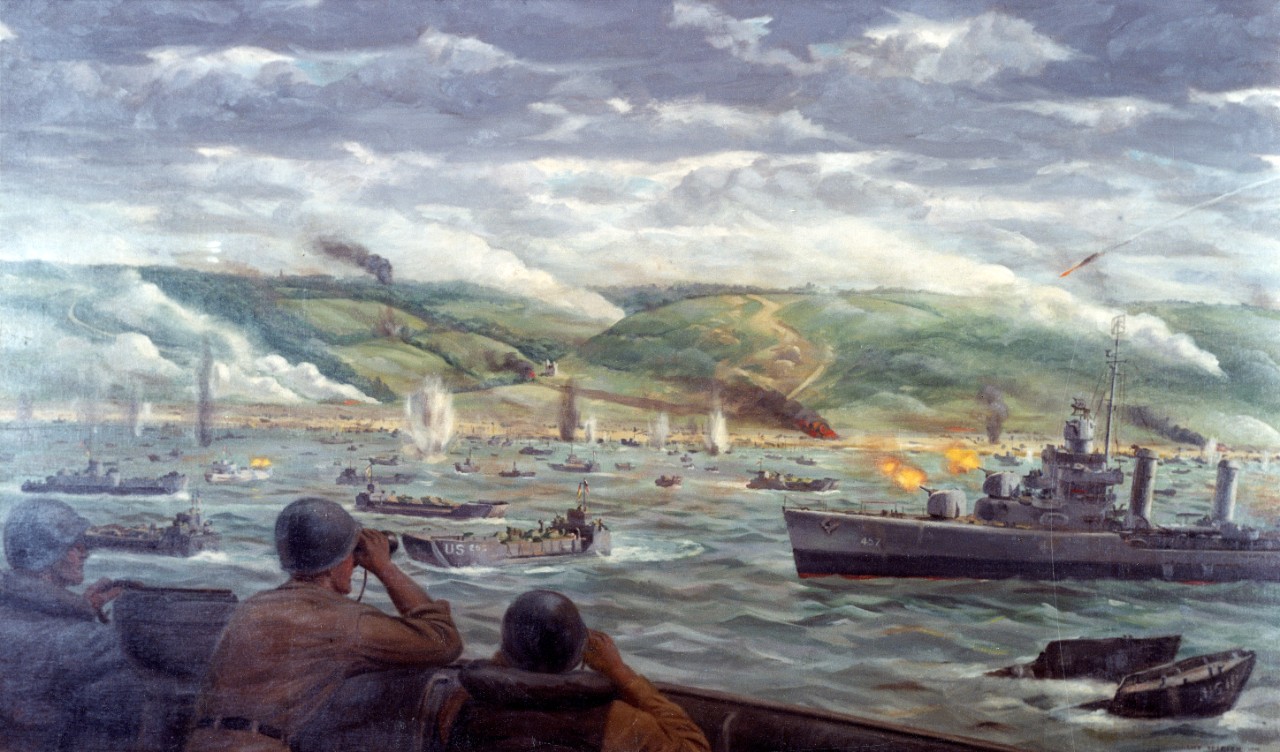
Not so in the "Omaha" area, where deep beaches backed by steep hills meant that the U.S. troops landing there were exposed to withering fire from enemy small arms, machine guns and artillery. Casualties were very heavy and the assult only succeeded after a day of brutal fighting, with warships coming in close to provide direct gunfire in support of the hard-pressed soldiers.
By nightfall on the sixth of June, the situation was favorable, even on Omaha. Entered the popular culture as THE "D-Day", a name it has retained ever since.
Note: This page is overwhelmingly concerned with amphibious landings in the American sector of the Normandy invasion area. Only a few views may show operations in the British and Canadian sectors, and there is virtually nothing on the airborne assaults. This reflects the nature of the images available in our collection and is in no way intended to deemphasize very significant British, Canadian and paratrooper contributions to the Normandy invasion. For pictorial coverage of non-U.S. participation in Operation "Overlord", we recommend contacting British and Canadian institutions. The U.S. Army photo collection in the U.S. National Archives should contain whatever coverage exists of the airborne assaults.


